High uncertainty for the Thu/Fri storm system
Oct 22, 2025
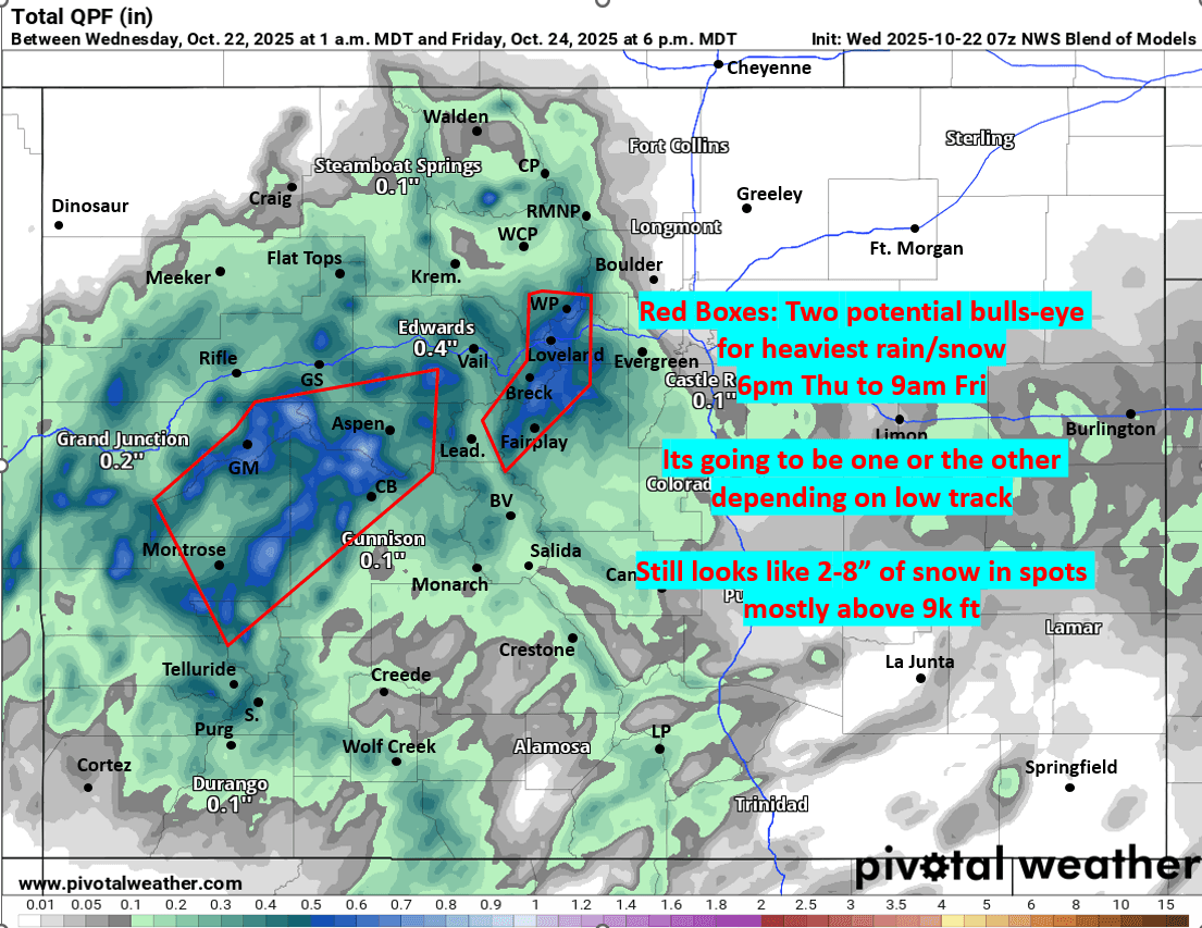
10/22/25 8am: Morning, happy Wed. Still little consensus on how the upper-level low tracks across CO on Thu afternoon into Friday.
Models are currently split with some showing the bulls-eye for heaviest rain/snow along/east of the Cont. Divide, favoring the Front Range mountains from Berthoud / Jones Pass areas to Loveland Pass/ ski areas, Grays/Torreys and eastern Summit Co (A-Basin, Keystone and toward Breck). This would makes sense if the low tracks just south of Summit Co with strong, east to west wrap-around flow
Other models have the low tracking further southwest, showing the bulk of the precip (and snow above 8k ft), mostly in/near the Elk Range between Aspen and CB (and western Elks west of Gunnison, etc) and maybe extending towards parts of thew western San Juans (near Telluride and Silverton).
Bottom line is biggest impact still expected from 12pm Thu to 12pm Fri (but snow showers may linger in the mountains through 6pm Fri). Snow level will drop to 8k ft by Fri am, but most of the meaningful accumulation will be above 9k ft.
Den/Bou and the front-range will have some rain showers from 6pm Thu to 12pm Fri, best chances Fri am, likely not that much measurable rain but some, best chances in the foothills and west. Cooler and cloudier on Fri.
I'll be putting out a snowfall forecast map tonight, but first just a quick comparison of the models below.
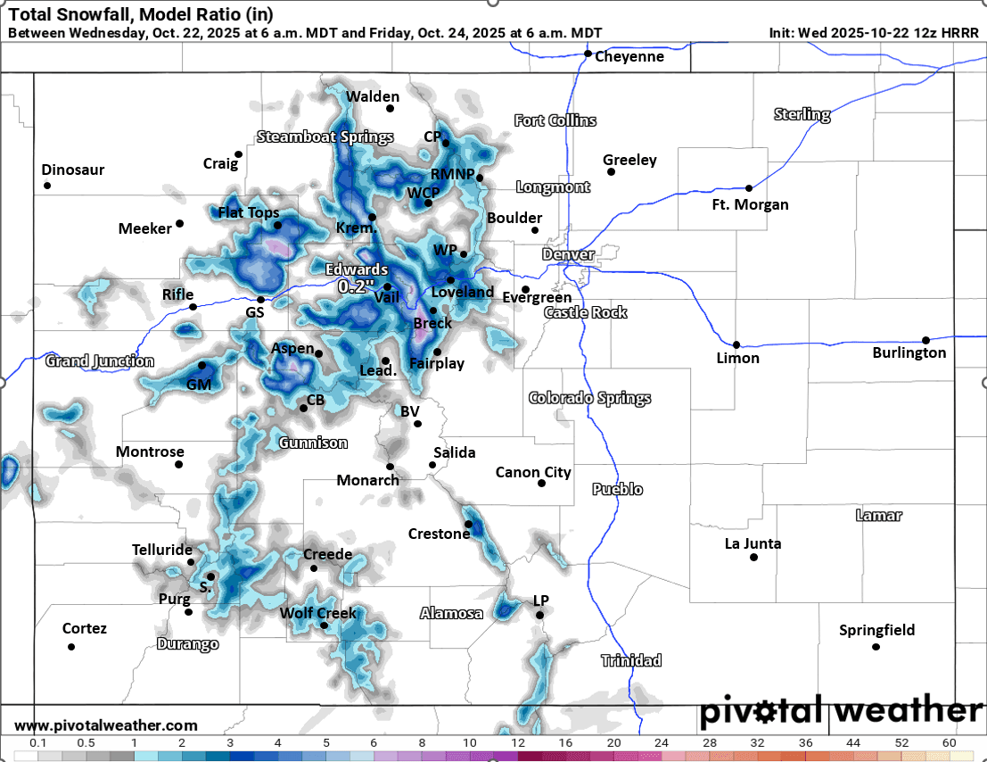
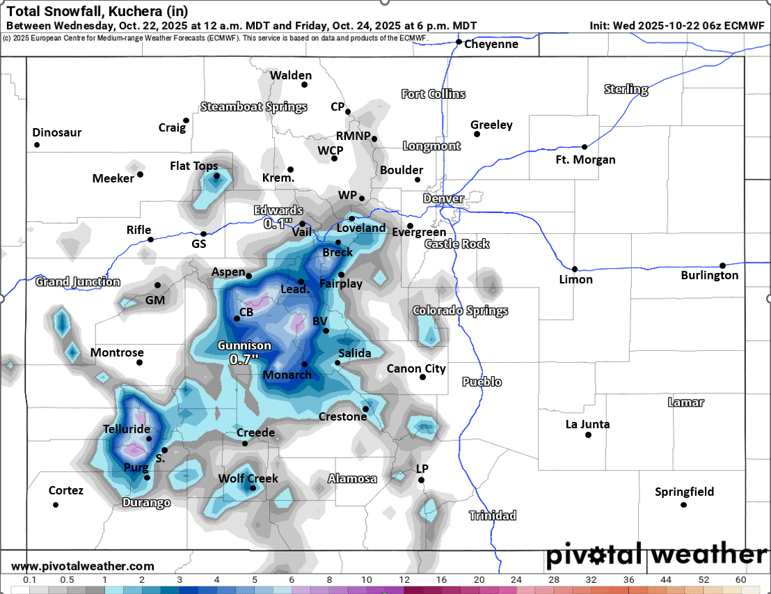
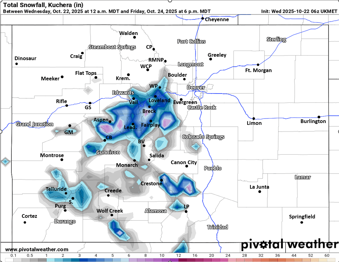
First image shows potential bulls-eyes on Thu night into Fri am, likely going to be one or the other. Images 2-4 compare forecast total snowfall from now through either 6am Fri (or 6pm Fri) from latest HRRR, UKMET and ECMWF models (these models have been more accurate in general, but who knows). In the comments I'll show the latest NAM which is cranking out a ton of rain/snow from Loveland Pass to Berthoud Pass, which I don't quite believe at the moment.
I'll have more this evening, including a snow map.

Like what you read?
Receive daily weather reports straight to your inbox with Seth's Daily Newsletter. Sign up below.