Halloween forecast. Dry, sunny but chilly for the front-range (with a little cold-front)
Oct 30, 2025
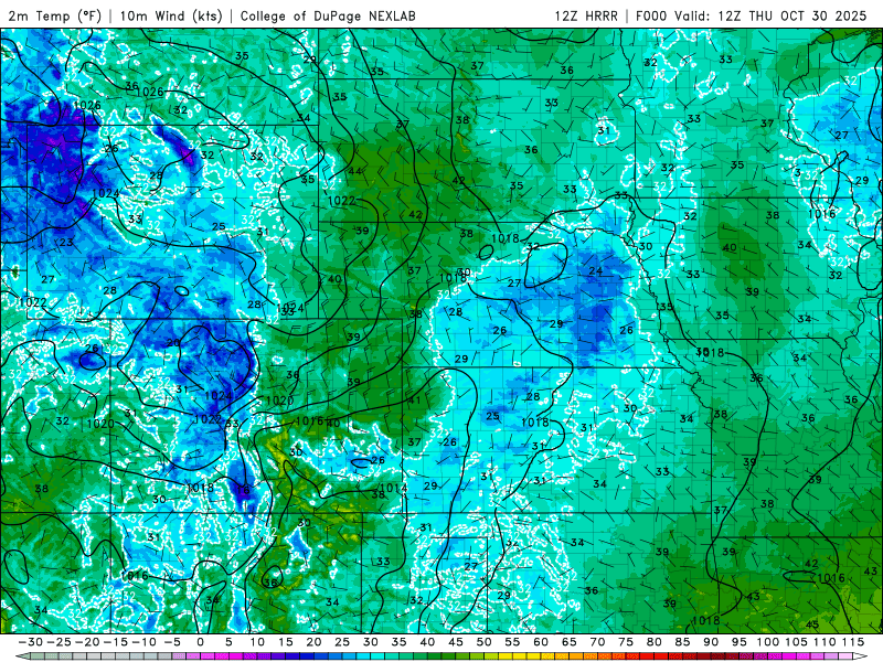
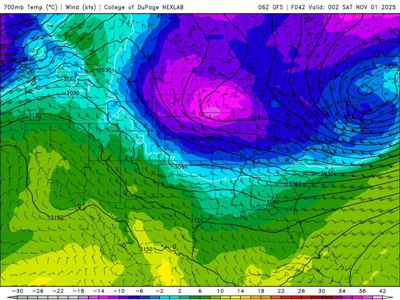
10/30/25 8:40am: Morning. The only weather to talk about for Colorado is a slight cool down for eastern CO and the front-range tomorrow into Sat am as a colder airmass grazes CO from the north / northeast.... This cold air will push a diffuse backdoor cold-front into eastern CO and into the front-range later tonight into tomorrow.
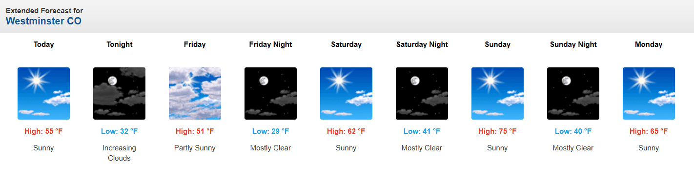
It will remain sunny and dry but will be a little chilly for Halloween east of the Cont. Divide. Beyond that, a big warm up commences on Sat and then back to mid-70s by Sun for Den/Bou! With 60s and 70s on the front-range most of next week. With 40s to 60s in the mountains (65 in Silverthorne on Monday).
For Den/Bou and the front-range will be under slow cold-air advection today into tonight, highs in the mid-50s today. Then cooler tomorrow, with high temps in the upper 40s / low 50s (will feel a bit chilly). For Halloween time (5pm-10pm), looks like we will have temps in the upper 30s along the front-range. It will actually be similar in the mountain valleys (since they will have more normal temps). But it will remain sunny and dry. Cool through Sat am (low temps in the 20s), then it will warm up in into the 60s on Sat. Then 70s on Sun. It will be really nice to be outside
In terms of wind: It will be turning a bit windy across the north-central mountains and western CO on Fri, with northwest wind-gusts of 20-40mph, strongest above 9k ft. Lighter wind for Den/Bou.
Looking ahead, I'm still tracking a weak storm system for around 11/06-11/07 but right now that storm looks moisture starved with limited impacts. Maybe some snow showers for the north-central mountains from next Thu night into Fri (maybe lingering into Sat am), 11/06-11/08. Maybe just a little bit of snow for the ski areas.
Maybe another weak storm around 11/12-11/13 but that is highly uncertain.
And lasty don't forget to set you clocks back 1-hour on Sun am, Standard times starts on Sunday (you get an extra hour to sleep in). I'll have more on the time change later.
First image loop shows forecast surface temperatures over the next 48hrs (6am this morning through 6am Sat) from latest HRRR. Second image shows the colder airmass aloft grazing the state on Fri (via 700mb temps/wind). Image 3 shows the 5-day forecast for Westminster CO (equivalent for Den/Bou).

Like what you read?
Receive daily weather reports straight to your inbox with Seth's Daily Newsletter. Sign up below.