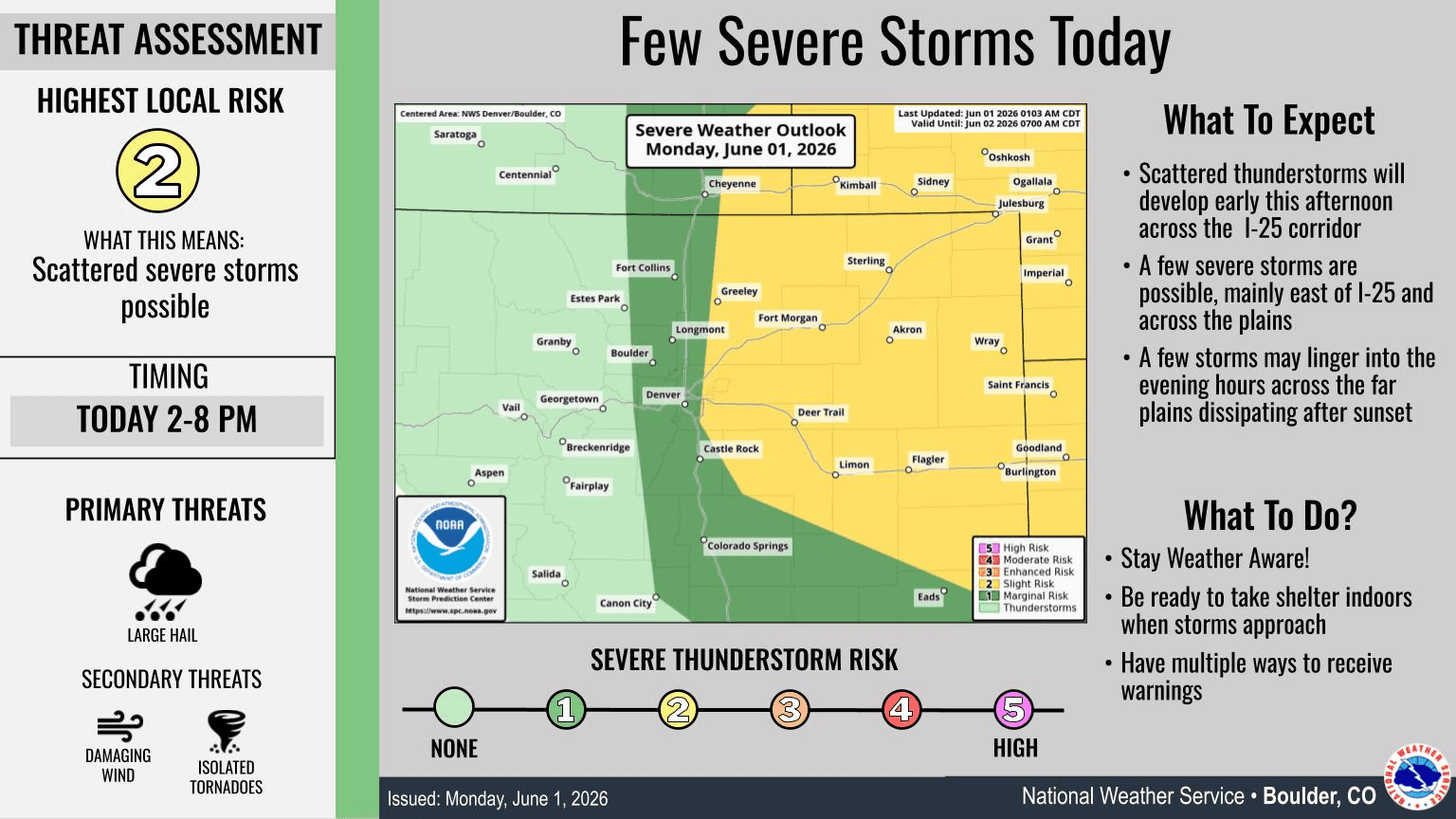
Good thunderstorm chances today for parts of the front-range (Den/Bou) and especially the eastern plains: 2pm-8pm
Jun 1, 2026
06/01/26 9am: Morning, its Monday, but at least its the first day of meteorological summer (June 1st). In early summer fashion we have a chance for some stronger thunderstorms in spots today.
Thunderstorms will first form near the foothills and over parts of Den/Bou after 1pm today. With a chance for isolated to scattered storms across the front-range urban corridor mostly from 2pm-6pm.
Stronger thunderstorm will develop east / southeast of Denver today. There is a threat of severe storms with up to 1" hail, heavy rain, strong wind and a brief tornado in the 3pm-9pm timeframe mostly east of a Greeley to DIA to Parker to east Springs line. Strong storms over the east / northeast plains this evening.
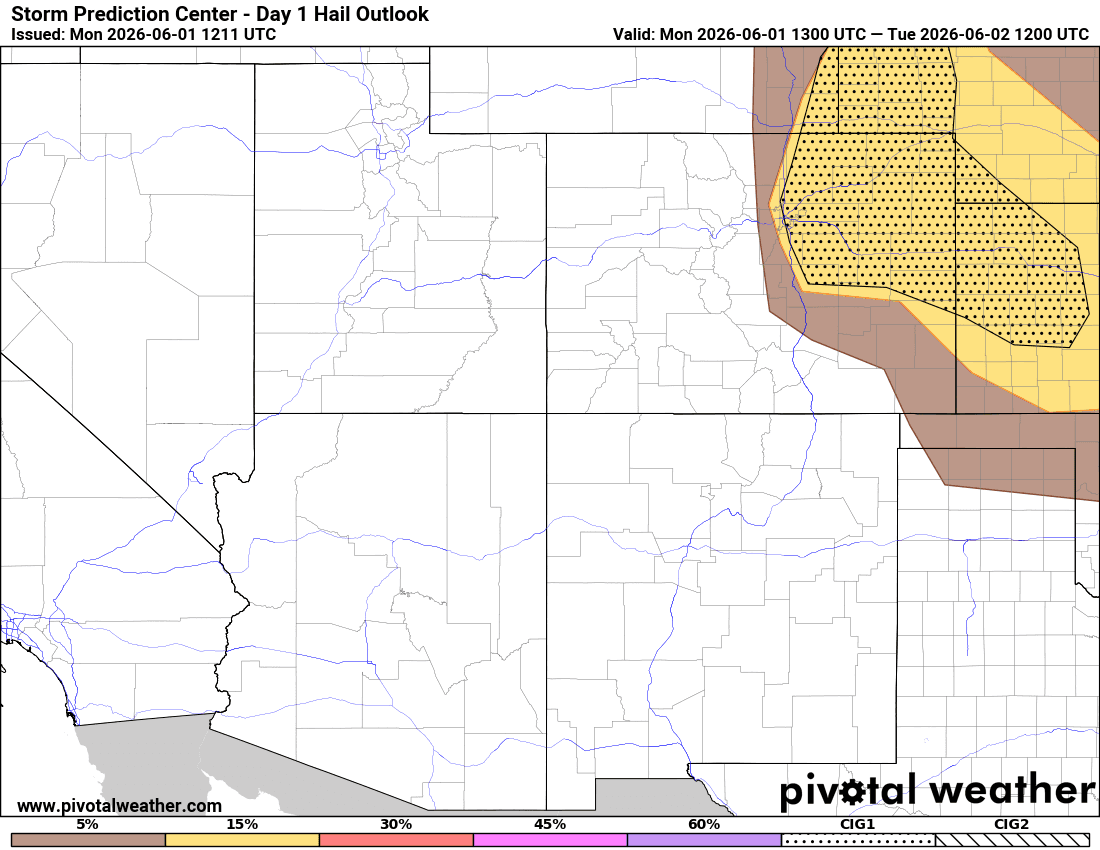
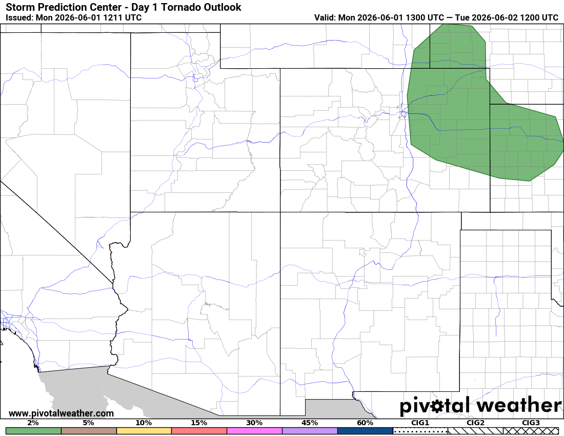
You can see where the biggest risk for large hail, an isolated tornado this afternoon on the maps below (DIA east, and most of northeast CO).
In the mountains most of the action today will be well east of the Cont. Divide (really from the front-range foothills and east), so not much. A better chance tomorrow.
On Tuesday: rinse, wash, repeat, pretty similar. Strong storms in spots, mostly over eastern CO in the 2pm-8pm timeframe, favoring southeast CO again. More on that later.
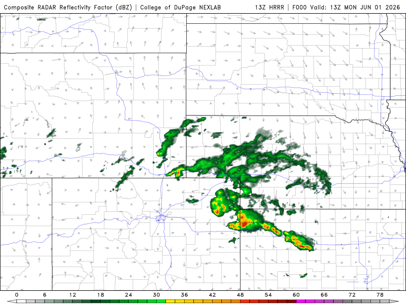
First image loop shows forecast radar over the next 18 hours (for today into early tomorrow). Second image is forecast slide from Den/Bou NWS officed (yellow area has highest chance for severe thunderstorms). Images 3 and 4 show the hail risk and tornado risk for today.

Like what you read?
Receive daily weather reports straight to your inbox with Seth's Daily Newsletter. Sign up below.