Forecat for the week, some details for the Thu/Fri storm system which will favor southeast CO
Nov 18, 2025
11/18/25 8:30am: Morning, we have some weather to talk about. We are still looking at a pretty impactful storm system (with much needed rainfall and some snow) for parts of the front-range and eastern CO on Thu into Fri (favoring southeast CO). Prior to this some snow for the western and southern mountains tonight into tomorrow.
In regards to the Thu/Fri storm still high uncertainty related to the storm track and where the upper-level low will strengthens. Still appears that Den/Bou will be on the northern edge of the best rain/snow but still some.
Models have increased precip a bit overnight but pretty similar to yesterday. I'd say Denver has about a 40% chance of seeing some light snow on Fri morning. Foothills and Palmer Divide should get their first significant snowfall of the season by Fri am with several inches.
Since the models are showing a true upslope event with southeast to easterly flow at the surface to mid-levels, this does not appear to be a favorable event for any significant snowfall for the north-central mountains around Eagle, Summit, Grand counties, etc. The focus will be along/east of the Cont. Divide / Front Range mountains
Also some heavier snow expected over southwest CO / San Juans Thu into Fri
Here are some main points right now
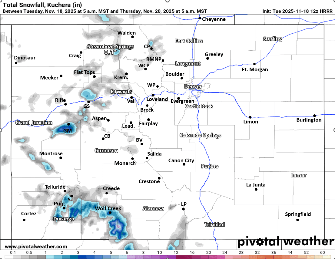
Initially for today into tomorrow some snow showers for the western and southern mountains, favoring the San Juans from 8pm tonight through 8pm Wed, 1-4” for parts of the San Juans and Grand Mesa areas, otherwise a Trace of snow for the rest of the central mountains
Rain/snow moves back into southern CO: San Juans to SLV to Sangres by 8am Thu
Rain/snow develops along the southern front-range (Trinidad to Pueblo to Springs) between 11am-2pm Thu
Rain/snow spreads into the northern front-range (Den/Bou) by 5pm Thu. Initially the snow-level will be above 8k ft on Thu evening, falling to 5600 ft by Fri morning
Snow showers move back into parts of the north-central / front-range mountains after 8pm Thu
The main event will be from 5pm Thu through 5pm Fri
In terms of rain/snow amounts, just starting to get a general idea but still high uncertainty, so take amounts with grain of salt
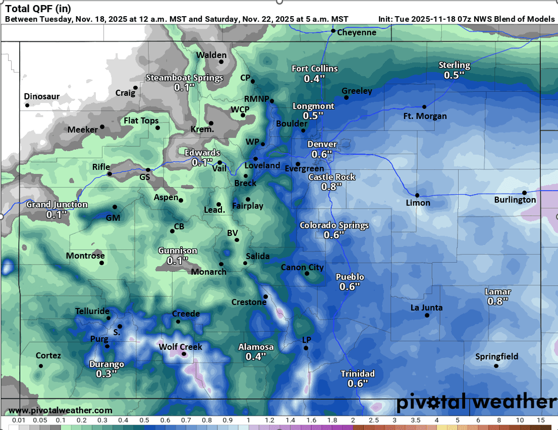
For Den/Bou and the front-range urban corridor likely 0.30" to 0.90" of liquid precip / rain. Maybe Trace-2" of snow below 5600ft
Foothills and Palmer Divide may get 2-6" of new snow by Fri afternoon, favoring areas from Evergreen south
Southern front-range (Springs to Trinidad) may get 0.50" to 1.50" of liquid precip (with some heavier snow in the foothills above 7k ft, 5-10" in spot)
For the Front Range mountains near Berthoud Pass, IPW, RMNP, etc: maybe 3-8", favoring areas east of the Cont. Divide
For the rest of north-central mountains around Pitkin, Routt, Eagle, Summit, Grand, ClearCreek counties, I-70 corridor, likely only 1-5" of snow for the local ski areas favoring areas further east and south (the east to west wind-flow is not that favorable for the northwest mountains)
For San Juans and Sangres above 9k ft, generally 6-12" of new snow by Fri evening (may extend to areas near Monarch as well)
That is all for now, I'm sure some if this will change some.
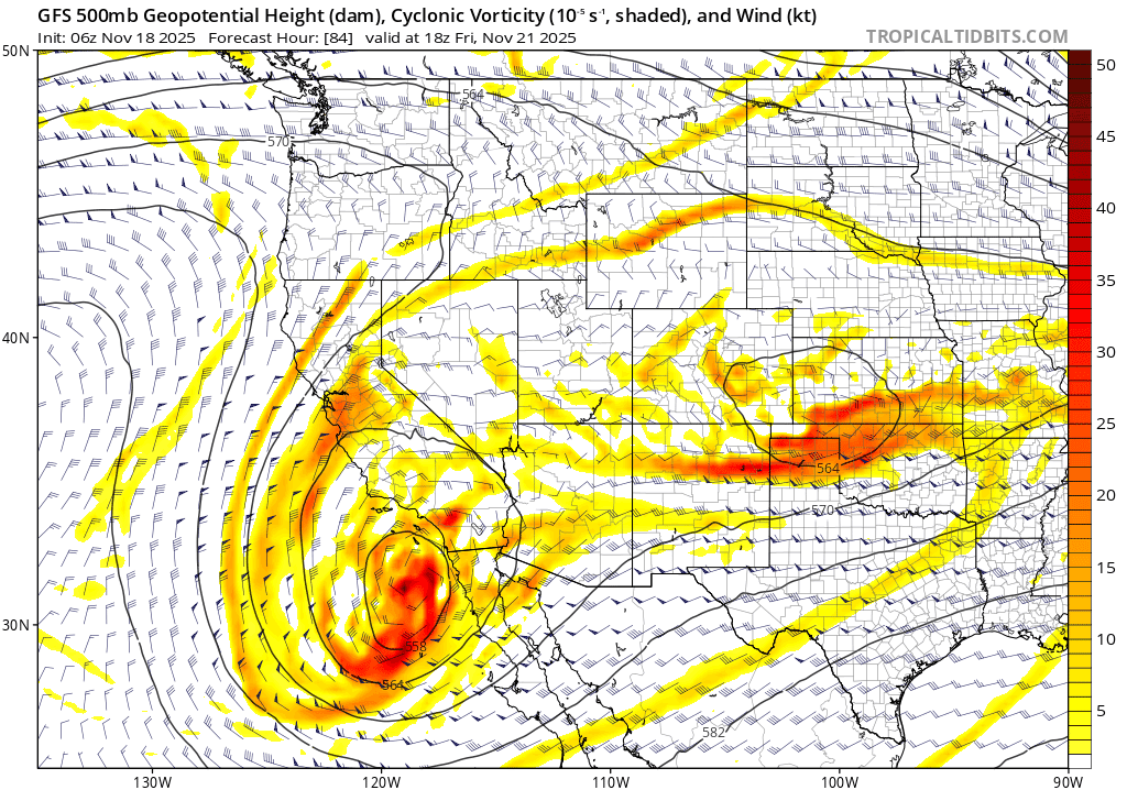
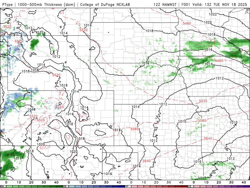
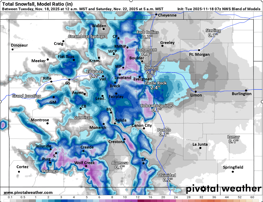
First image shows the upper-level low over southeast CO at 11am Fri from latest GFS. Second image loop shows forecast radar / precip-type over the next 60 hours (5am this morning to 5pm Thu) from NAM-3km model, just the first part of the storm. Image 3 shows just forecast total snowfall from now through 5am Thu from latest HRRR (before the storm). Image 4 shows forecast total liquid precip form now through 5am Sat from latest NWS Blend of Models and I circled the area with likely biggest impacts. Fifth image shows forecast total snowfall from now through 5am Sat from NWS Blend of models, take with a big grain of salt, the details will change some.
See my post from last night for updated snow total from this last wave. Also thanks to everyone that donated, I really appreciate it! I'm giving you the forecast details because you motivated me 🙂

Like what you read?
Receive daily weather reports straight to your inbox with Seth's Daily Newsletter. Sign up below.