Forecast outlook for the weekend and next week: next monsoon surge 08/30-09/01
Aug 27, 2026
08/27/26 8:10pm: Hi, lets take a look at the weather for the weekend and beyond and when we can expect a return to some more monsoon flow and rain.
It looks much more active / wetter, especially for the mountains and western CO from Sun-Tue next week (that is the next monsoon surge).
First, worth mentioning there is a lunar eclipse tonight, starting right now and extending into the early morning hours of Fri. Looks like its pretty clear out there as well, go check it out (blood moon).
In terms of the weather ahead:
First turning hot for Friday and Saturday, high temps in the mid-90s again (sigh) for Den/Bou..
Some isolated thunderstorms for parts of the north-central mountains and front-range (Den/Bou) tomorrow from 1pm-7pm
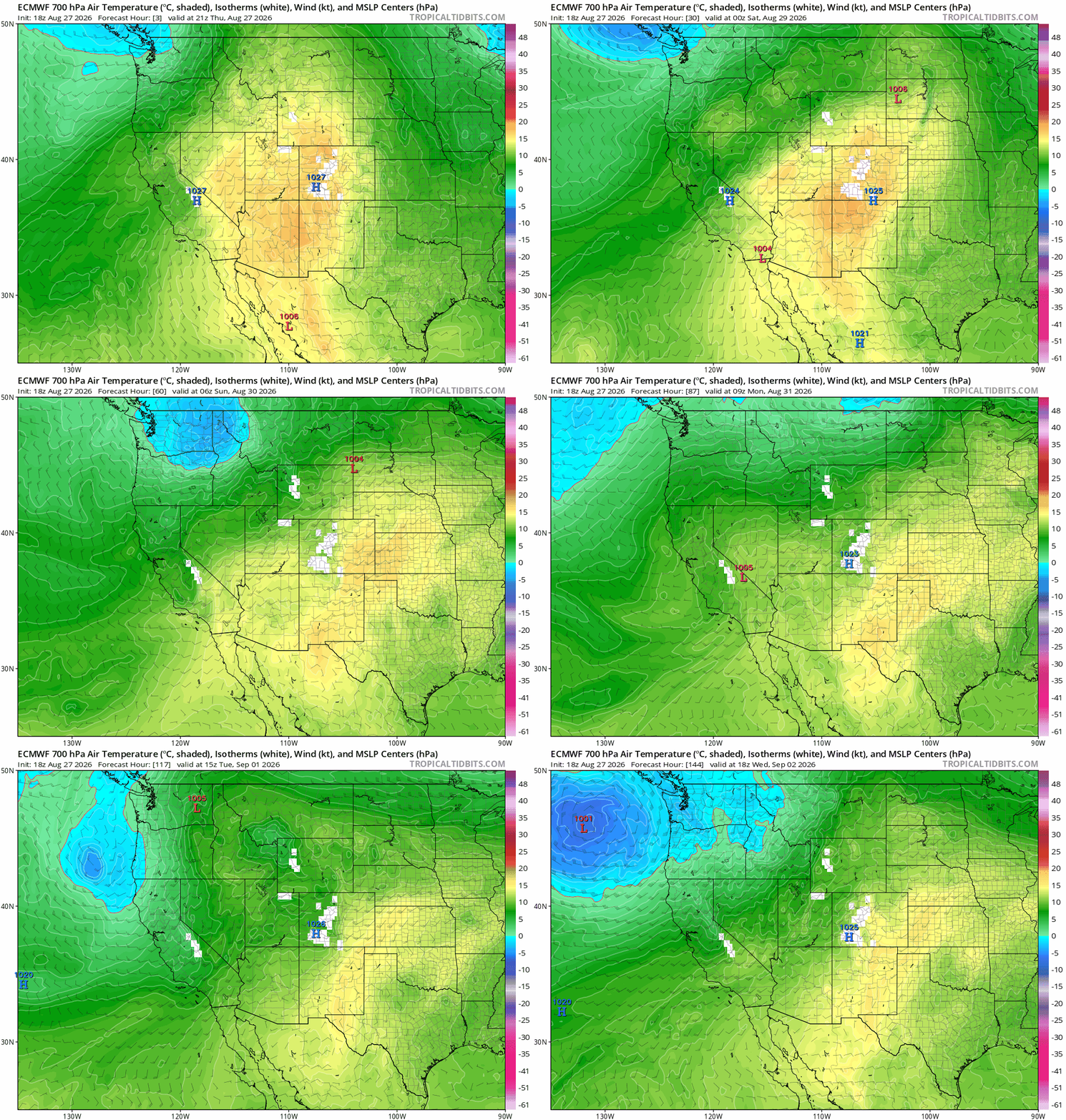
Then models show an initial cold-front moving into the central mountains Sat afternoon along with some better monsoon moisture...
So increasing thunderstorm chances especially for the mountains: 1pm-9pm Sat favoring areas west of the Cont. Divide.
For the front-range (Den/Bou) on Sat hot with better thunderstorm chances as well: 2pm-9pm, still hit or miss.
Then models show a secondary cold-front for the mountains (seasonable cool, not snow yet) on Sun afternoon into Mon along with deeper moisture. They also show this cooler air filtering in the front-range (Den/Bou) as well by Sun into Mon.
So likely the best days with afternoon thunderstorm chances for much of the state will be Sun, Mon and Tue (08/30 - 09/01) from 1pm-10pm each day.
In fact models show a stronger short-wave on Mon evening into Tue which should further enhance things.
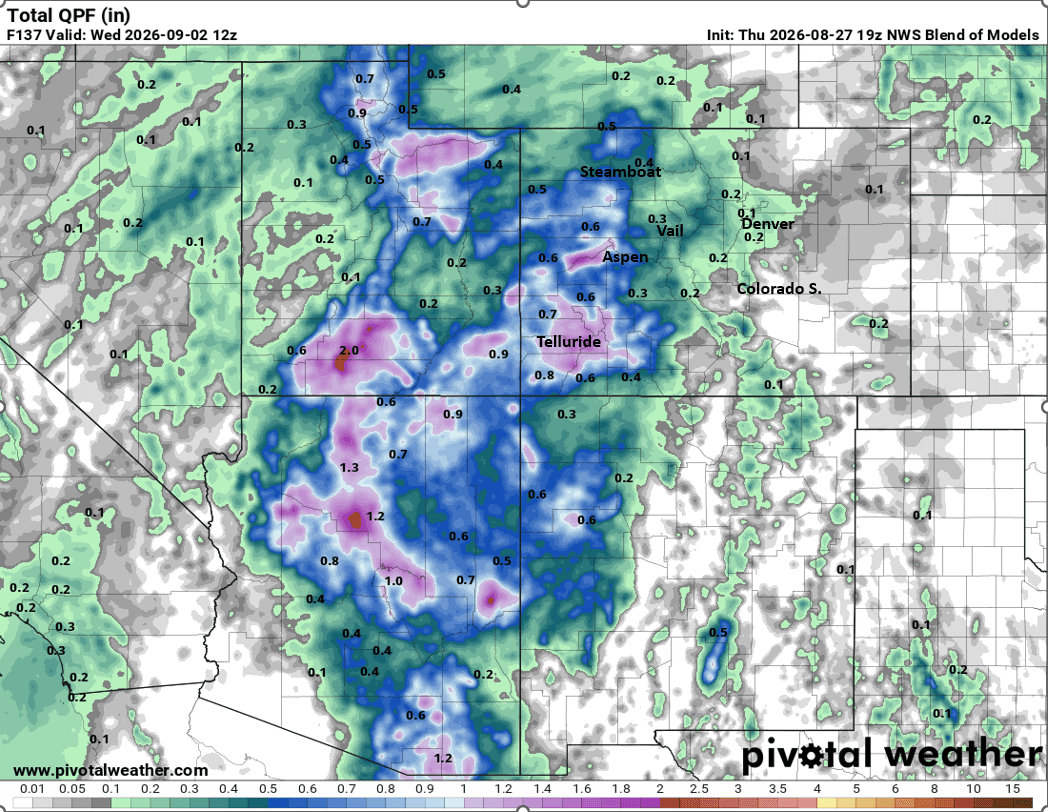
Overall heaviest rain will likely favor southwest CO / San Juans as models show some heavy rain at times down there (and cooler, will feel like fall).
Likely decent thunderstorm chances for Den/Bou and the front-range as well, especially Mon and Tue along with a slight cool-down.
Then back to warm and dry from Wed-Fri leading up to Labor Day weekend.
First image loop shows forecast 700mb temps over the next 7 days (at about 10,500ft) and a good proxy for the airmass / cold-front: the more greens to blue are colder (oranges/reds hot). Second image shows forecast max/min temps for Boulder from NBM. Image 3 and 4 compare forecast total liquid precip from now through next Wed at 6am (09/02) from latest NBM and ECMWF take forecast precip amounts with big grain of salt, but they show the strong signals in spots.



Like what you read?
Receive daily weather reports straight to your inbox with Seth's Daily Newsletter. Sign up below.
