Forecast outlook for the next 10 days (overall dry, windy and warm).
Jun 26, 2026
06/26/26 9pm: Hi, hope you are having a good Friday. We are getting ready for our trip to CA but wanted to take a look at the extended forecast for CO:
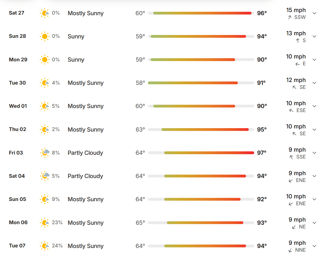
Overall we enter a drier, summer like pattern for the next 10 days or so. Looks like some moisture could return by July 6-8th. No sign of the true monsoon yet. It will be seasonable hot (90s for Den/Bou, 70s/80s for the mountains).
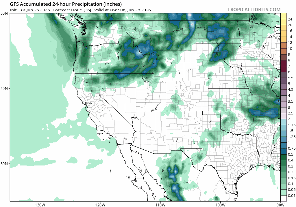
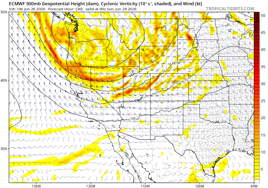
In the meantime dry and windy in CO on the south side of a big trough pushing into the northwest Sat-Sun (you can see that on the second image below). With the track of the low (actually multiple waves) staying north of CO this will just produce a bunch of wind, especially tomorrow. As I mentioned strong wind Sat especially for western CO and the mountains, Red Flag Warnings, gusts of 50-70 mph above 9k ft.
On the other hand this unseasonable trough for the northwest will actually produce some snow up in Idaho, Wyoming and Mountain mostly Sat into Sun (maybe Mon), with 5-10" in spots up there above 7kft, wish that was CO, but the track is too far north.
Overall looking warm and dry (with wind at times) most of next week and heading towards the 4th of July. As of now the 4th looks pretty dry overall in CO, maybe a few afternoon storms for the front-range and eastern plains.
Looking a ways out models do show a return of some moisture around July 6th, but it could favor the front-range (Den/Bou) and the eastern plains for better storm chances July 6, 7, and 8th. Or maybe some for the mountains. Who knows its a ways out.
I don't see any sign yet of the North American Monsoon...which relies on a consistent area of high-pressure (clockwise circulation) setting up south / southeast of CO (advecting in moisture).
Anyway, I'll be out for a good portion of the next 2 weeks, but may post a few updates (maybe some photos to the group). We will be out on a Central CA tour: Santa Cruz area, San Fran / Bay area, Napa/Sonoma, then finishing in Lake Tahoe with family. Wish us luck!
Oh yeah, just glad I was hear for all this rain. I picked up another 0.51" today bringing my 3 day total to 1.94" (almost 2", much needed).
First image loop shows forecast 24hr liquid precip and is a good way to just gauge the pattern in terms of when more significant precip returns to the state (you can see not much initially). Second image shows the large trough to our northwest on Sat via 500mb vorticity / wind from ECMWF. Third image shows forecast total snowfall for ID, WY and MT through Tue am from RRFS model. Fourth image shows the 10+ day forecast for Denver from TWC, you can see fairly boring this next week.


Like what you read?
Receive daily weather reports straight to your inbox with Seth's Daily Newsletter. Sign up below.