Forecast outlook for the mid-week storm system (Tue-Thu)
Sep 26, 2026
09/26/26 8:15pm: Hi, hope you are having a good Sat. Here is a little check in on the expected mid-week storm system.
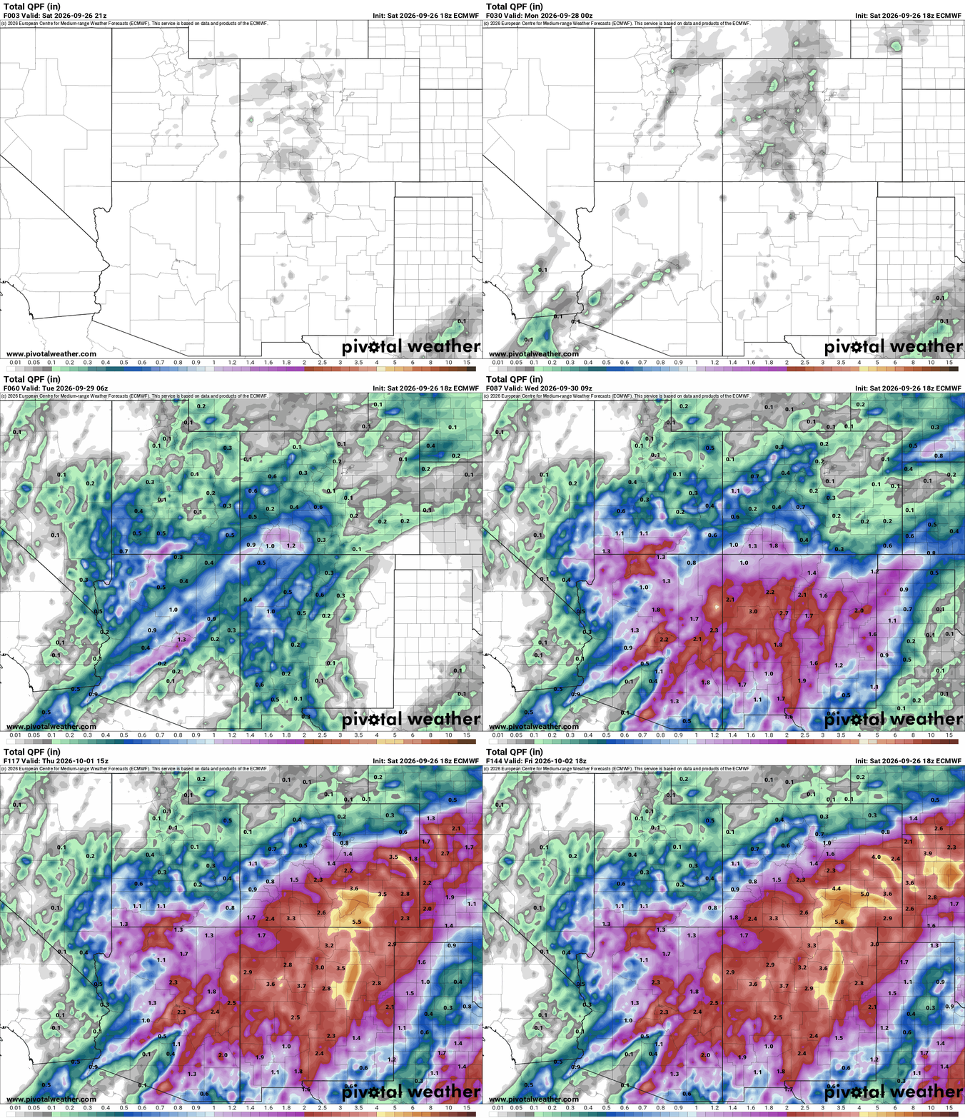
Still high uncertainty in storm track and rain/snow amounts. Still expecting main impacts from Tue-Thu (except in the San Juans it will start on Mon am). Still looks like southern CO will be favored for heaviest precip amounts (south of a CB to BV to Springs line, maybe 1-3" of precip for southern CO).
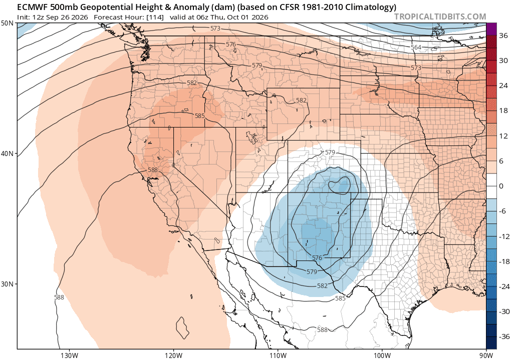
Highest uncertainty right now revolves around the the forecast for the front-range (Den/Bou) and has to to do with how the low evolves on Wed into Thu...
ECMWF (and GEM to some degree) show a double-barrel low with the northern piece bringing a big round of upslope and rain to the front-range, favoring areas from Boulder south (with maybe 0.50" to 1.50" for certain areas).
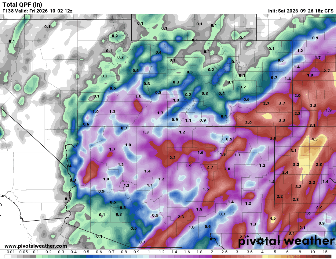
GFS on the other hand doesn't show this double-barrel piece and keeps the dominant low much further southeast and hence almost nothing for Den/Bou and the northern front-range...so you can see it can go either way.
It does look like parts of southeast CO from Springs to Pueblo to Trinidad and east could also get some very heavy rain (> 2"), especially Wed night into Thu am.
Main timing windows:
Rain moves back into southwest CO: Durango to Pagosa areas to all of the San Juans: 3am Mon through 6am Tue initially with some heavy rain in spots.
During the day Tue rain showers across much of the north-central and south-central mountains
Then if ECMWF has its way the main round of rain for the front-range (including Den/Bou) and the foothills will be from 6pm Wed through 6pm Thu (with rain showers prior to this).
Also in the mountains generally looks like the snow-level will fall from 12k Tue to closer to 10k by Wed night into Thu, so some snow maybe even down to the pass levels (San Juans will be favored for heaviest amounts). Maybe some for the Front Range mountains as well.
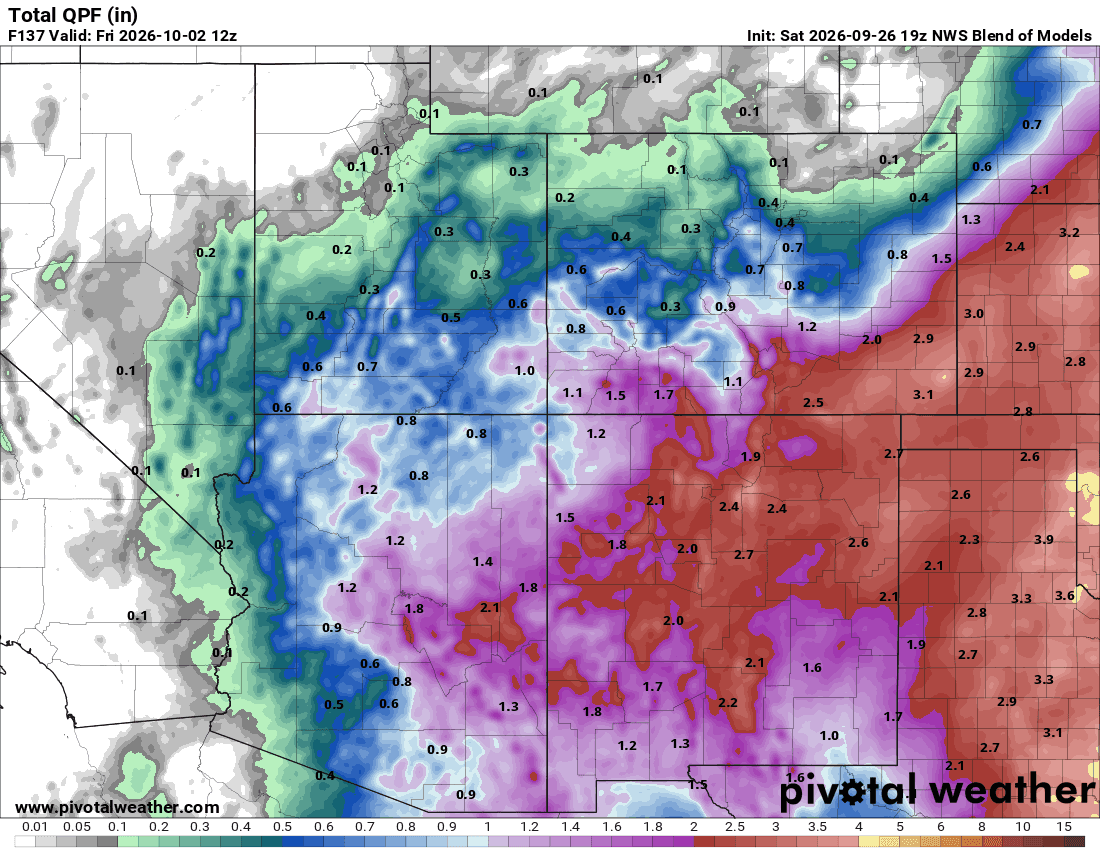
First image loop shows forecast total liquid precip from now through 12pm Fri from latest ECMWF model. Second and third image shows forecast total precip from now through 6am Fri from latest GFS and NWS Blend of Models (take exact precip amounts with a grain of salt, it just shows where best chances are). Fourth image shows the upper-level low 12am Thu from ECMWF.

Like what you read?
Receive daily weather reports straight to your inbox with Seth's Daily Newsletter. Sign up below.
