Forecast from today through next Wed. Active weather coming up for the weekend.
May 13, 2026
05/13/26 8:20am: Morning. Going to be nice and warm today but we do have some weather to talk about. I see a more active pattern with better rain/snow chances across the state from Saturday afternoon through Tue afternoon as models now show basically 3 distinct storm-systems moving through in that timeframe.
In the meantime, hot today with high temps near 90 for Den/Bou (70s on the mountains ) with a chance for a few storms in spots.
Models show a weak short-wave and some moisture moving through this afternoon evening:
For much of the north-central and south-central mountains some isolated to scattered thunderstorms from 1pm-8pm today. Then a few more rain/snow showers overnight (10pm tonight to 3am tomorrow), snow level generally above 10k ft.
For Den/Bou and the front-range a slight chance for some isolated, high-based thunderstorms from 4pm-9pm today, best chances around the edges (foothills, PD, east of Denver, etc).
For tomorrow turning windy over much of western CO and the mountains with westerly wind-gusts of 20-50 mph. Most of western CO is under a Red Flag warning tomorrow 12pm-8pm
Breezy in Den/Bou and the foothills tomorrow with wind-gusts of 15-30 mph.
Looks pretty nice on Friday: limited storm activity and less wind.
Then things get interesting for the weekend. Models show an initial (weaker) short-wave moving across the state on Sat afternoon / evening.
Rain/snow possible in the mountains from 3pm Sat to 3am Sun, snow-level mostly above 10k ft: Trace-2" in spots by Sun am
Den/Bou will have a chance for some scattered thunderstorms Sat afternoon: 4pm-10pm.
Then a second, colder storm system with a cold-front will impact northern CO (mountains and front-range): Mostly from 3pm Sun through 3pm Mon: Mountains could get 1-5" of snow above 9500ft
Den/Bou and the foothills will have good rain chances on Sun evening into Mon.
Foothills could get some snow by Mon am (snow-level generally above 9k ft).
Then the third short-wave is expected Tue morning through Wed morning: More rain/snow for the mountains by Tue am
More rain (and maybe snow for the foothills) Tue afternoon into Wed am as well.
So you can see its going to get pretty active. But with this complex flow pattern the details will change some. But I'm getting stoked for more rain and snow.
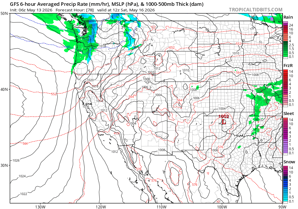
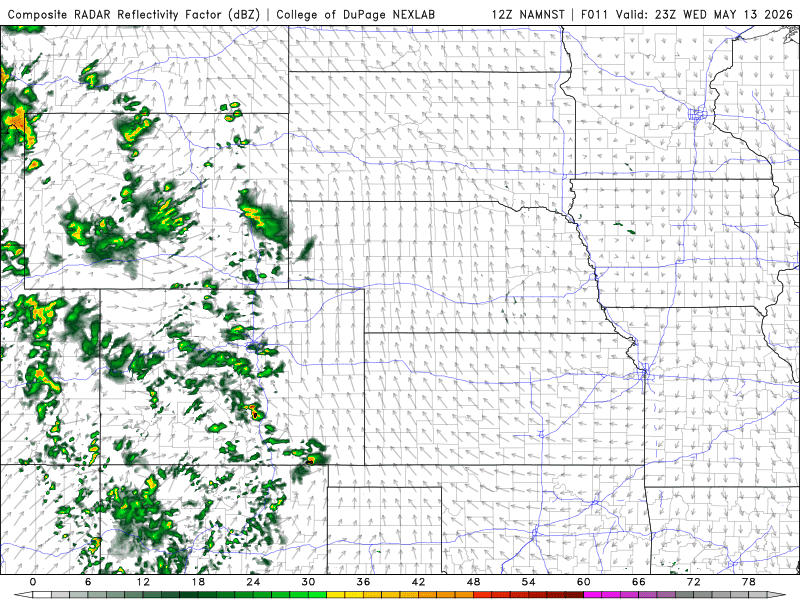
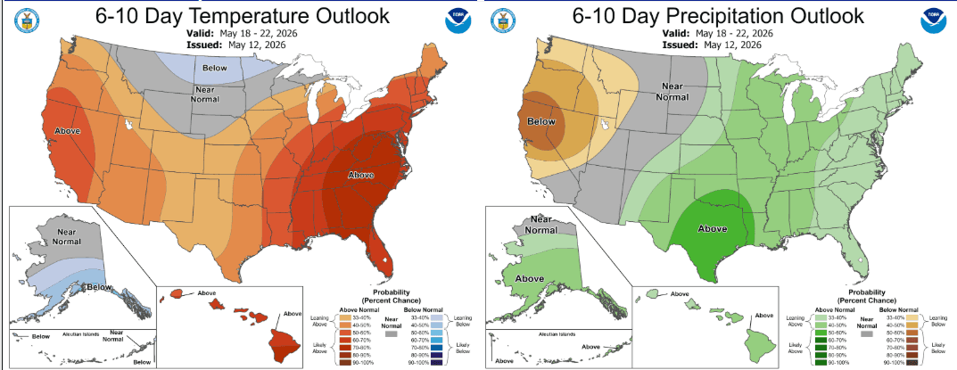
First image loop shows forecast precip-type / rate from Sat to next Wed via GFS, you can see the active pattern shaping up. Image 2 shows forecast radar at 5pm today from latest NAM-3km model, take with a grain of salt. Third image shows the 6-10 day outlook from NCEP showing a chance for above average precip over parts of CO, especially eastern CO.

Like what you read?
Receive daily weather reports straight to your inbox with Seth's Daily Newsletter. Sign up below.