Forecast for the weekend into next week: Turning active for eastern CO Sun-Tue
Jun 19, 2026
06/19/26 9am: Happy Friday. We do actually have some weather to talk about, well i guess for the eastern half of the state lol.
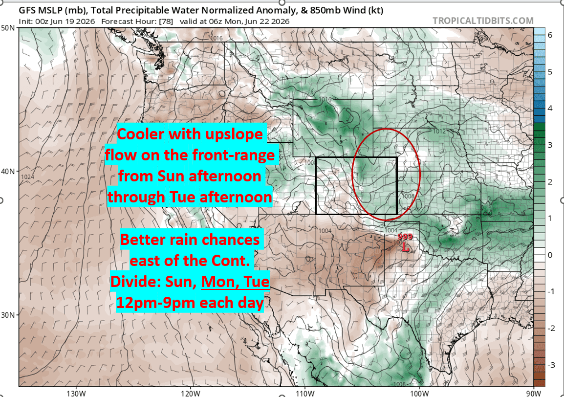
I'm seeing some interesting weather for the early part of next week as the models show moisture and upslope flow on the front-range (including Den/Bou) Sun-Tue behind a couple different cold-front coming in from the north. So it will be turning active for the eastern part of the state.
Prior to this increasing thunderstorm chances from today through Sun for parts of southern CO and eastern CO (and maybe the front-range).
I made some graphics for you below highlighting where the best thunderstorm / rain chances will be on Fri and Sat initially and then where the focus for more upslope flow and rain will be Sun-Tue.
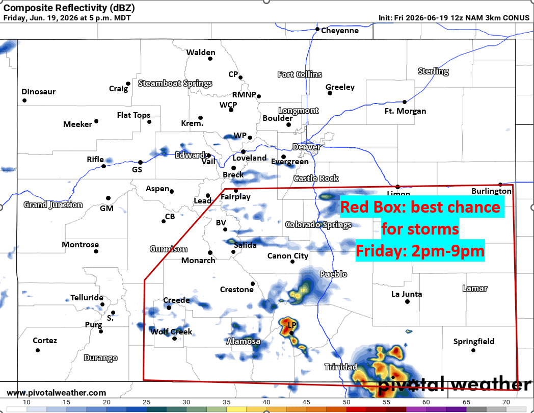
For today, best chances for storms will be from Colorado Springs south on the front-range and over parts of southern CO (from the eastern San Juans to SLV to Sangres and southeast plain): 2pm-9pm. Hit or miss storms.
Further north for Den/Bou (and the adjacent northern mountains) not much today, a few isolated storms after 3pm.
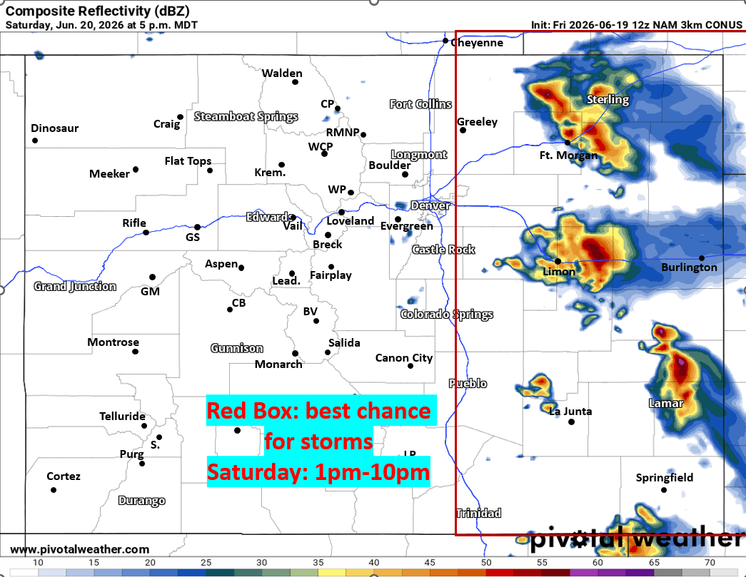
Then for tomorrow the highlight will be some strong to severe storms on the eastern plains mostly along/east of a line from Greeley to DIA to Limon and east of there, between 1pm-10pm.
Some severe storms possible out east (with large hail, strong wind, isolated tornadoes, mostly after 2pm Sat).
Den/Bou and the foothills may have a few isolated, stronger storms tomorrow between 1pm-6pm, best chances east of I-25.
Not much rain in the mountains Fri and Sat (some isolated activity the front-range mountains).
Then the weather gets interesting starting Sun, at least for the eastern half of the state.
Models show an initial cold-front with deeper moisture moving into the front-range either Sun morning or Sun afternoon/evening depending on the model.
Cooler and cloudier on the front-range on Sun, with a chance for storms, mostly between 12pm-8pm again. Or if the front comes in later, could be 4pm-11pm Sun.
Then models show and additional cold-front and better upslope flow on the front-range on Mon into Tue.
I think best rain chances for Den/Bou will be on Mon: 12pm-8pm, and possible again Tue: 12pm-8pm. Hard to say where best thunderstorm coverage will be, but basically up and down the front-range and parts of the eastern plains.
Some rain / thunderstorms for the Front Range mountains and foothills Sun-Tue (each afternoon) mostly east of the Cont. Divide.
Unfortunately, I'm not see much rain for the mountains and western CO, west of the Cont. Divide Sun-Tue.
Deeper monsoon moisture may return by end of June into early July but that is a ways out.
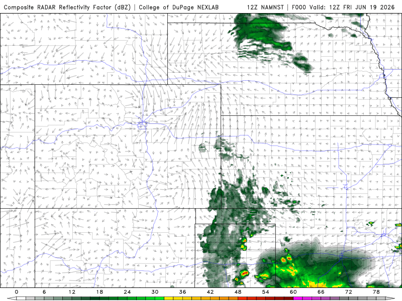
First image shows forecast radar at 5pm today, highlighting where best storm chances are for today. Second image shows forecast radar at 5pm tomorrow (and where best storm chances are tomorrow). Third image shows where the upslope and moisture will be Sun-Tue. Fourth image loop shows forecast radar over the next 60 hours (6am this morning through 6pm Sun) from latest NAM-3km model.

Like what you read?
Receive daily weather reports straight to your inbox with Seth's Daily Newsletter. Sign up below.