Forecast for the weekend into next week (increasing thunderstorm chances)
Aug 20, 2026
08/20/26 8:45am: Good morning. I'm getting ready for a camping trip with the boys but wanted to get out my forecast for the weekend. Here are some main themes:
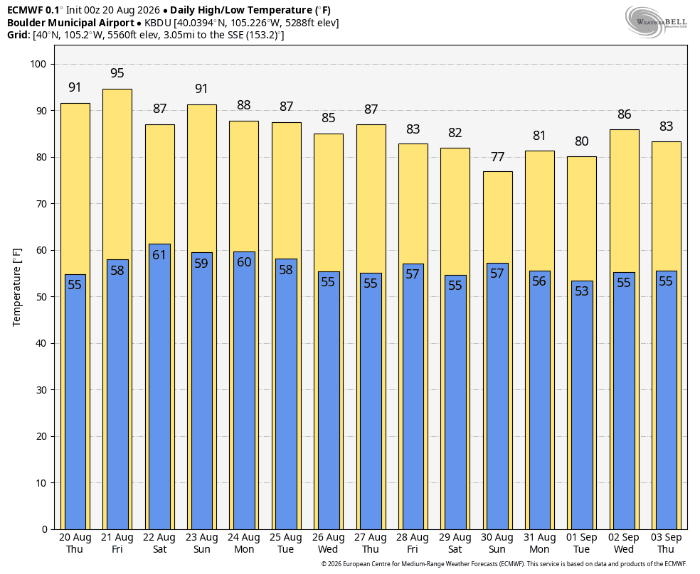
It will be hot for the front-range (Den/Bou) and lower elevations both today and especially Fri, with highs in the mid-90s (could be above 95 on Fri in Denver, sigh)
Mostly dry across northern CO today
For today (Thu): Best rain chances will be over south-central CO and parts of the southern front-range: 1pm-8pm
Already a few storms this morning over western CO (near Aspen to CB) ahead of an active day
For Friday, better storm coverage over both the north-central mountains and northern front-range (Den/Bou) but it will be more isolated / weaker thunderstorms: 1pm-9pm
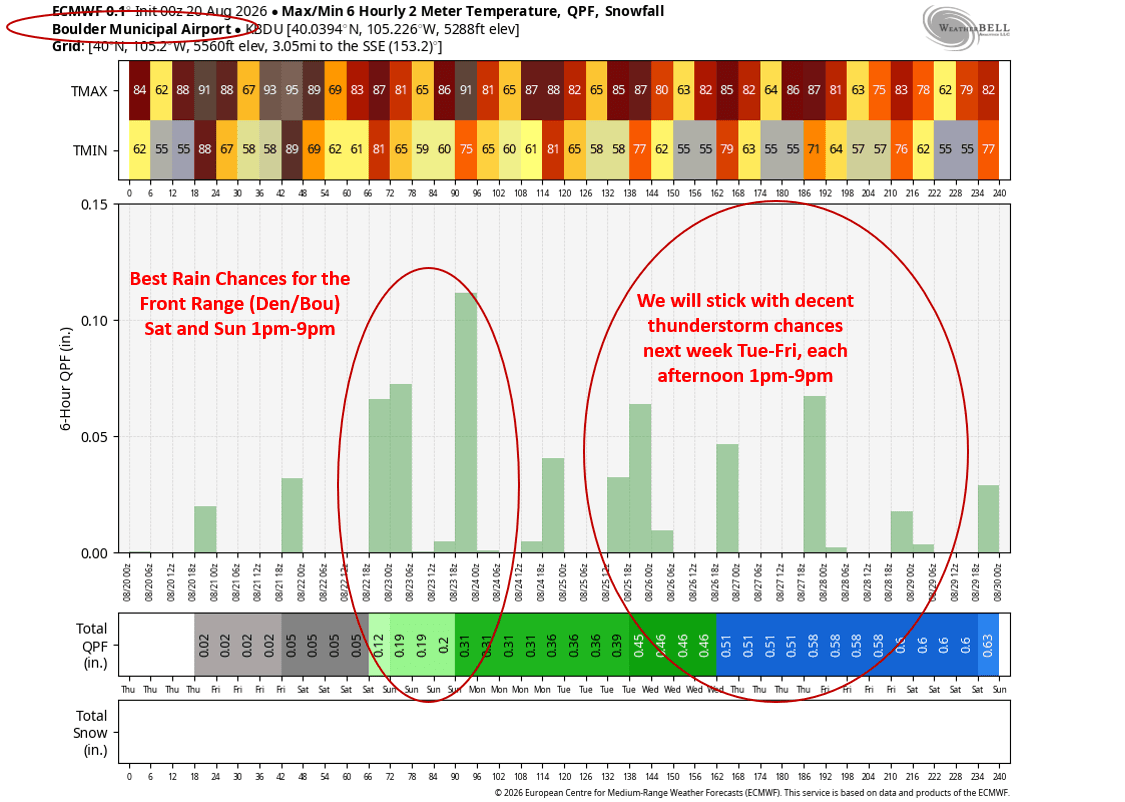
Saturday will feature the best chance for thunderstorms across much of the state, including the north-central mountains and front-range primarily from 12pm-10pm for the mountains, 3pm-11pm for Den/Bou and the front-range
Sunday will also feature good storm chances for the front-range (and the adjacent mountains), generally 1pm-9pm.
Looking ahead to next week, some decent monsoon moisture is forecast to rotate into the state, especially Tue-Fri of next week, so we will stick with good storm chances each afternoon next week
Potentially a cool-down coming towards the end of the month (08/29 through 09/02 looks a bit cooler an active) but its a ways out
As I mentioned, I'll be out for a boys camping trip from this afternoon through Sunday afternoon, near the Collegiate Range. Looks like we could be dealing with some afternoon thunderstorms today (and likely tomorrow and Sat) as well. Wish us luck! At least it will be in the 60s lol.
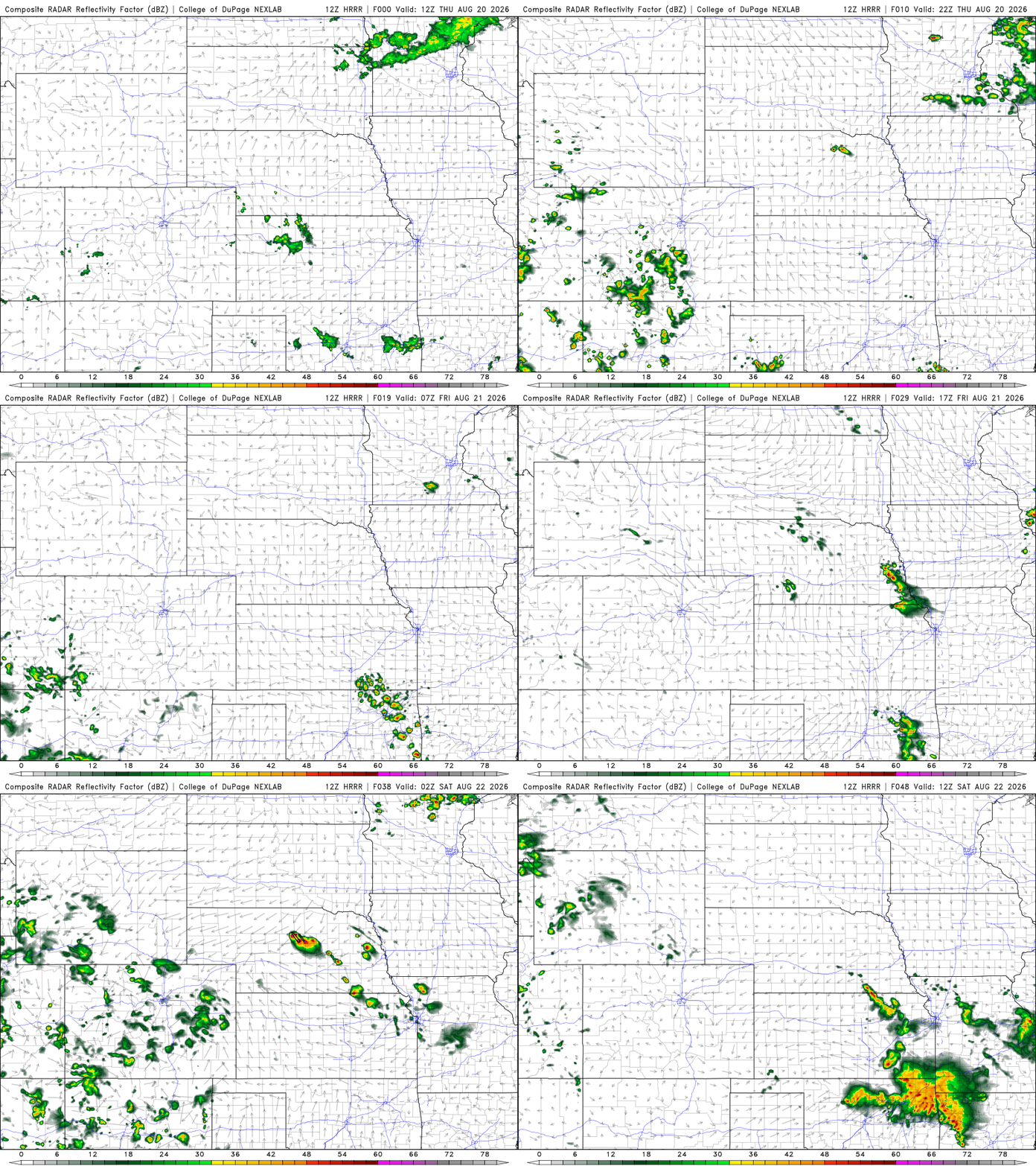
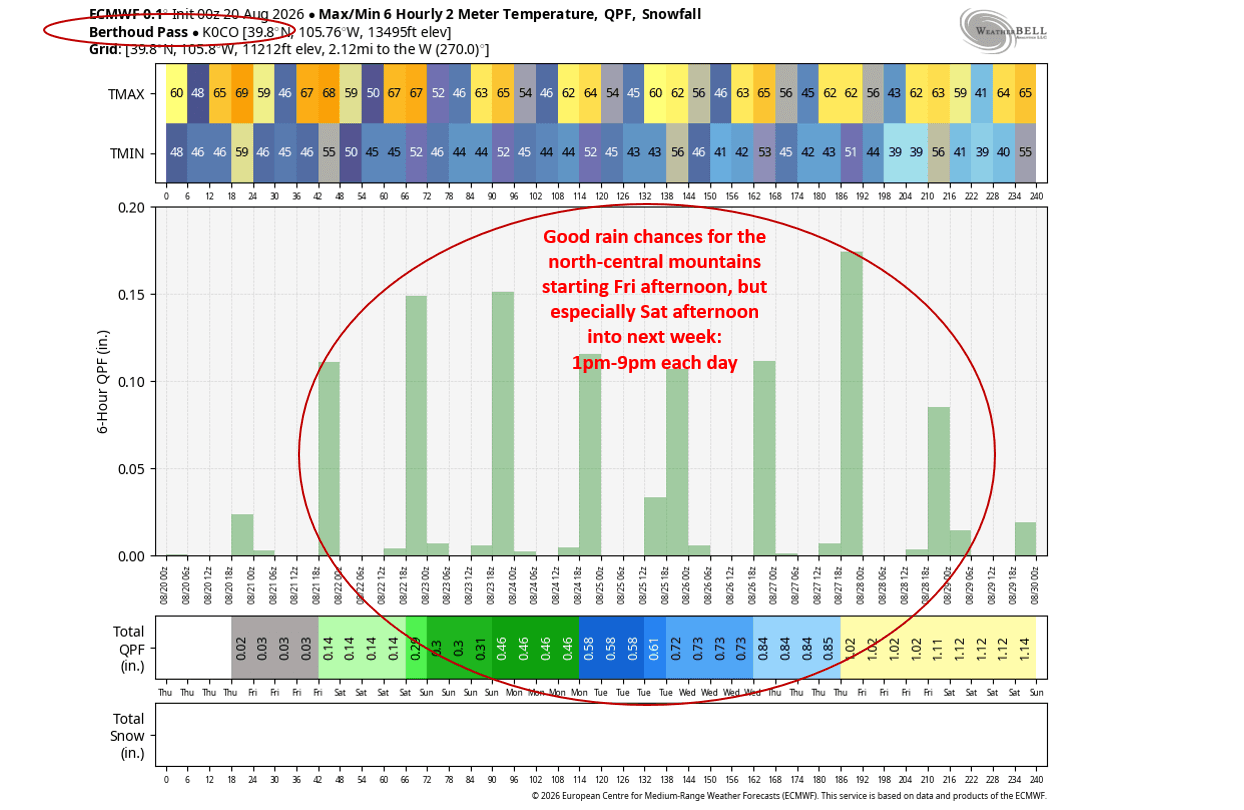
First image shows forecast radar at 5pm today from latest HRRR but I highlight where best storm chances are today. Second image is forecast radar over the next 48hrs (6am this morning through 6am Sat) from latest HRRR. Image 3 shows max/min temps for Boulder over the next 10 days from ECMWF. Images 4 and 5 show Max/Min 6Hr 2M Temp. + QPF (rain) Chances for Boulder (image 4) and Berthoud Pass (image 5) and you can see when the best chances will be.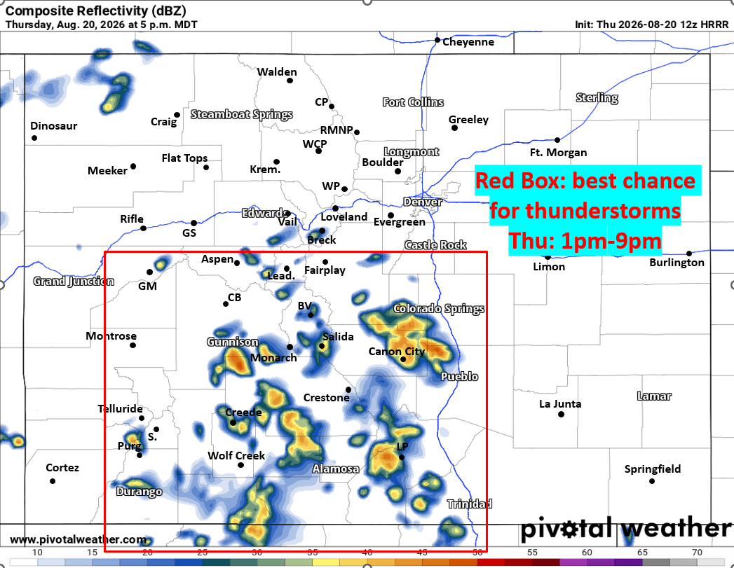

Like what you read?
Receive daily weather reports straight to your inbox with Seth's Daily Newsletter. Sign up below.
