Forecast for the weekend and early next week. Unsettled with rain and snow. Bigger storm Mon into Tue
Apr 10, 2026
04/10/26 9am: Morning, happy Friday. We do have some weather to talk about. Some afternoon thunderstorms today, some rain/snow for the mountains tomorrow (and more rain showers for the front-range tomorrow afternoon) and still eyeing a colder storm system with rain/snow for parts of the mountains and front-range from Mon afternoon through Tue afternoon.
First, good to see at least a little bit of rain in spots yesterday. Here are some notable rain reports:
Boulder 3.6 SSE: 0.14"
Greeley 1.1 ENE: 0.07"
Superior 2.8 S: 0.07"
Fort Collins 5.9 E: 0.06"
Littleton 4.5 WSW: 0.03"
My house (Westminster): 0.01"
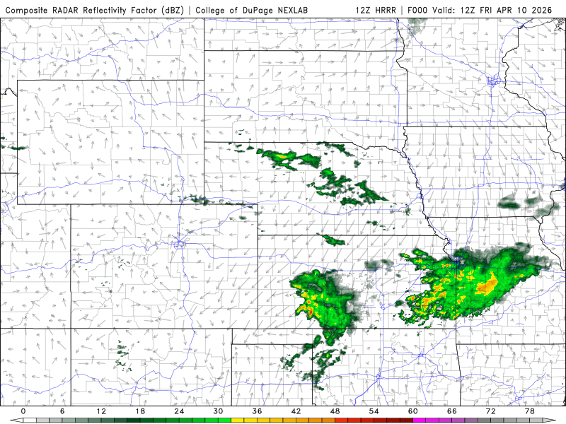
Anyway for today, another decent chance for some scattered thunderstorms across parts of the north-central mountains (Summit, Grand, etc) and part of the front-range (Den/Bou, foothills) from 2pm-8pm.
Best chance for Den/Bou will be 4pm-6pm. Brief moderate rain, small hail, some wind and lightning in spots. Best chances from the Palmer Divide north today.
For tomorrow models show a short-wave moving across the state form southwest to northeast (although the best jet-energy stays northwest of CO), this will produce some rain/snow.
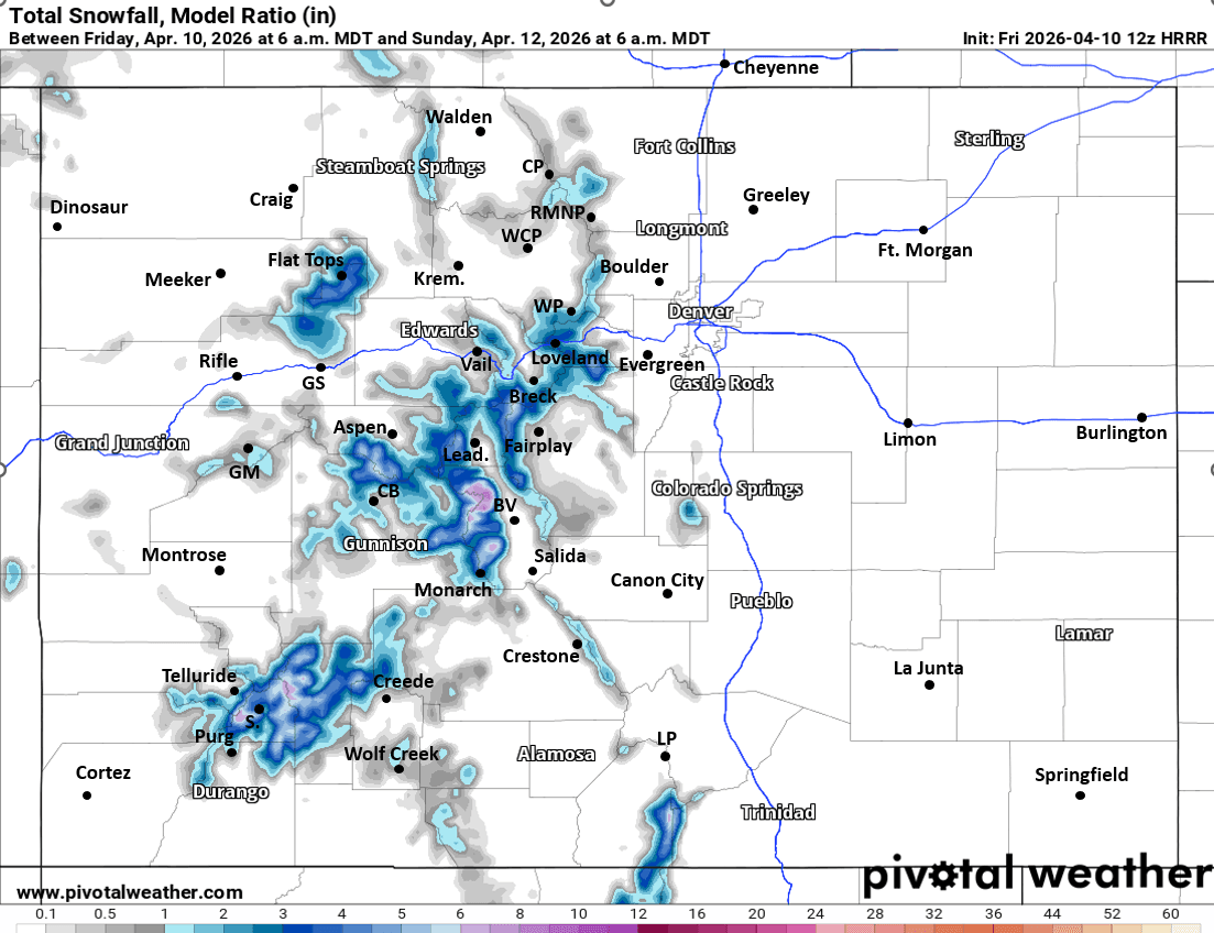
For the north-central mountains on Sat a round of rain and snow showers (snow mostly above 10k ft during the day, lowering to 9k ft by Sat night) from 11am-11pm. Rain / weak thunderstorms in the valleys, snow up high. Some of the high-res models show 1-4" of new snow for the ski areas and mountain passes by Sun am
Best chances for heavier snow > 4" will be in upper parts of the San Juans, Elks and Collegiate Range (southern Sawatch).
For Den/Bou and the front-range on Sat, maybe a brief early round of storms 12pm-2pm, but then the best chance for some scattered rain showers and weak thunderstorms will be 3pm-8pm. Brief moderate rain, small hail and lightning in spots. Fairly unsettled weather Sat afternoon.
Back to dry and seasonally warm weather for Sunday.
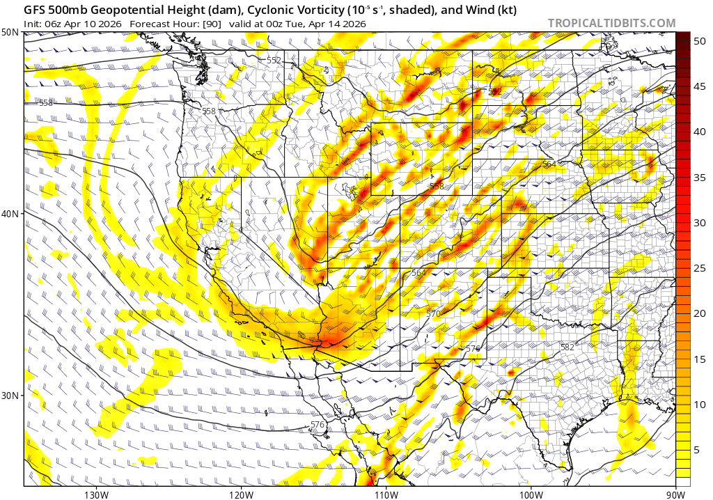
Then a colder upper-level low will impact the state on Mon into Tue (or maybe into Wed depending on the model). Model show a disorganized system with a split in the energy so uncertainty is high in exact rain/snow amounts and timing.
But likely more rain/snow for the mountains (north and south central) from 12pm Mon through 6pm Tue (could linger into early Wed). Biggest impact will be Tue am. Could be an additional 3-8" of snowfall for the higher terrain (above 9k ft) by Tue mid-day or Wed.
For Den/Bou and the front-range a shot of rain/snow likely from late Mon night into Tue morning, best chances from 12am-2pm Tue. There could be some minor snow accumulation by Tue am: Trace-2" for lower elevations, 1-4" possible for the foothills above 7k ft by Tue afternoon. Uncertainty is high for this one.
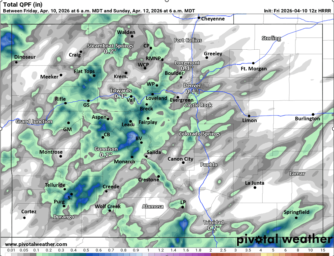
First image loop shows forecast radar over the next 48hrs (6am this morning through 6am Sun) from latest HRRR model. Images 2 and 3 show forecast total liquid precip and total snowfall from now through 6am Sun from latest HRRR, take with a big grain of salt, just shows where heavier precip will be possible. Image 4 shows the big, disorganized upper-level low on Mon afternoon via 500mb vorticity / wind from latest GFS.

Like what you read?
Receive daily weather reports straight to your inbox with Seth's Daily Newsletter. Sign up below.