Forecast for the week: thunderstorms for the mountains on Tue. Upslope for the front-range Wed
May 25, 2026
05/25/26 8pm: Hi, I hope you had a great Memorial Day and enjoyed the nice weather! Was a good morning for either a run at the Bolder Boulder or to finish the soccer season (for our daughter). Just a few showers earlier today but nothing major as expected. But we do have a bit more weather coming up this week.
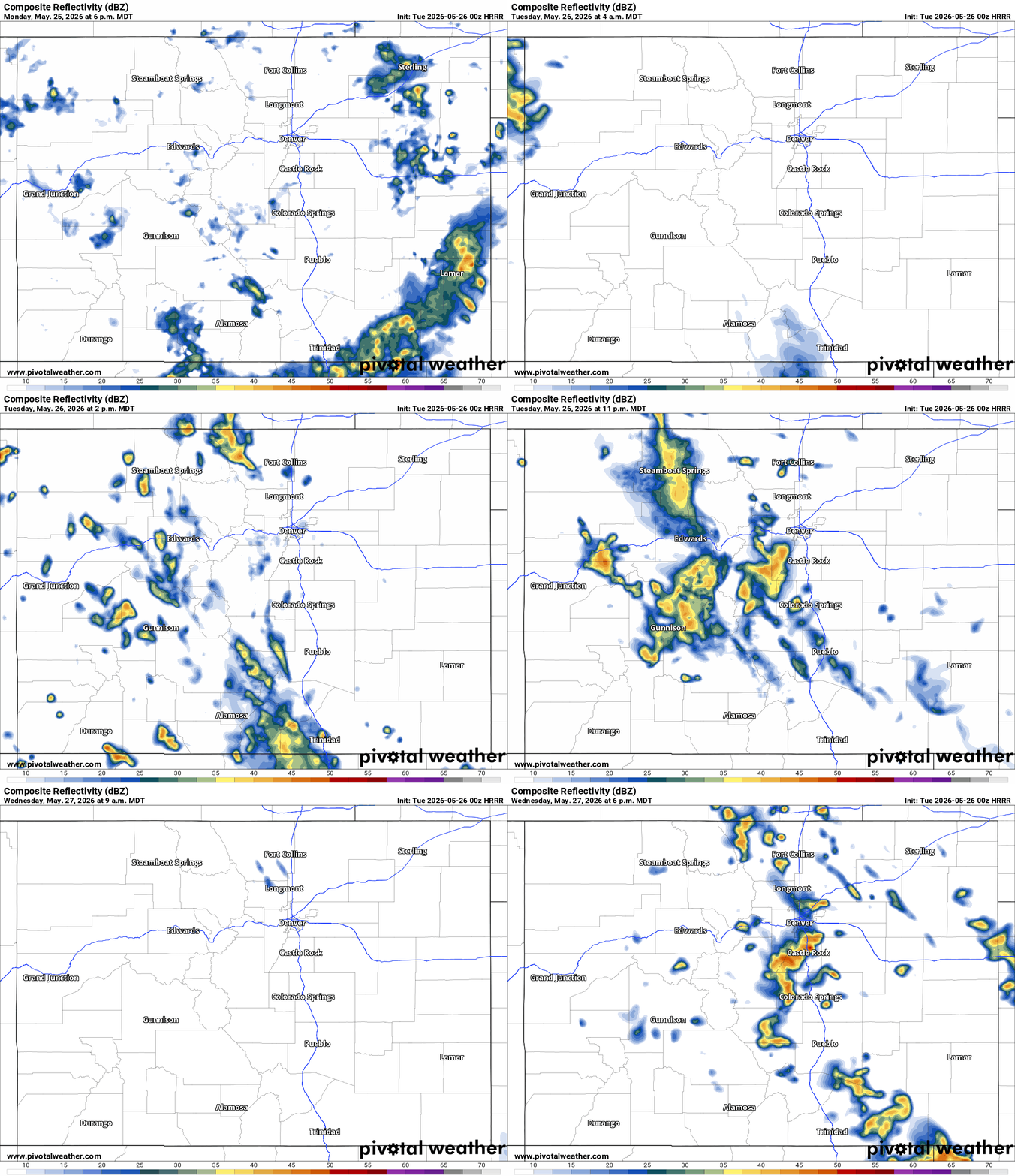
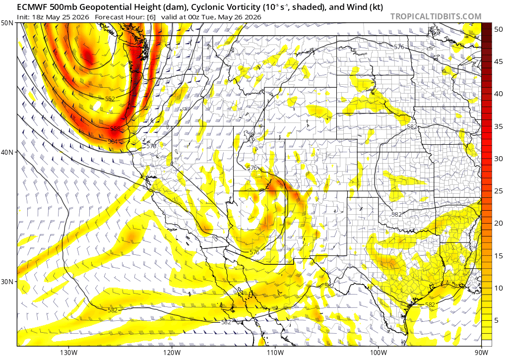
For tomorrow models show a little short-wave rotating up across west / southwest CO and this will bring a much better chance for some rain and thunderstorms to the mountains starting as early as 10am tomorrow (for the San Juans) and by 12pm for the north-central mountains.
North-central and south-central mountains can expected scattered storms tomorrow from 11am Tue through 2am Wed, best chances: 1pm-8pm, best coverage along the Cont. Divide from the Front Range mountains towards Hoosier Pass and towards the Elks Range .
For Den/Bou and the front-range most the action likely stays in the mountains and foothills but a chance for some isolated to scattered storm tomorrow 4pm-11pm, best chances near the foothills.
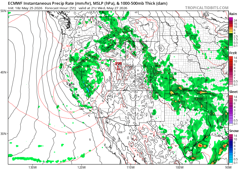
Then as the bigger low drops in to the west of CO this will likely produce some better upslope flow along the front-range on Wed into Thu.
So for Den/Bou and the front-range, best chances for some rain and thunderstorms will likely come between 12pm-9pm on Wed under a southeast flow upslope regime
Stil some questions on where the low tracks, but generally will stay west of CO and then slowly fall apart and move northeast...so limited impacts...
But basically a decent chance for more rain/thunderstorms each afternoon from Thu-Sat, maybe best chances again either Sat afternoon or Sun afternoon (05/30-05/31) but its uncertain.
Overall a summer like pattern kicking into gear now but also with some moisture, good storm chances each day basically.
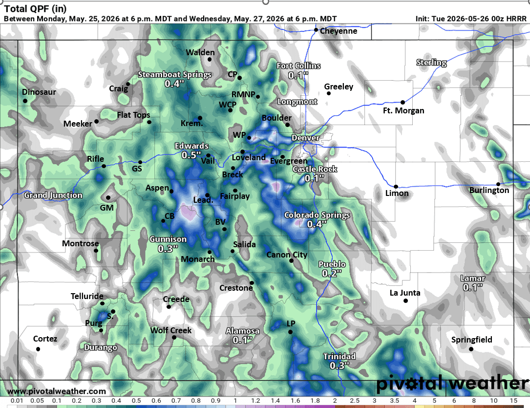
First image loop shows forecast radar over the next 48hrs (6pm Mon to 6pm Wed) from latest HRRR. Second image shows forecast total liquid precip over the next 48hrs from latest HRRR (take amounts with grain of salt). Image 3 shows the short-wave for Tue (via 500mb vorticity / wind from GFS). Image 4 shows the upslope setup and rain for the front-range on Wed afternoon from latest ECMWF model.

Like what you read?
Receive daily weather reports straight to your inbox with Seth's Daily Newsletter. Sign up below.
