Forecast for the week of 04/19 to 04/26 (active with several storms towards the weekend)
Apr 19, 2026
04/19/26 12:45pm: I hope you are having a good Sunday. Busy soccer morning for this family again. Anyway, I wanted to mention what I'm seeing in the forecast for this week and beyond. Once we get past some warm and dry weather from today through Tue the weather pattern slowly gets more active again towards the end of the week.
In general, seeing a much more active pattern across the state from Friday 04/24 through Friday 05/01.
First a ridge of high pressure will dominate the weather through Wed morning. Back to high temps near 80 for Den/Bou, Mon-Wed (60s/70s for the mountains).
Moisture and a short-wave return by Wed afternoon / evening and the pattern gets more active:
First, a weak wave slated for Wed evening through Thu morning: For the north-central mountains some rain/snow showers mostly between 6pm Wed to 6am Thu: Trace-2” of new snow in spots by Thu am.
Maybe some brief gusty rain showers for Den/Bou and the front-range on Wed evening, but won't be much (too much downslope flow, will be windy).
It will remain breezy / windy over the State on Thu.
More unsettled weather for Fri afternoon into Sat morning, or Sat afternoon into Sun am but its unclear where the short-wave(s) track (how far north or south), how strong the systems are and how much cold air makes it into northern CO and the front-range.
GFS shows a decent shot of snow for the mountains and for the front-range (Den/Bou) from Fri night into Sat morning (snow for Den/Bou on Sat morning maybe) (6pm Fri to 12pm Sat).
Or according to latest ECMWF the impacts will be from 12pm Sat through 12pm Sun, with most of the precip Sat night into Sun morning (snow of Den/Bou on Sat night, or Sun am?). Looks unsettled Sat/Sun but details are uncertain.
Then potentially a stronger / juicier storm system from 6pm Sun through 6am Tue, with biggest impacts on Mon into Tue (04/26 to 04/28), but details are all over the place.
Then maybe another storm system that following Wed/Thu (04/29 to 05/01).
Bottom line is we are looking at an active weather pattern with several storms in the forecast mostly from Fri (04/24) through Fri (05/01).
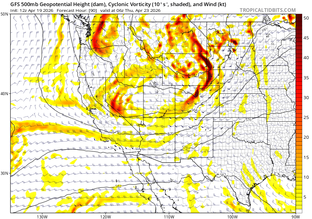
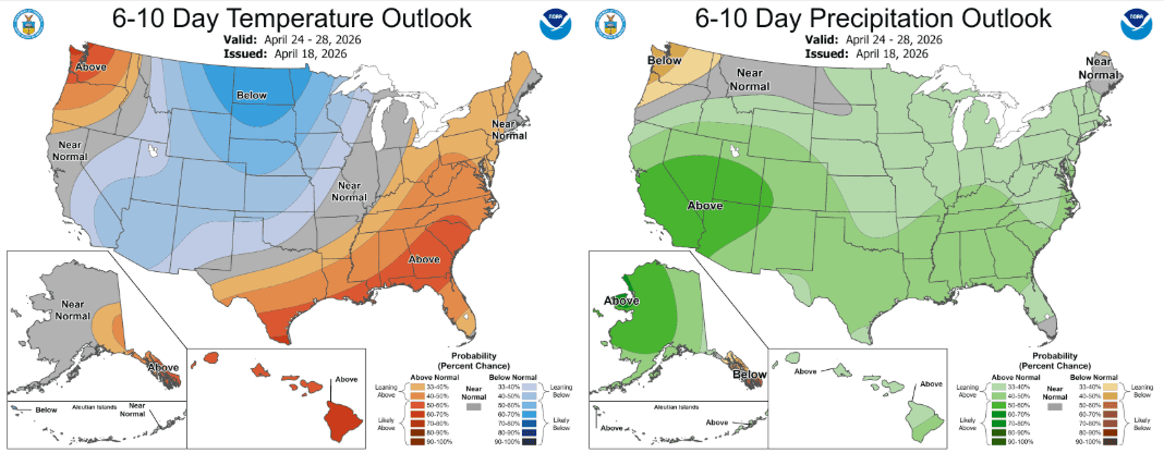
First image loop shows forecast precip-type / rate from latest 12z GFS from 6am Wed (04/22) through 6am Fri (05/01). Second image shows the super complex flow pattern at 6am Thu with 3 waves rotating around (high uncertainty). Image 3 shows the latest 6-10 day outlook from NCEP, showing the signals for a more active (wetter) and cooler pattern. Fingers crossed.
Go Avs! Go Nuggs (stoked we are 1-0 in that series). Great time of year to be a Denver sports fan!

Like what you read?
Receive daily weather reports straight to your inbox with Seth's Daily Newsletter. Sign up below.