Forecast for the week of 04/06 through 04/13, turning active towards the weekend
Apr 5, 2026
04/05/26 10:30am: Happy Easter and Passover. I hope you are having a good weekend. Lets take a look at what we can expect weather-wise this week and beyond. It looks fairly active, albeit on the weaker side initially, then maybe some bigger storms as we head towards mid-April. Here are some things I'm seeing right now:
Nice weather today, sunny with light wind, near 70 for Den/Bou, 40s/50s in the mountains
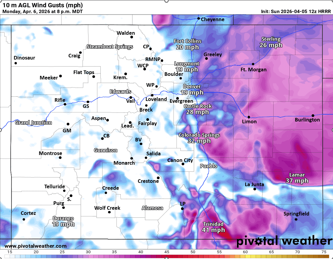
A backdoor cold-front will bring some cooler temps and some wind to the eastern plains and front-range (Den/Bou) tomorrow afternoon / evening, nothing major, but some northeasterly wind-gusts of 20-30 mph from 6pm-11pm tomorrow evening (dropping temps into the upper 50s)
Starting Tue afternoon and through next Sat, models show better moisture streaming into the state with a couple short-waves, although initially fairly weak forcing aloft
So this will setup more of an afternoon thunderstorm / rain shower regime from Tue-Sat, with rounds of rain/snow showers in parts of the mountains and some rain / weak thunderstorms each afternoon after 2pm (generally speaking)
Getting into the details more: Models show a weak disturbance passing over southern CO on Tue afternoon into Wed am:
So a round of rain/snow showers is likely for the mountains from 3pm Tue to 3am Wed, best chances in the southern CO (San Juans, etc) but some over the north-central mountains as well. Could be some small snow accumulation in spots above 10k (Trace-3” in spots, favoring southwest CO)
Then models show a short-wave passing north of CO on Wed into Thu. This will push another cold-front across the front-range on Wed afternoon / evening but still nothing major. A few rain showers possible for parts of the front-range and mountains on Wed afternoon / evening (after 2pm).
On Thu likely a few more afternoon rain/snow showers mostly over the mountains (unclear if Den/Bou gets much on Thu, just a bit cooler). Nothing too major for Thu
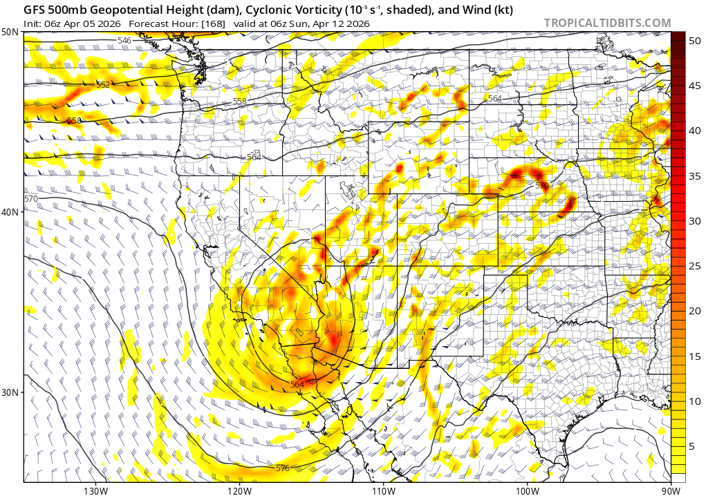
Then things get interesting for next weekend although the details are very uncertain as models are all over the place
The global models show an upper-level low approaching southern CO from the west/southwest on Fri into Sat…high uncertainty on where the low tracks on Sat into Sun. Does the low stay north, closer to CO like GFS is showing with bigger impacts, or does it track further south, like ECMWF is showing with limited impacts for CO
It does look like a another round of afternoon rain/snow showers is possible for the front-range mountains on Fri afternoon
Then a better chance for rain showers (snow in the foothills and adjacent mountains) from maybe 2pm-11pm Sat
Looking ahead, the most active part of the pattern will likely show up around Monday, April 13th through Wed, April 15th….maybe a larger colder storm system with snow possible for the front-range (Den/Bou) and for the adjacent mountains but details are all over the place, so who knows
So as you can see looking fairly active, especially towards mid-April.
That's all for now
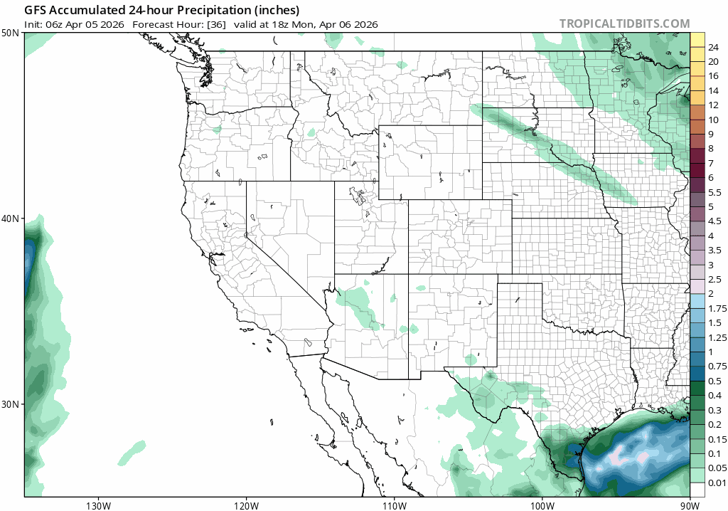
First image basically shows rain chances over the next 10 days via 24hr accumulated liquid precip from GFS....you can see the signals showing up for a wetter pattern towards next weekend and the following week (details need to be worked out). Image 2 shows the upper-level low at 12am Sun, big questions on where this thing tracks and impacts on CO. Third image shows forecast wind-gusts at 8pm Mon from latest HRRR (backdoor cold-front).

Like what you read?
Receive daily weather reports straight to your inbox with Seth's Daily Newsletter. Sign up below.