Forecast for the week of 03/02-03/08: two storm system: Tue-Wed, Fri-Sat
Mar 2, 2026
03/02/26 8am: Morning. I had a great hut trip (see the group post). Anyway, its Monday and we have some weather to talk about. Really two storm systems this week:
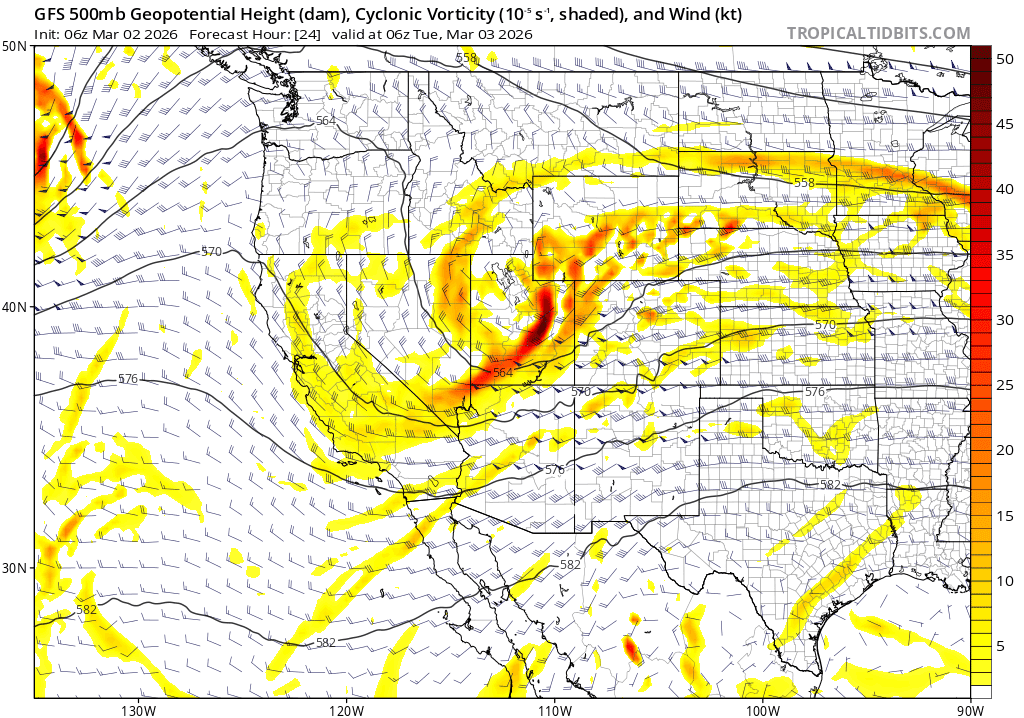
First weaker storm system will impact the state from 10pm tonight through 2am Wed (some rain/snow for both the mountains and front-range).
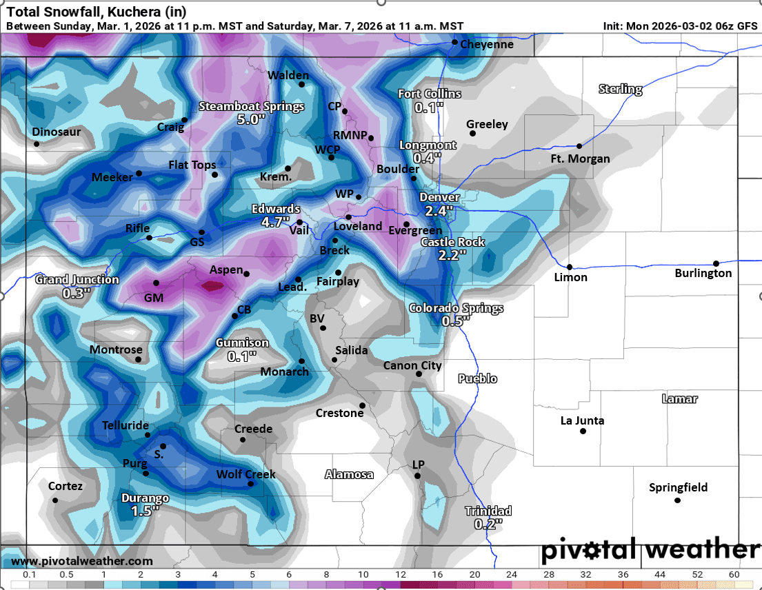
Second, stronger upper-level low will impact the state from about 2am Fri through 5pm Sat. Again brining some snow to the mountains and likely a decent shot of rain/snow (or all snow) to the front-range including Den/Bou (especially Fri afternoon into Sat)
Focusing in on this first wave.
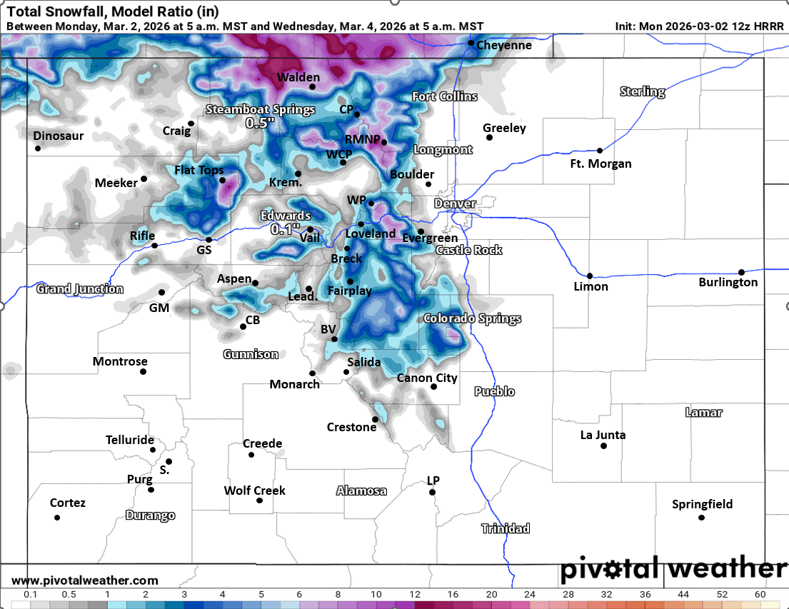
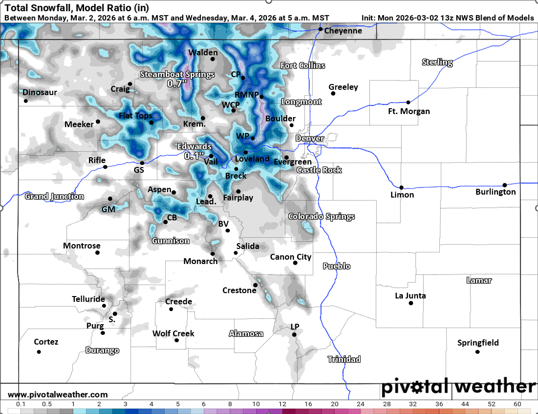
For the north-central mountains: snow / snow showers from 10pm tonight (Mon) through 2am Wed, most of the snow will fall from 12pm Tue to 12am Wed:
For the I-70 mountain corridor and local ski areas, spotty snow amounts of 1-4" possible, best chances near/along the Cont. Divide, secondarily west of Vail Pass.
Heavier snow likely for parts of the Front Range mountains and northern mountains: IPW, RMNP to Cameron Pass areas: 2-6" by Wed am. Maybe similar for parts of the Park Range towards Walden as well.
For Den/Bou and the front-range: models do show some upslope with this first storm system so hopefully some wetting precip for parts of the front-range:
For Den/Bou and the lower elevations: rain possible from 8am-8pm Tue (best chances Tue afternoon).
For the foothills some snow possible from about 12pm Tue to 12am Wed: 1-3" in a few spots above 7k ft.
Then as I said more rain/snow for the state on Fri into Sat.
Den/Bou may get some accumulating snow Fri afternoon into Sat morning initially.
More snow for the central mountains Fri afternoon through Sat afternoon as well. I'll have more on that later.
First image shows the first storm system valid at 11pm tonight via 500mb vorticity / wind from latest GFS model. Images 2 and 3 compare forecast total snowfall from now through 5am Wed from latest HRRR and NWS Blend of Models take with a grain of salt. Fourth image shows potential total snowfall form now through 11am Sat from latest GFS (both storm systems combined, take with a big grain of salt).

Like what you read?
Receive daily weather reports straight to your inbox with Seth's Daily Newsletter. Sign up below.