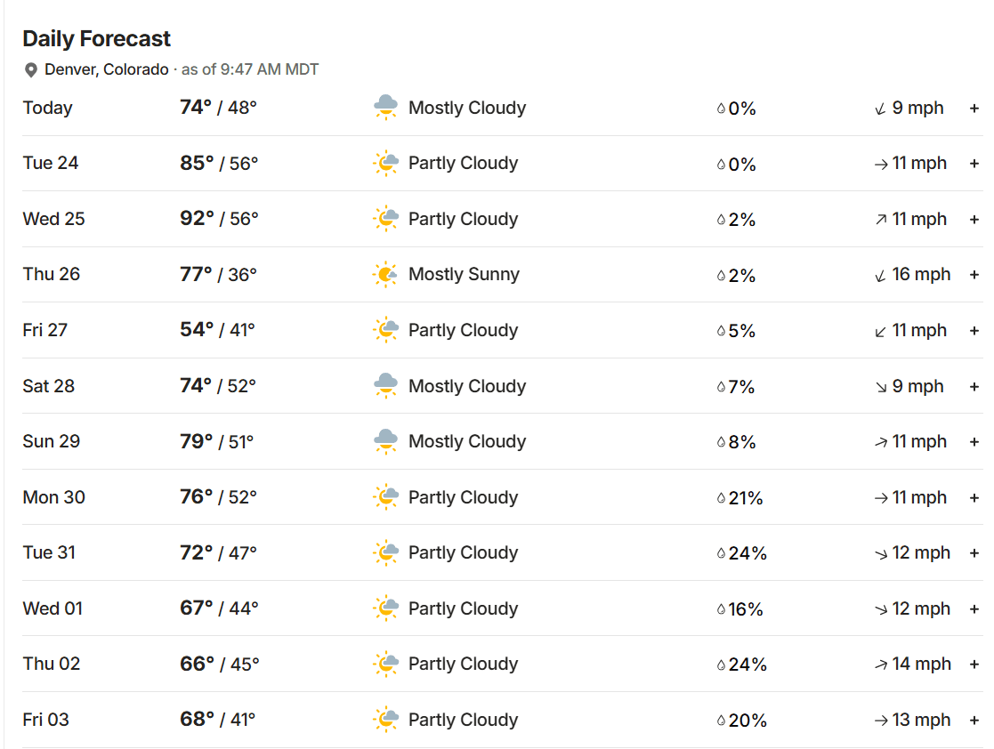
Forecast for the week: a little bit of weather and some hot temps on Wed, colder by Thu/Fri
Mar 23, 2026
03/23/26 10am: Morning, its Monday. We do have a little bit of weather to talk about for this week. Relatively cooler today, a little bit of snow showers for the mountains tonight, a big warm up again for Tue afternoon and especially Wed. Then a cold-front with a little bit of rain/snow for the front-range (Den/Bou) on Thu afternoon into Friday.
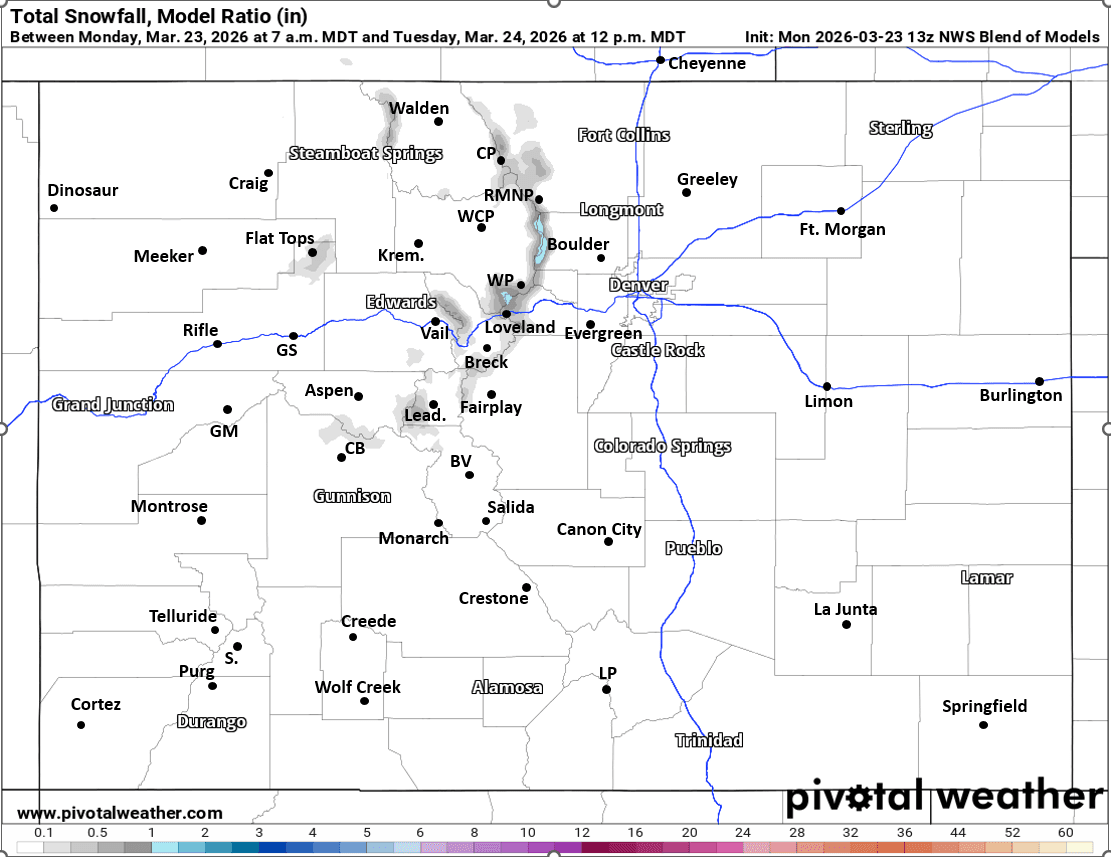
Models show a very weak short-wave and a bit of moisture moving across the state this evening. For the north-central mountains some snow showers over the higher terrain from 8pm tonight through 4am tomorrow morning: Trace-2" of snow in spots, best chances near the Cont. Divide (won't be much). Warming up tomorrow.
Some wind over the Front Range mountains (along/east of the Cont. Divide) both this afternoon and tomorrow afternoon: westerly wind-gusts of 30-50 mph (less wind west of the Divide and less wind on the front-range).
Then another ridge moves in for Tue and Wed. Looking very hot again for Wed with high temps near 90 for Den/Bou (70s in the mountains).
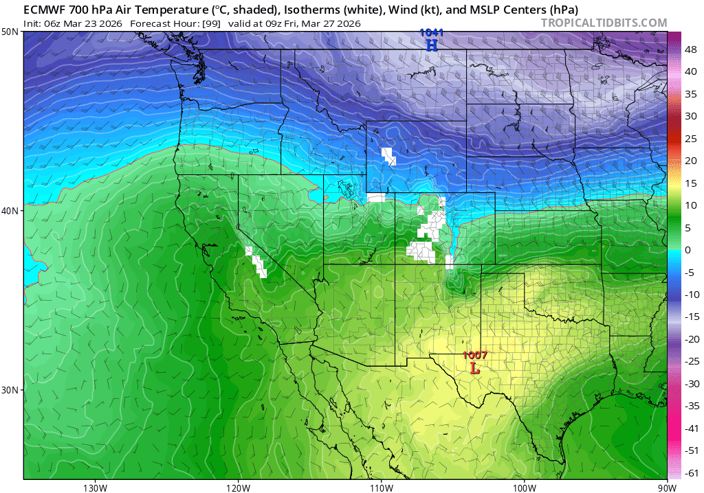
Then models show another short-wave and cold-front impacting the state on Thu into Fri.
Initial front move down the front-range by mid-day Thu.
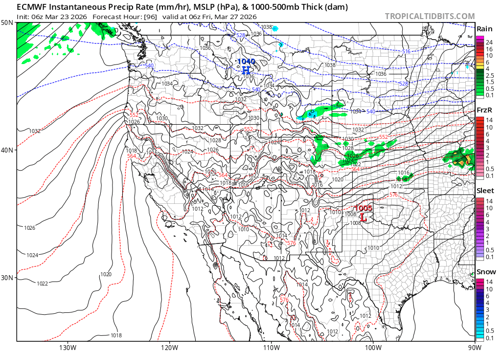
For Den/Bou and the front-range a round of rain/snow likely from about 6pm Thu to 6am Fri...rain initially for lower elevations Thu afternoon may change to wet snow by Fri am: Trace-2" of snow in spots. Best chances for some light snow will be in the foothills and along the Palmer Divide (1-4" possible for the foothills and higher terrain).
North-central mountains from Summit Co east and the Front Range mountains will also likely get a round of light snow from about 4pm Thu to 4am Fri: 1-4" for some of the ski areas (favoring areas near the Cont. Divide again).
Looking ahead, I'm tracking a pattern change with a series of bigger / wetter storm systems coming in around March 30th through April 4th, more on that later.
First image shows forecast total snowfall from now through 12pm Tue from NWS Blend of Models. Second image shows 10-day forecast for Denver from TWC. Image 3 shows the colder-air aloft coming in on Thu night. Fourth image shows forecast precip-type/rate at 12am Fri from latest ECMWF model.

Like what you read?
Receive daily weather reports straight to your inbox with Seth's Daily Newsletter. Sign up below.