Forecast for the next 1-2 weeks
Jan 11, 2026
01/11/26 1:30pm: Hi, I hope you are having a good Sunday. Lets take a look at the weather pattern over the next 1-2 weeks. Initially over the next 10 days or so, a ridge of high pressure will dominate the weather across the western U.S. with a few intrusions of colder air (and maybe some light snow) impacting Colorado from the north / northeast, CO will be on the edge of the colder air at times).
Overall a drier and warmer pattern over the next 10 days before the next more active and colder period around Jan 23rd-27th.
And of course some wind at times, especially in the front-range mountains and foothills (but not too bad initially, windier later this week but nothing major)
Here are some main points:
Seasonably warm and dry across the state today through Tue pm
Models show a dry, back-door cold-front moving into eastern CO and the front-range on Tue night into Wed
Colder for Den/Bou and eastern CO on Wed (highs back in the 40s) but will remain dry. Windy in the Front Range mountains and foothills on Tue into Wed
Warm and sunny again through mid-day Thu
Then possibly a stronger cold-front for the northern CO and the front-range (Den/Bou) on Thu night into Fri
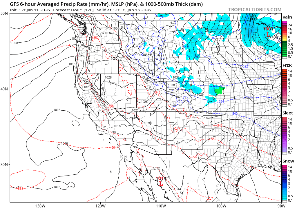
Some model like GFS show a round of light snow for Den/Bou and the northern front-range from about 3am-12pm on Fri, could be a Trace-2" of snow in spots, favoring the foothills. ECMWF doesn't show much
Also looks like a round of light snow / snow showers for the north-central mountains / I-70 mountain corridor from 5am-5pm Friday (Trace-3" in spots, or less)
Then likely back to dry weather from next Sat (17th) through the following Thu (22nd). And likely warm again for the first part of that week (19th-22nd)
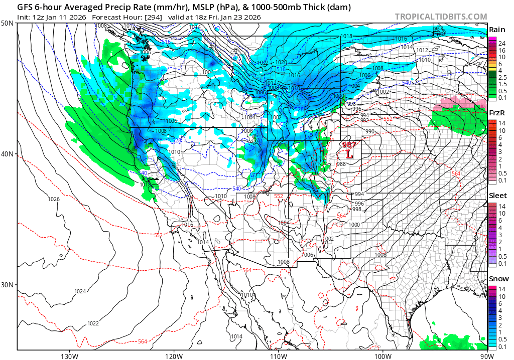
Looking a ways out, global models show a much more active and colder pattern for the western U.S and Colorado starting around January 23rd / 24th and lasting through about January 27th... So several chances for heavier mountains snow in that time-frame and maybe more snow for Den/Bou.... but since this is more than 10 day out, uncertainty in the details is very high.
That is all for now. How is your Sunday going weather wise? Later tonight or tomorrow I'll have a snowpack update.
First image loop shows the evolution of the forecast pattern via forecast 700mb temps and MSLP over the next 15 days from latest GFS....we want to see the darker blues to purple (representing the colder air and snow chances). The greens to yellow is very warm and air associated with the ridge. Image 3 shows forecast precip-type/rate and thickness on Fri morning (01/16, showing the chance for snow along the front-range and adjacent mountains). Image 3 is equivalent but for Friday, January 23rd, take with big grain of salt.


Like what you read?
Receive daily weather reports straight to your inbox with Seth's Daily Newsletter. Sign up below.