Forecast for the approaching, fast moving storm system, slated to impact northern CO
Oct 27, 2025
10/27/25 8am: Alright, here comes the fast moving short-wave slated to impact northern CO mostly from this afternoon into tomorrow morning. And some much colder air coming to the front-range tonight after 9pm.
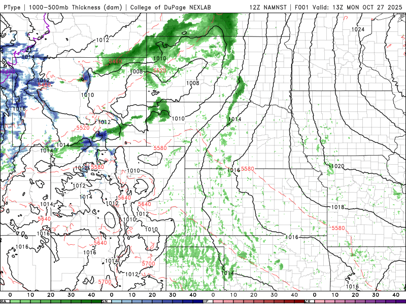
Forecast is on track for the most part. Some clouds and snow-showers moving into the northern mountains now (especially near Cameron Pass area, with some snow flying up there right now).
Models show the bulk of the snow for the north-central mountains between 4pm tonight to 4am tomorrow morning. Models are struggling a bit with the details like how much snow and where.
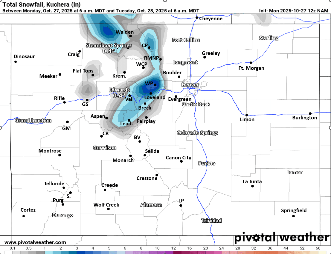
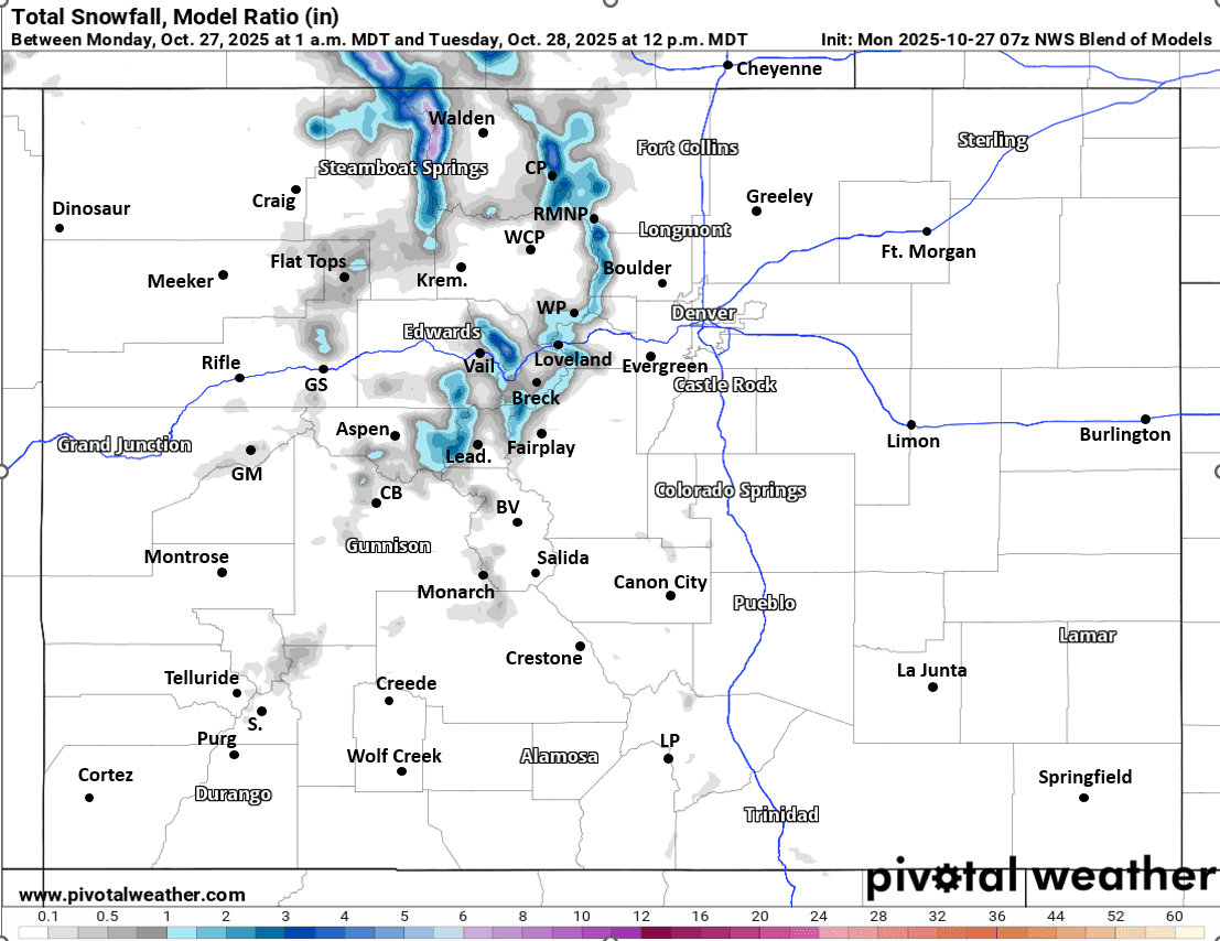
Some of the models have increased snowfall just a bit for parts of Summit, ClearCreek and especially Grand counties (models like NAM, ECMWF show more in those area), on the flip side high-res models like HRRR and CAIC WRF 2km show way less in those areas with more of the snow further north.
I'm still expecting 1-4" for the local ski areas, favoring areas near Berthoud/Jones Passes, Winter Park, Loveland ski, A-Basin, etc (with maybe up to 5" in a few favored spots)
Parts of the Park Range (north of Steamboat) and Medicine Bow Range (closer to Cameron Pass to RMNP) can expect 3-7" in spots.
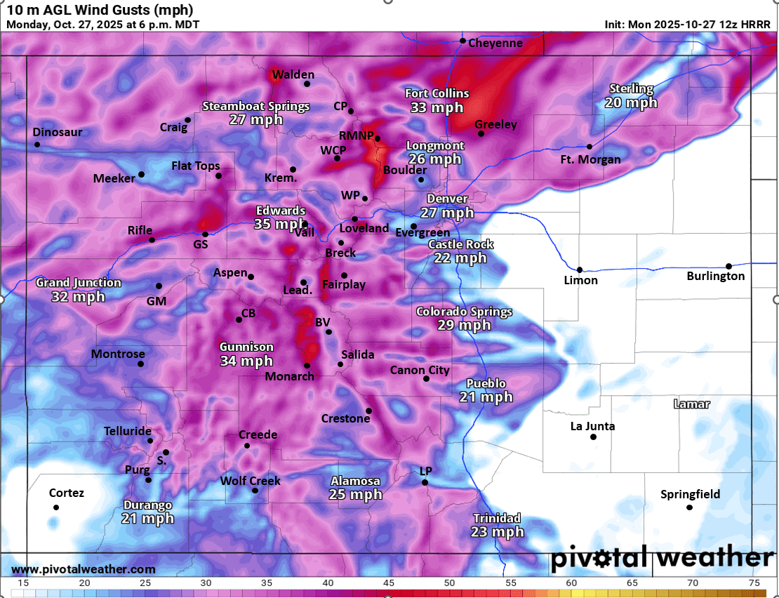
It will be turning very windy across the mountain after 12pm today (12pm-11pm) with west / northwest wind-gusts of 30-60mph, strongest in the Front Range mountains near the Cont. Divide above 10k ft.
For Den/Bou and the front-range the main cold-front is slated to move through in the 3-6pm timeframe, coming in on some chilly northwest winds: wind-gusts of 20-40mph this afternoon (strongest from 2pm-8pm). Maybe a few gusty rain showers (and a few snow showers in the foothills above 8k ft) between 4pm-9pm, best chances near/along the Palmer Divide (not expecting much measurable precip for Den/Bou due to the strong wind).
Then turning much colder for Den/Bou on Tue, high temps only in the 40s.
It will also be cold in the mountains on Tue with high temps only in the 20s (above 9k ft) with westerly wind gusts as well 20-40mph, especially along/east of the Cont. Divide on Tue (Front Range mountains) looks like full on winter in the mountains.
Hard freeze expected on the front-range by Tue morning, but especially Tue night into Wed am (low temps around 20 degs for Den/Bou make sure your sprinklers are blown out)
The weather warms up and dries out for Wed-Fri.
First image loop shows the evolution of the storm via forecast precip-type/rate over the next 24hrs (6am this morning to 6am Tue) from latest NAM-3km model. Image 2 shows forecast wind-gusts at 6pm this evening as the main cold-front moves through. Images 3 and 4 compare forecast total snowfall from now through 6am Tue from latest NAM (a bit lower resolution but can indicate where bullseye maybe) and NWS Blend of Models (an average of the models, since uncertainty is high). I'll attach ECMWF in the comments which is really trying to crank it out (but I don't believe it yet).

Like what you read?
Receive daily weather reports straight to your inbox with Seth's Daily Newsletter. Sign up below.