Forecast for Mother's Day weekend and beyond. A transition to a more summer like pattern
May 8, 2026
05/08/26 9am: Morning, Happy Friday! Well that was a nice run of spring storms, looks like we are going to transition to a more summer like pattern in the next 1-2 weeks.... That doesn't mean we are completely done with rain chances, but its going to transition to more summer like afternoon rain showers and thunderstorm with less chances for widespread snow, although likely a few more storms in mid to later pater of May.
Overall looking pretty nice for Mother's Day weekend but we do have a little bit of weather to talk about:
For today: windy over the front-range mountains and foothills, with westerly wind-gusts of 25-50 mph, strongest above 9k ft. For Den/Bou just breezy at time today with temps near 70 (wind-gusts generally below 30).
Sat will start out quite nice, especially on the front-range (Den/Bou): sunny with temps climbing into the upper 70s, breezy in the afternoon.
For the mountains on Sat, turning windy again, especially near/east of the Cont. Divide, with westerly wind-gusts of 30-60 mph, strongest over the Front Range mountains above 9k ft.
Then models show a short-wave and cold-front moving across northern CO tomorrow evening.
Initially the front will push into northeast CO after 3pm tomorrow, from 3pm-9pm, the northeast plains (east of a Greeley to DIA line) will have a chance for isolated to scattered thunderstorms.
Also on Sat afternoon, a slight chance for some isolated / scattered storms over southern CO, San Juans to SLV to Sangres, after 4pm.
Then the main cold-front will push into Den/Bou after 9pm Sat with some strong northeast winds. This will also usher in a chance for some late thunderstorms and rain showers over the northern front-range, with best chances from 9pm Sat to 3am Sun (hopefully some night-time boomers, may not be much).
The northern mountains, mostly north of I-70 will have a chance for some snow showers late Sat night into Sun morning.
Then cooler on Sun behind the front (upper 60s for Den/Bou) again, but mostly sunny and pleasant. On Sun afternoon a slightly chance for some rain showers in/near the foothills, after 3pm, won't be much.
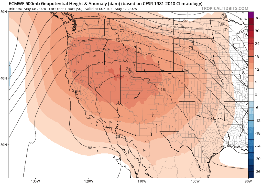
Looking ahead, the big story for next week will be a strong ridge of high-pressure moving into the western U.S. and CO with some hot temperature and mostly dry conditions.
For Den/Bou we are looking at temps in the mid-80s to near 90 from Mon-Thu next week. With temps in the 60s/70s for the mountains.
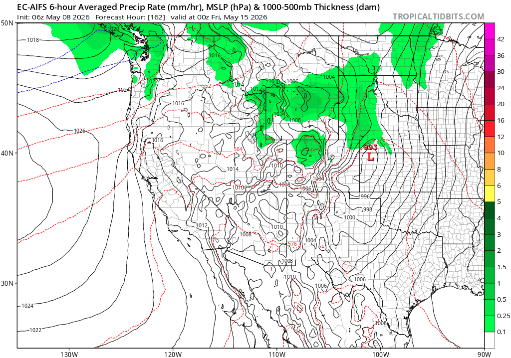
Then maybe the next storm system coming out of the southwest, will impact the state next Thu afternoon into Fri (05/14-05/15) with some rain/snow for the mountains and rain showers for the front-range in that timeframe, but details are uncertain.
Likely dry again for that following weekend then maybe more active the week of 05/18-05/22 but who knows.
Thats all for now. Have a great Mother's Day weekend!
First image loop shows forecast radar over the next 60 hours: 6am this morning through 6pm Sun, you can see the storm on Sat night, take with grain of salt. Image 2 shows the big ridge of high pressure building in by Mon afternoon into Tue from ECMWF. Third image shows the potential next storm system for next Thu/From EC-AIFS model.

Like what you read?
Receive daily weather reports straight to your inbox with Seth's Daily Newsletter. Sign up below.