First day of meteorological fall. Some good rainfall for parts of Denver yesterday. Rain reports below
Sep 1, 2026
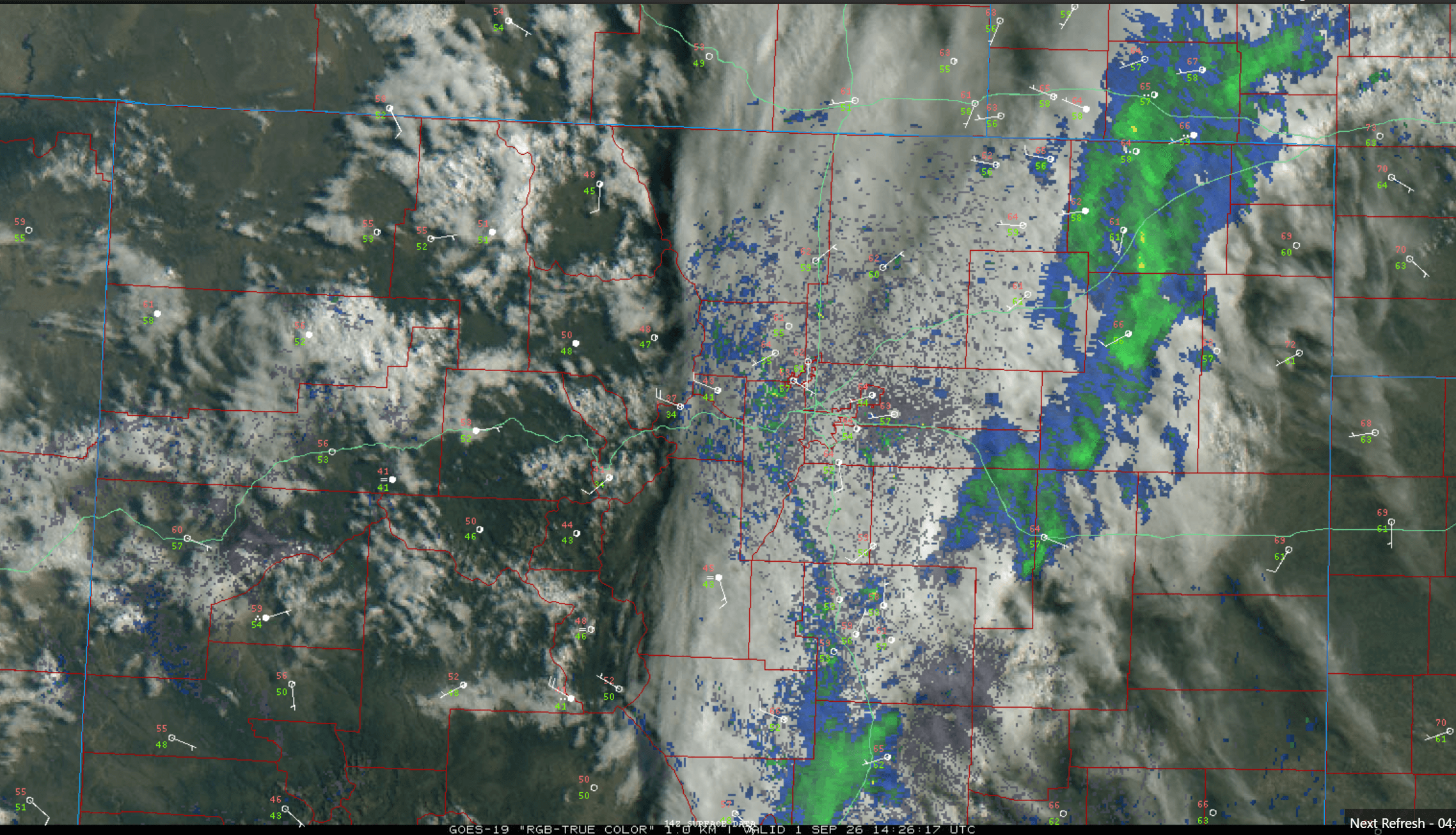
09/01/26 8:35am: Happy September 1st, the first day of meteorological fall! (Sep, Oct, Nov). Nice and cool out there on the front-range with some rain still ongoing over the eastern plains as the short-wave exits the state.
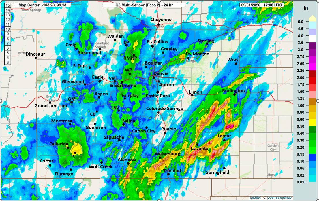
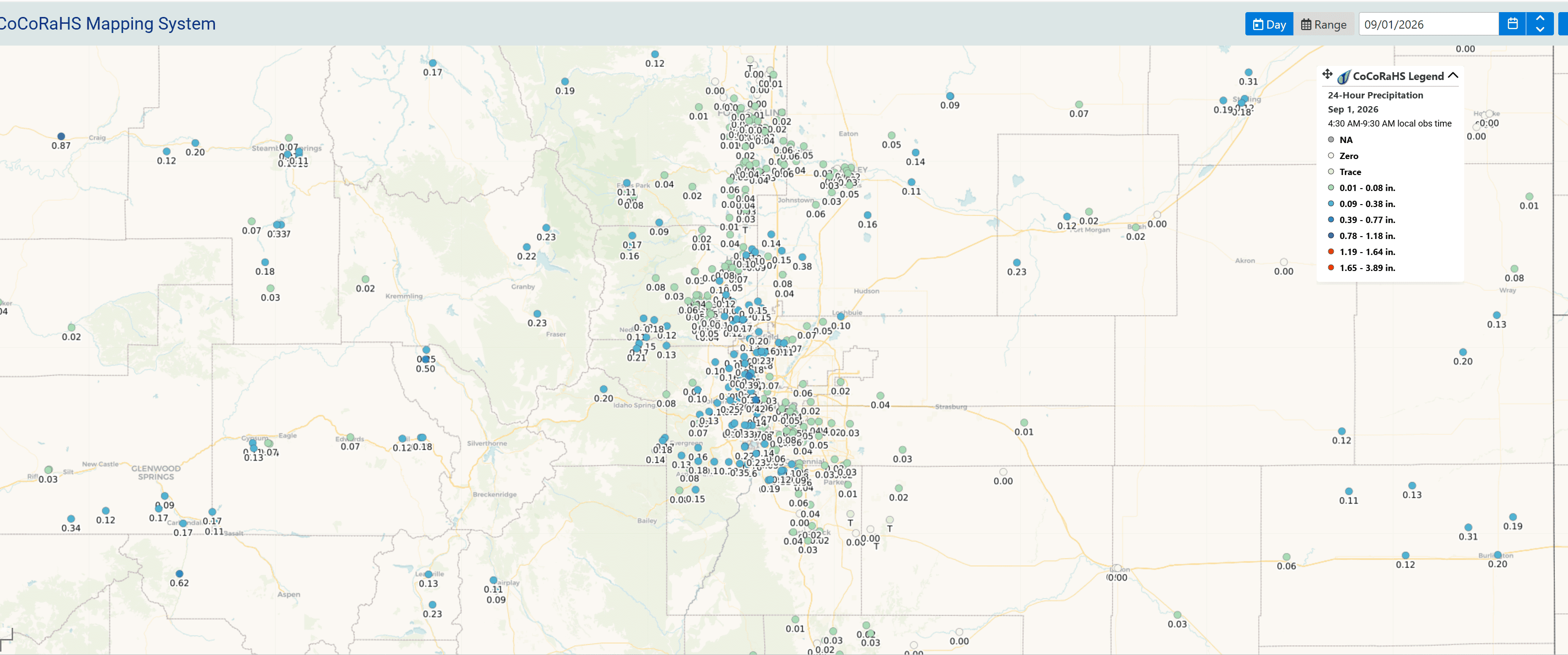
Stoked to get some more meaningful rain yesterday evening. I measured 0.18" at my house (some parts of the metro area picked up nearly 0.45"). Below I show some 24hr rain reports.
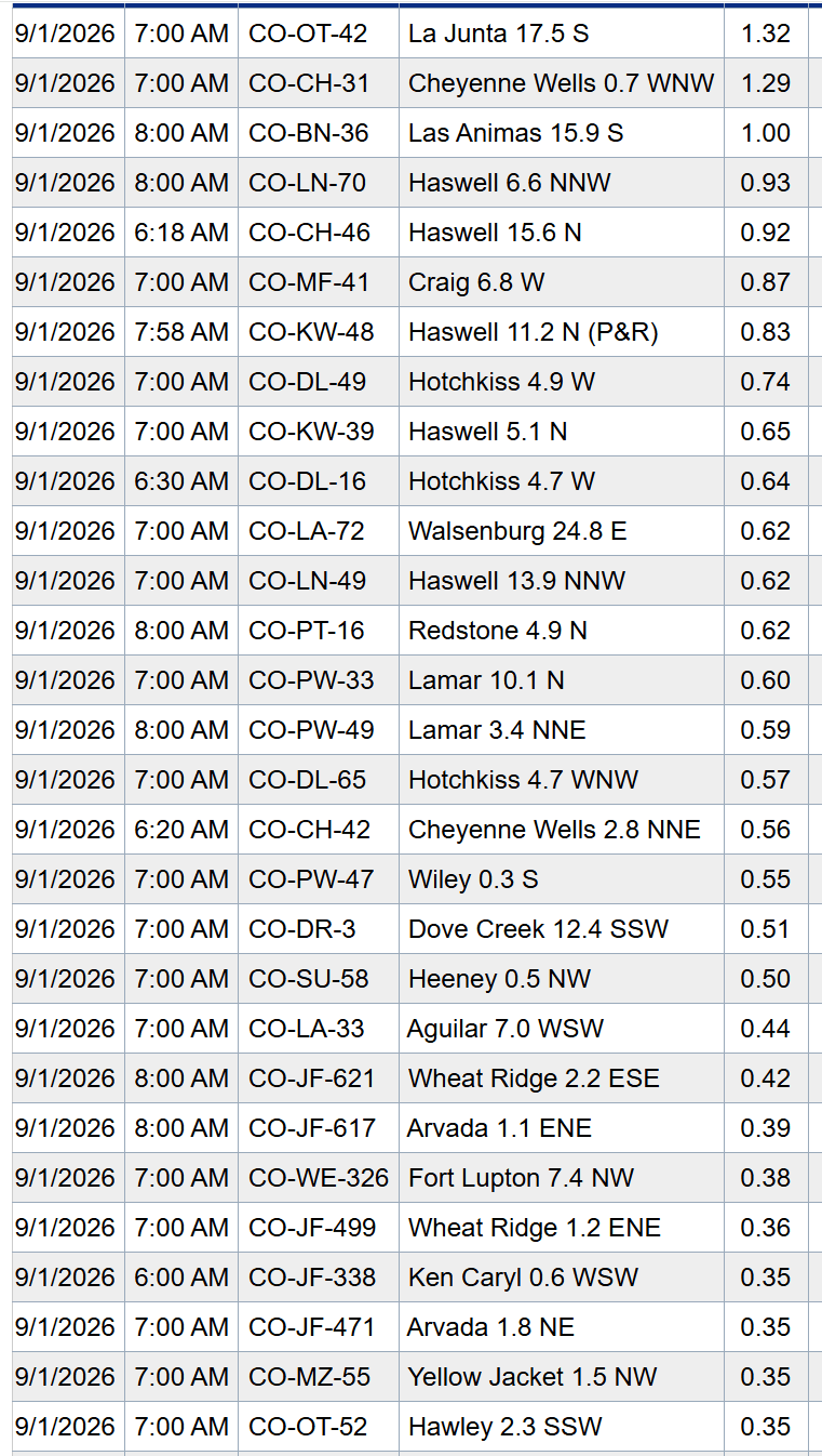
First image shows 24hr observed rainfall from MRMS. Second image shows top 24hr reports from CoCoRaHS and third image is a map of reports over Den/Bou. Fourth image is current satellite/radar/surface overlay.
Here are some notable top reports:
Cheyenne Wells 0.7 WNW: 1.29"
Las Animas 15.9 S: 1.00"
Craig 6.8 W: 0.87"
Hotchkiss 4.9 W: 0.74"
Lamar 10.1 N: 0.60"
Heeney 0.5 NW: 0.50"
Alamosa 1.6 ENE: 0.34"
Silverton 0.3 WSW: 0.34"
Oak Creek 4.7 E: 0.33"
Tabernash 2.7 NW: 0.23"
Leadville 6.3 S: 0.23"
Vail 2.1 ENE: 0.18"
Wheat Ridge 2.2 ESE: 0.42"
Arvada 1.1 ENE: 0.39"
Golden 3.3 ENE: 0.25"
Lakewood 3.3 NNE: 0.24"
Westminster 1.3 NNE: 0.23"
Evergreen 5 W: 0.18"
Lafayette 0.7 WSW: 0.17"
Boulder 1.9 SE: 0.07"
Denver 2.8 ESE: 0.05"
Aside from the rain on the eastern plains this morning, Overall less rain chances for most areas today.
For both the central mountains and front-range, isolated thunderstorms from 3pm-9pm, best chances east of the Cont. Divide and from the Palmer Divide south (southeast CO will be favored), hit or miss storms, won't be much.
Tomorrow or later today we will look at 7-day rain totals. How much rain did you get yesterday? In the last 3 days?
Also if you see any legit snow on the high peaks (would be above 13k ft), let me know 🙂

Like what you read?
Receive daily weather reports straight to your inbox with Seth's Daily Newsletter. Sign up below.
