Extended forecast for week of 08/31 through 09/07 (and Labor Day weekend)
Aug 30, 2026
08/30/26 8:30pm: Hi, hope you are having a good Sunday evening (and getting some more rain in western CO / mountains, as I posted about earlier). Anyway, I put together a couple little graphics highlighting the upcoming weather.
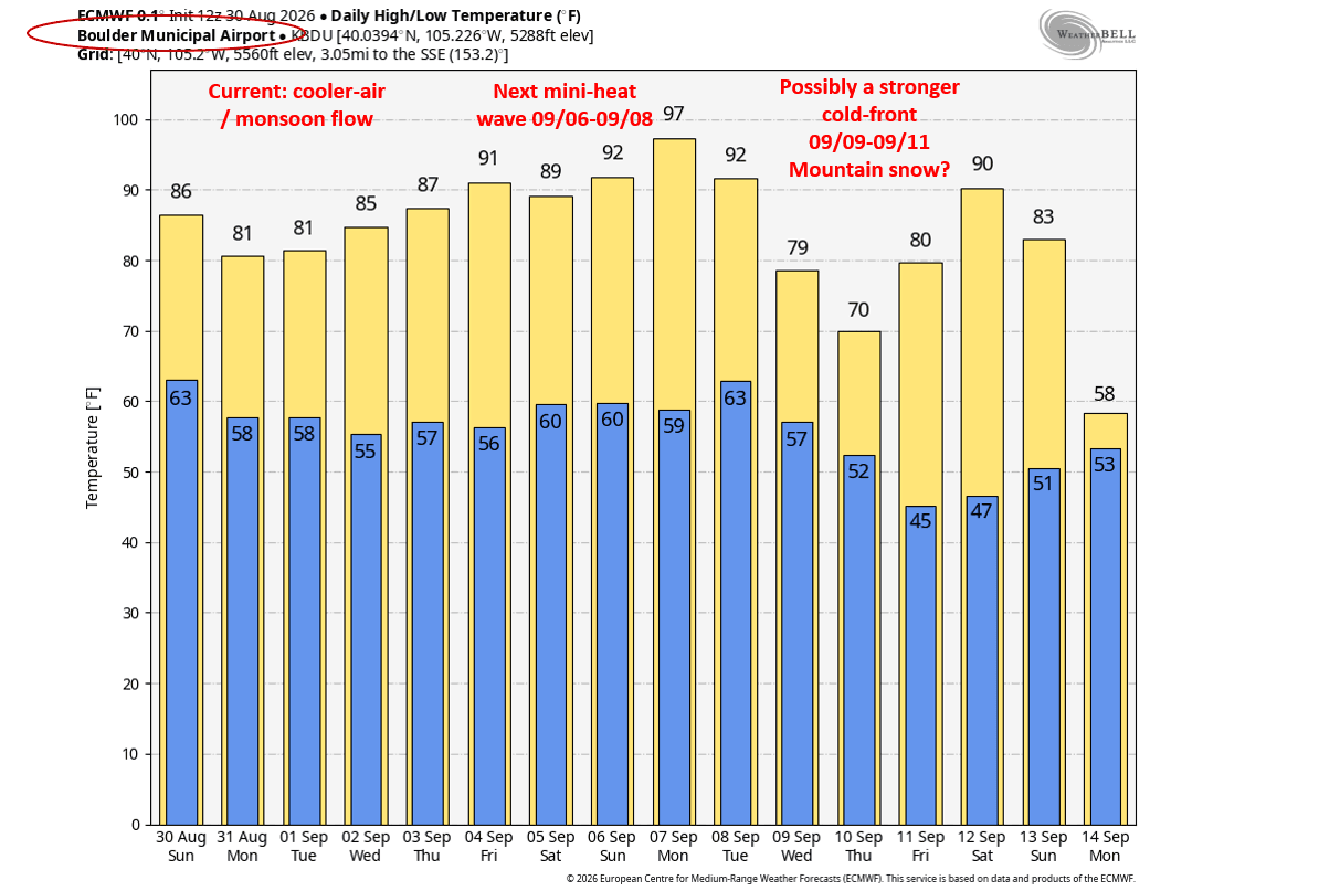
First image shows max/min temps over the next 10 days for Boulder but a good proxy for both the front-range and adjacent mountains in terms of whats coming up.
From today through Tue, cooler, better monsoon flow with some short-waves as times to enhance the rainfall (like another wave Mon evening into Tue). So it will remain unsettled through Tue night.
Then back to hot and dry for much of Labor Day Weekend. In fact modes show another min-heat wave for basically Fri-Mon, with the hottest days next Sat-Mon (09/06-09/08), high temps back in the mid-90s for Den/Bou, upper 70s / low 80s for the mountain towns (I know I'm sick of the heat, don't shoot the messenger, el nino brings more heat at times).
But then beyond that models show potential for a stronger / colder trough moving across CO around 09/09-09/11, with maybe a nice cold front for the front-range (some upslope) and possibly a little bit of real snow for the mountains around that time-frame, but will depend on how far south the trough moves in, etc.
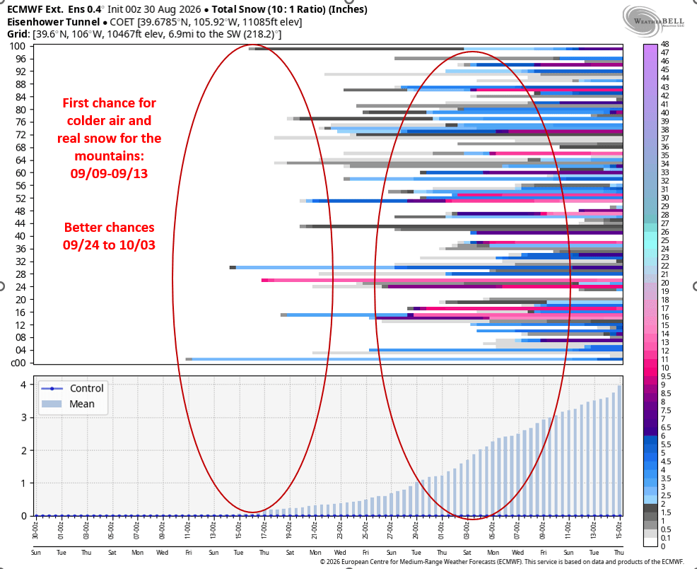
Looking at the ECMWF extended forecast for snowfall chances at Eisenhower Tunnels, Cont. Divide area (second image) you can see initial snow-chances show up around 09/09-09/13, but then better snow chances and colder around 09/24 to 10/03...but that is so far out, very uncertain how it will all play out...but some better signals for colder air at end of Sep / beginning of Oct.
What are your thoughts on the extended forecast and more heat next weekend?
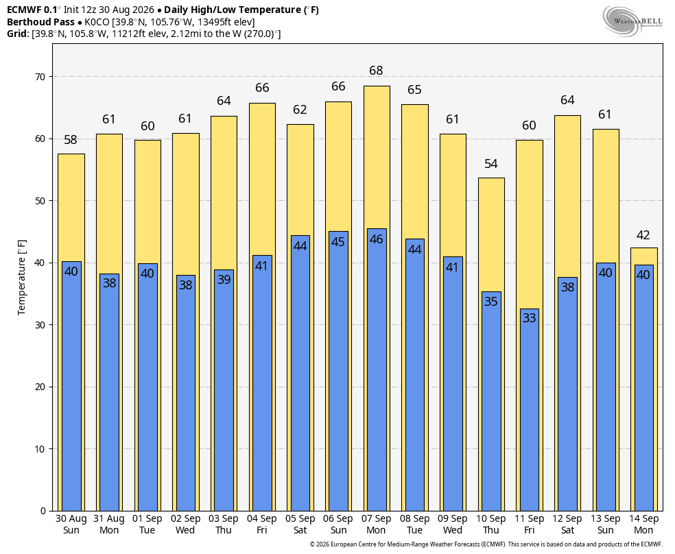
Third image shows max/min temps for Berthoud Pass over the next 10 days from ECMWF (first image is Boulder).

Like what you read?
Receive daily weather reports straight to your inbox with Seth's Daily Newsletter. Sign up below.
