Details for the Wed/Thu storm: snow for the mountains, wind for the front-range
Dec 16, 2025
2/16/25 8am: Lets take a look at some details for the approaching storm system which will bring a round of snow to the mountains Wed afternoon into Thu morning, some rain/snow showers to the front-range Wed evening and some very strong wind to the mountains and front-range on Wed into Thu.
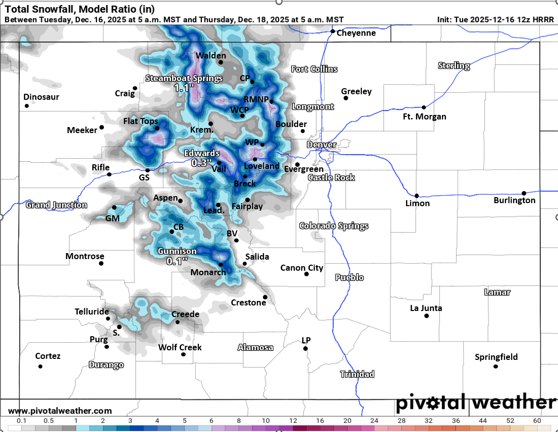
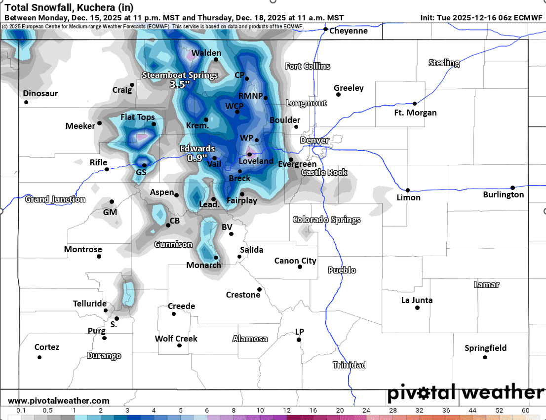
For the north-central mountains (including Eagle, Summit, Grand, ClearCreek, western Boulder/Larimer counties and the I-70 mountain corridor), snow primarily from 2pm Wed to 2am Thu, heaviest Wed night. 2-5" for the ski areas and mountain passes favoring the Front Range mountains (Loveland to Berthoud to WP, IPW, RMNP, Cameron Pass and also in the Park Range north of Steamboat).
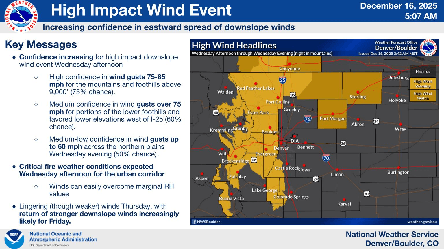
A High Wind Warning is in effect from 11am Wed through 12am Thu for much of the eastern north-central mountains and front-range mountains for westerly wind gusts of 50-90 mph, strongest above 8k ft and along/east of the Cont. Divide
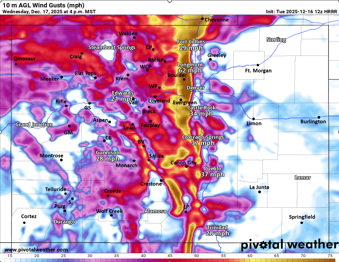
For Den/Bou and the front-range turning very windy tomorrow after 11am ahead of the cold-front. Then a chance for some brief rain/snow showers from about 5pm-11pm. Likely not much actual precip hitting the ground due to the strong downslope winds. But maybe a few snow showers in the foothills and Palmer Divide (mostly after 6pm), minor accumulation above 7k ft.
Western suburbs including Ft. Collins to Longmont to Boulder to Golden to Lakewood to Castle Rock is also under a High Wind Warning from 11am Wed through 12am Thu. The rest of Den/Bou is under a Red Flag Warning most of the day tomorrow into early Thu.
Strong wind will continue along the front-range on Thu (strongest east of the Cont. Divide), less further west.
Another round of light snow likely for the north-central mountains from about 5pm Thu to 2am Fri: 1-3" additional snow at some of the ski areas, favoring area along/noth of I-70
Then more snow likely for the mountains from about 5am Sat to 5am Sun: additional 2-6" at the ski areas seems likely, details need to be worked out.
That is all for now. We are actually heading out for our annual tropical vacation (thanks Mom) to the Cayman Islands on Fri, for a week. So I'm hoping to get a little of that snow / pow in the mountains before I leave, we shall see.
I will likely have a snowfall map for the Wed/Thu wave tonight.
First two images shows forecast total snowfall from now through 5am Thu from latest HRRR and ECMWF models (take modeled snow amounts with grain of salt). Third image is forecast slide from Den/Bou NWS office about the wind. Fourth image shows forecast wind-gusts at 4pm Wed from latest HRRR (very strong wind west of I-25).

Like what you read?
Receive daily weather reports straight to your inbox with Seth's Daily Newsletter. Sign up below.