Cooler with much better rain chances coming next week (07/21-07/25)
Jul 15, 2026
07/15/26 8pm: Next week is lookin rather interesting weather wise. Potentially some much needed, beneficial rain coming to most of the state by the time we get to the end of next week (if recent models runs hold, they have been somewhat consistent lately).
Models show some cooler-air from the north and some usplope flow for the front-range combining with some much deeper monsoon moisture moving up from the south especially in the next Tue to Fri timeframe (07/21-07/24). If this pans out some more consistent rounds of thunderstorms for both the mountains and front-range (Den/Bou) and parts of the eastern plains.
Even prior to this some decent monsoon flow for the mountains this weekend, but favoring southern CO like it has the last few days.
And you can see the much cooler weather for Den/Bou, via the plot for Boulder, showing forecast high/low temps in response to the cooler air, cloud-cover and better rain chances next week. High-temps maybe only in the upper 70s during the middle of next week!
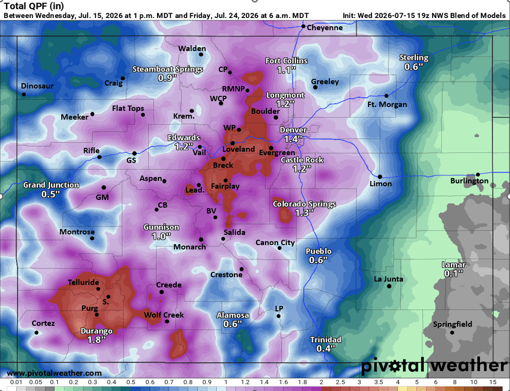
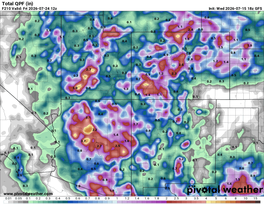
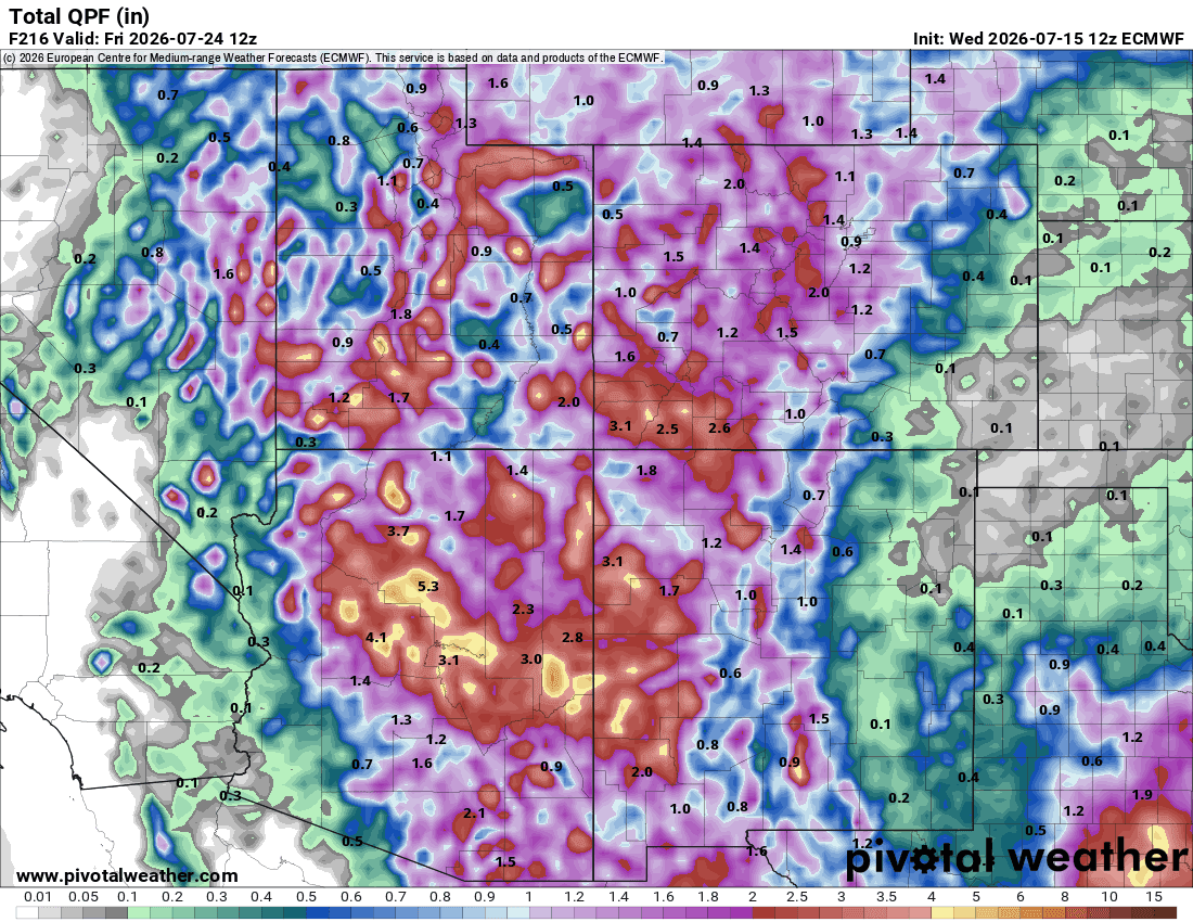
Models are cranking out a bunch of precip from now through next Fri (most of it next Tue-Fri) but you have to take the numbers with a huge grain of salt this time of year as we are dealing with convection: hit or miss thunderstorms (not everyone will get that much rain). This time of year more of an indication of who has the best chances for heavy rain:
Overall heaviest rain in the next 7-10 days will be in parts of the mountains, favoring the San Juans, but also areas in the north-central and south-central mountains near the Cont. Divide.
Also looks like parts of western CO / western slope, etc should get some beneficial rain as well as we move through next week, still hit or miss storms.
And really hoping Den/Bou and the front-range gets some more rain (looks likely next week with some upslope flow), but also going to be much cooler, which I'm really looking forward to!
Fingers crossed for some deep monsoon moisture combined with a cold-front!
Forecast total precip plots are from now through next Fri (07/24), showing NWS Blend of Models, GFS and ECMWF (it will not fall as it shown but signals are strong for rain).


Like what you read?
Receive daily weather reports straight to your inbox with Seth's Daily Newsletter. Sign up below.
