Another morning with some cold low temps (48 in Denver, tied the record low. 27 in Fraser this morning)
Aug 5, 2026
08/05/26 8:45am: Morning, did you put your jacket on!? Wow is it chilly out there for early August. Some cold low temps this morning in spots.
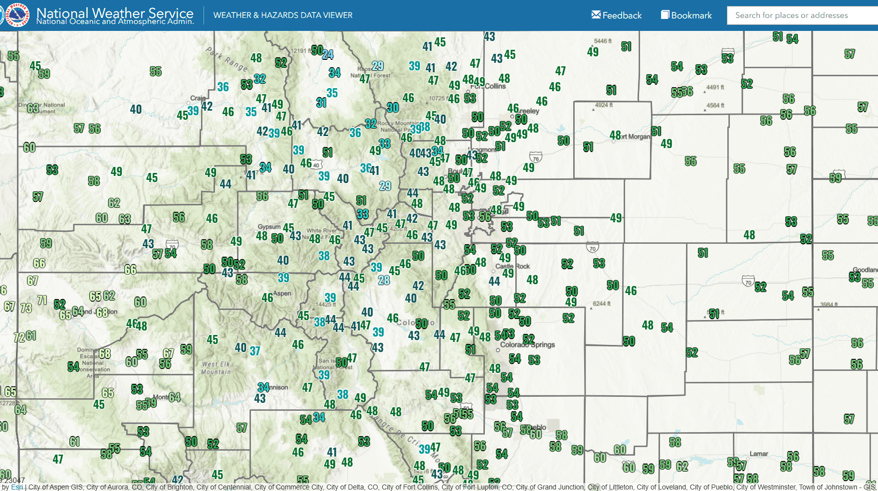
Denver tied a record low temp this morning (for the date) with a low of 48 degs. Mind you this comes shortly after the record high temp on Sun (of 102).
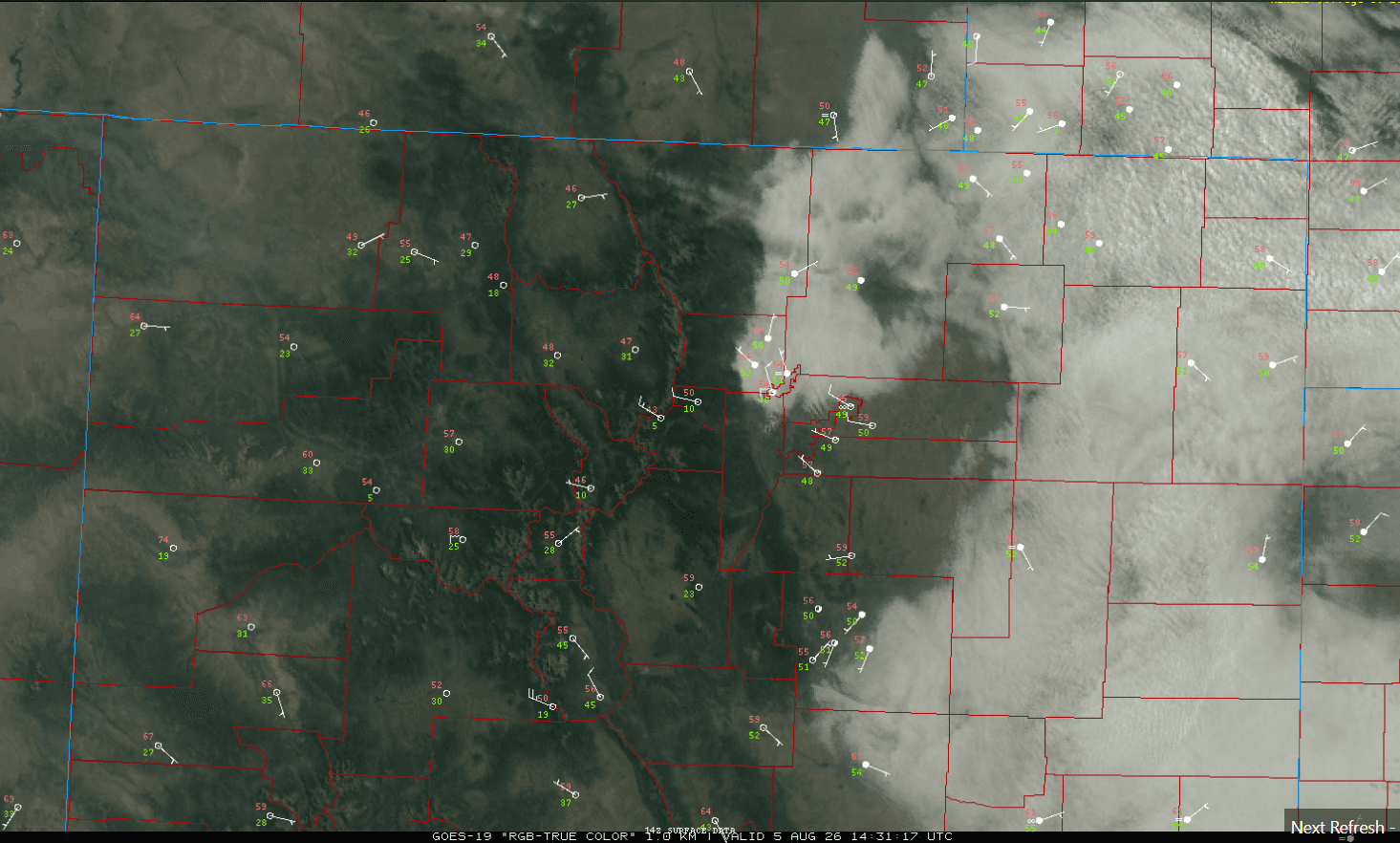
And it is still chilly on the front-range with another surge of surface upslope and low clouds as you can see on the satellite image below. Some shallow, low clouds over parts of the front-range now, with temps only in the low 50s right now (53 at my house).
It was also a chilly morning in the mountains (after a cool and clear night). Fraser (near Winter Park) had a low of 28 degs and it was 24 near Walden! Here are some notable low temps this morning:
Cowdry Stn (near Walden): 24
Fraser Flats: 28
Jefferson (north of Fairplay): 28
Clark (north of Steamboat): 32
Snowmass Village: 34
Leadville: 39
Craig: 39
Silverthorne: 43
Denver (DIA): 48
Going to be a pretty nice day. Low clouds on the front-range will eventually clear out and give way to sunny but smoky skies at times.
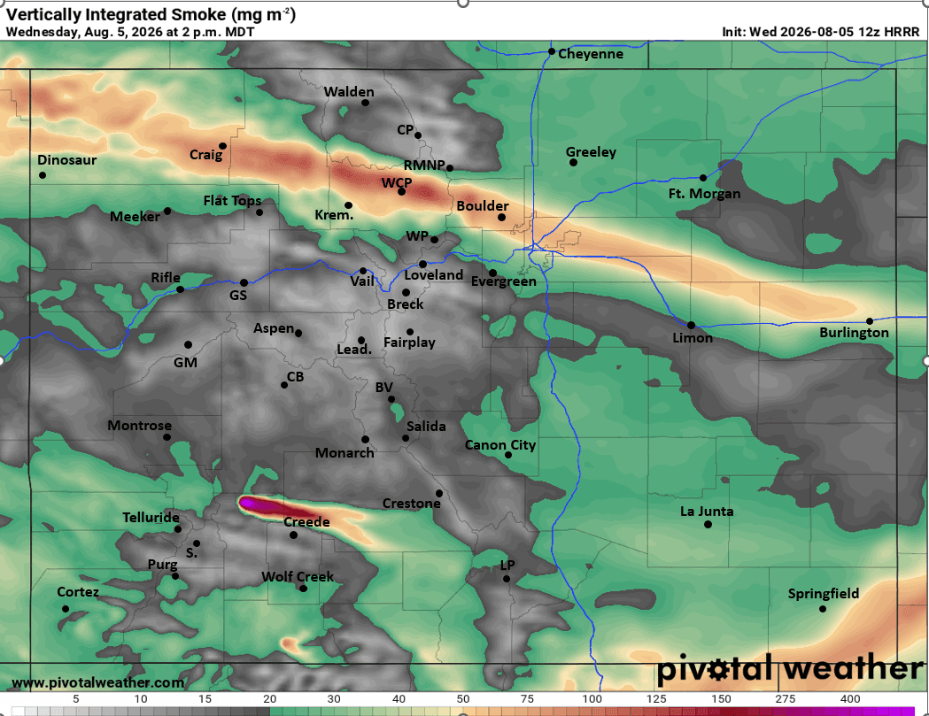
Does look like we will have some rounds of smoke moving over CO, a batch this afternoon (around 1pm-5pm).
Then more smoke moves into western CO, parts of the mountains on Thu afternoon.
There is a new fire of concern in Hinsdale County, with the Elk Fire north of Lake City (currently at 2785 acres), that could grow some over the next few days.
Much of the north-central and south-central mountains are under a Red Flag Warning from 12pm-8pm today, westerly wind-gusts of 20-35 mph in spots. So heads up there.
How are conditions in your neck of the woods? Did you need a jacket this morning!
This cold-air could be a preview of more cold-air to come in mid-Aug as I mentioned last night. After this next weekend the weather pattern looks quite interesting for CO (see my post from last night).
First image is current, local satellite/surface overlay. Second image shows low temps (min-T since midnight) over the state. Third image shows forecast vertically integrated smoke forecast at 2pm today from latest HRRR.

Like what you read?
Receive daily weather reports straight to your inbox with Seth's Daily Newsletter. Sign up below.
