An increase in early monsoon moisture this week with better thunderstorm chances for the eastern half of the state
May 31, 2026
05/31/26 10:15am: Happy Sunday! I can't believe its the last day of May, the last day of meteorological spring! Summer is here. Anyway, lets take a look at what we can expect weather wise this week.
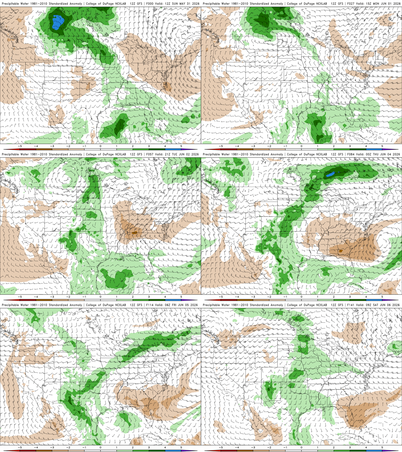
Models show a surge of early monsoon moisture moving into the state from the south/southeast Tue-Thu and this will bring increased thunderstorm chances for parts of southern CO and the front-range (Den/Bou) this week, starting Mon afternoon. First image I show where best thunderstorm chances will be this week, 1pm-8pm each day.
Overall pretty dry today, just a few isolated storms over parts of the northwest / north-central mountains (after 2pm) and near the Palmer Divide and east (after 4pm). Most areas stay dry. Breezy but nice
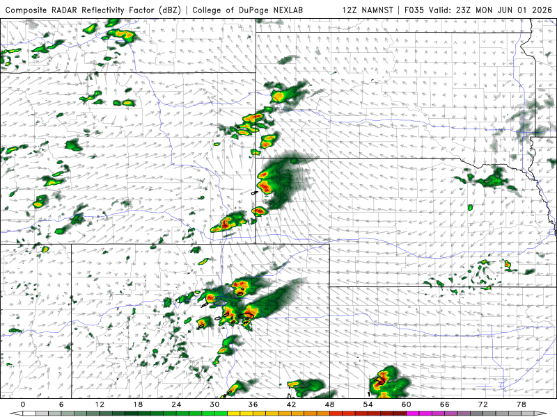
Models show a little cool-front moving into northeast CO tomorrow afternoon and this surge of northeast upsloe, combined with a short-wave aloft, will bring better storm chances to parts of the front-range (Den/Bou) and eastern plains tomorrow from 1pm-8pm. Best chances from Denver south and east and especially near/along the Palmer Divide and east.
Some strong / severe storms expected over eastern / northeast CO tomorrow afternoon, mostly after 3pm
Then moisture increases on Tue. Initially on Tue, after 12pm the focus for storms will be over parts of southern CO: San Juans and especially the Sangres and east onto the southeast plains.
But then another good chance for storms for Den/Bou and the front-range on Tue afternoon from: 3pm-9pm
Then biggest surge of moisture likely on Wed (but again favoring areas east of the Cont. Divide and parts of southern CO)
So for Den/Bou, foothills and the front-range another good chance for storms on Wed afternoon: 2pm-8pm primarily
For the north-central mountains also an increased chance for thunderstorms on especially Tue and Wed but the focus will be from Summit Co east (including Summit, ClearCreek, Grand, western Boulder/Larimer counties) from 1pm-7pm each day
Less chances west of Vail Pass. Unfortunately looking quite dry across western CO during this stretch but some isolated storms in spots each day
We will still with continued storm chances over the eastern half o the state on Thu as well, detail need to be worked out (1pm-8pm again)
First image shows forecast total liquid precip from now through 6am Fri from latest NWS Blend of Models, take amounts with big grain of salt (convection) but it gives general idea of where best rain/thunderstorm chances will be. Image 2 is a loop showing forecast Precipitable Water Anomaly over the next 6-7 days from the GFS, we look for the deeper greens moving into CO. Third image shows forecast radar at 5pm tomorrow from latest NAM-3km model, showing the chance for strong storms in spots (near PD)

Like what you read?
Receive daily weather reports straight to your inbox with Seth's Daily Newsletter. Sign up below.
