A quick look at the Thu/Fri storm system: rain more likely than snow for Den/Bou, more snow for the mountains
Nov 17, 2025
11/17/25 12:30pm: I know we are all anxious on the front-range for a big storm and first snowfall but that may not happen with the Thu/Fri storm system. I'm seeing high uncertainty in the models in regards to the track and strength of the upper-level low, also where it will undergo cyclogensis and strengthen. Its a complex flow pattern and a relatively warm storm system (for this time of year).
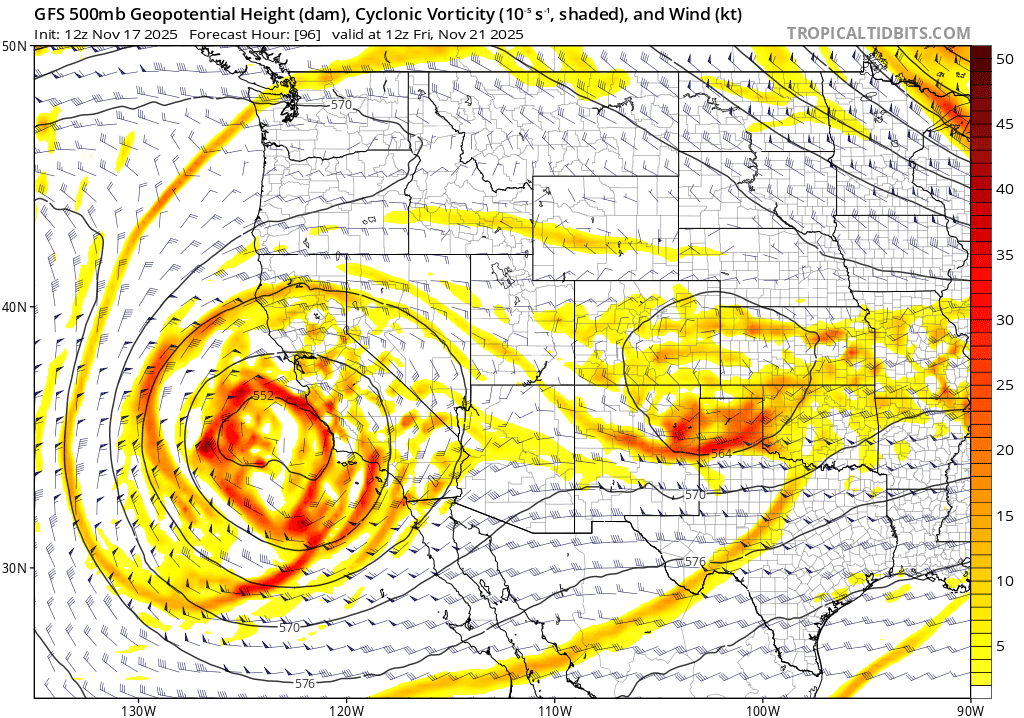
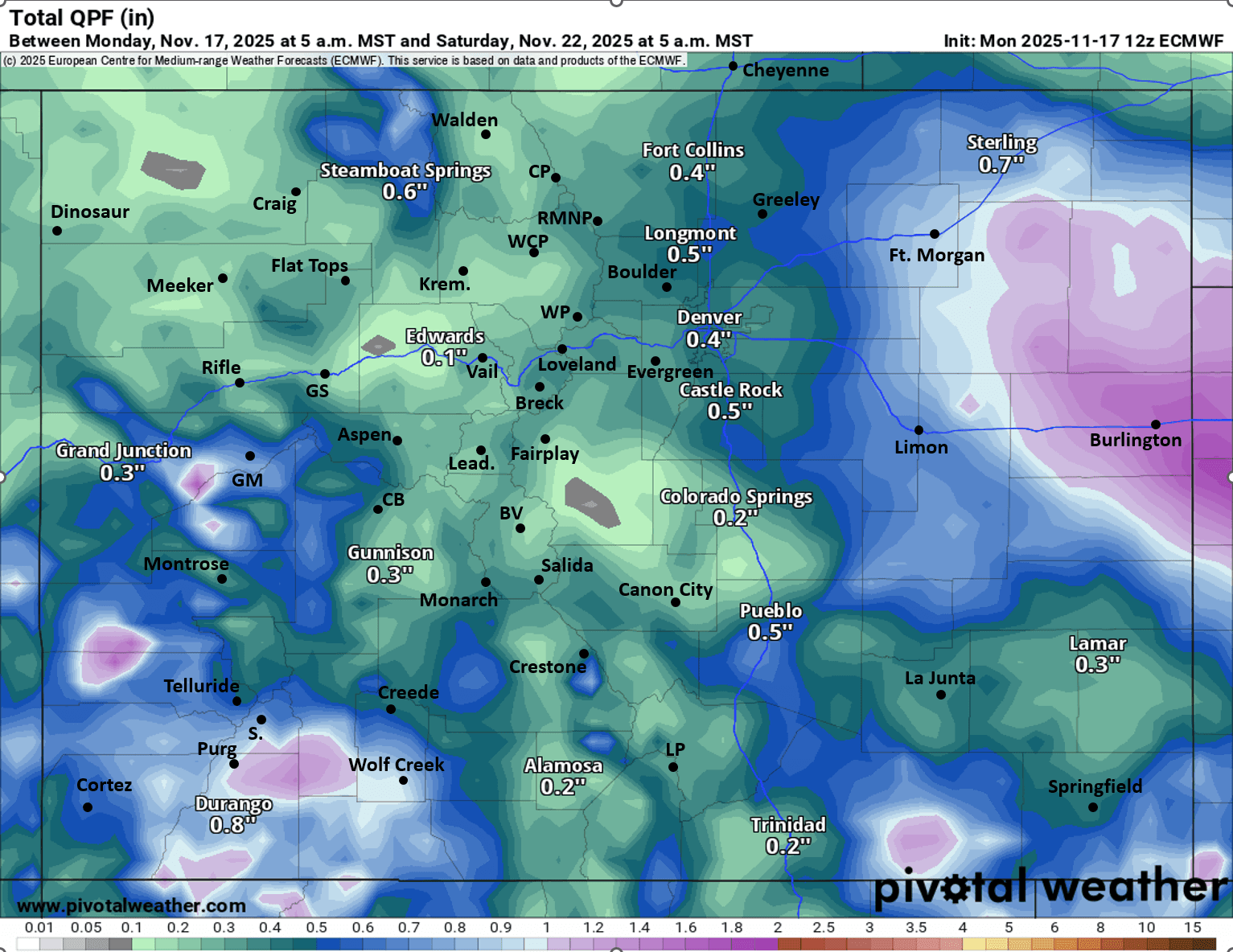
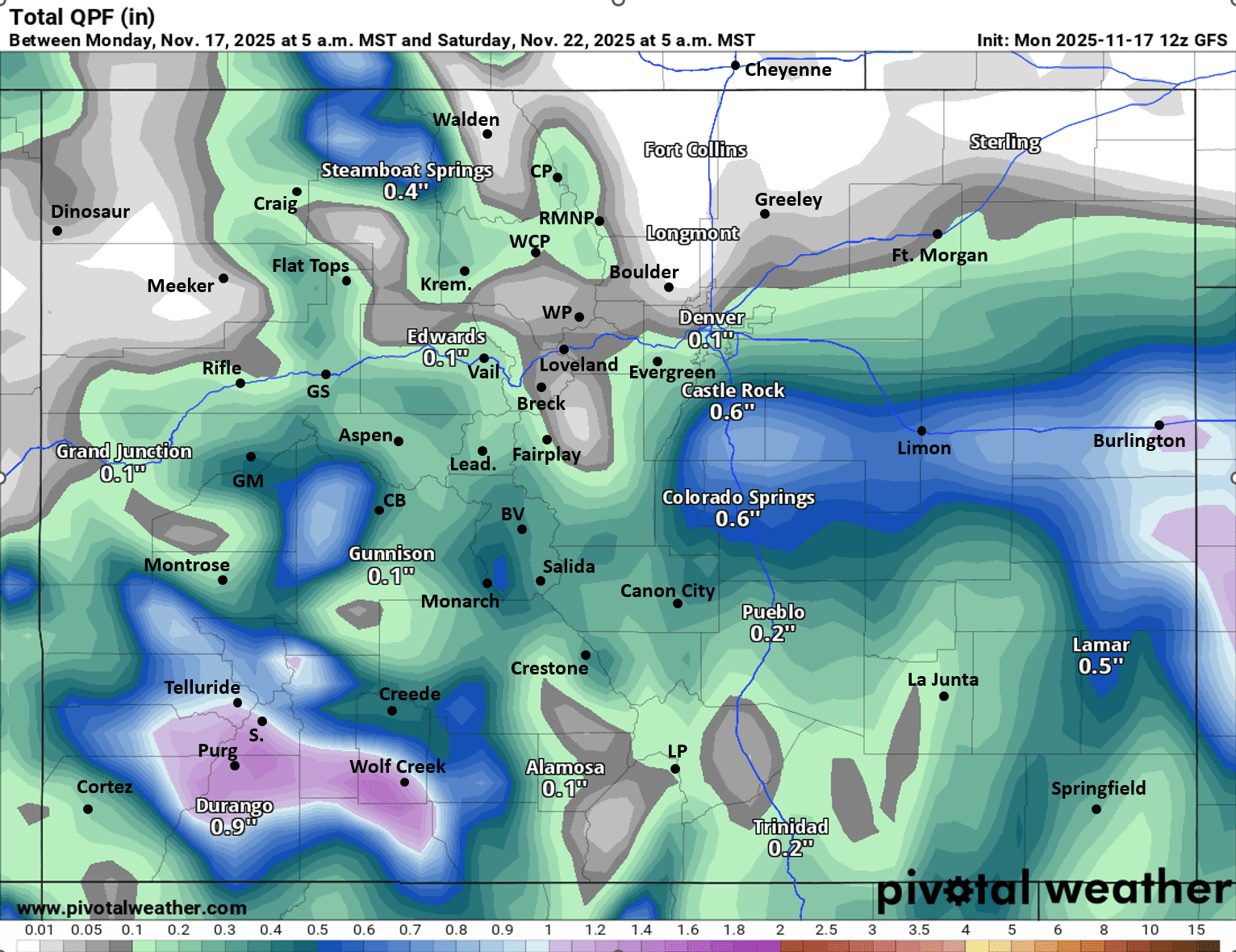
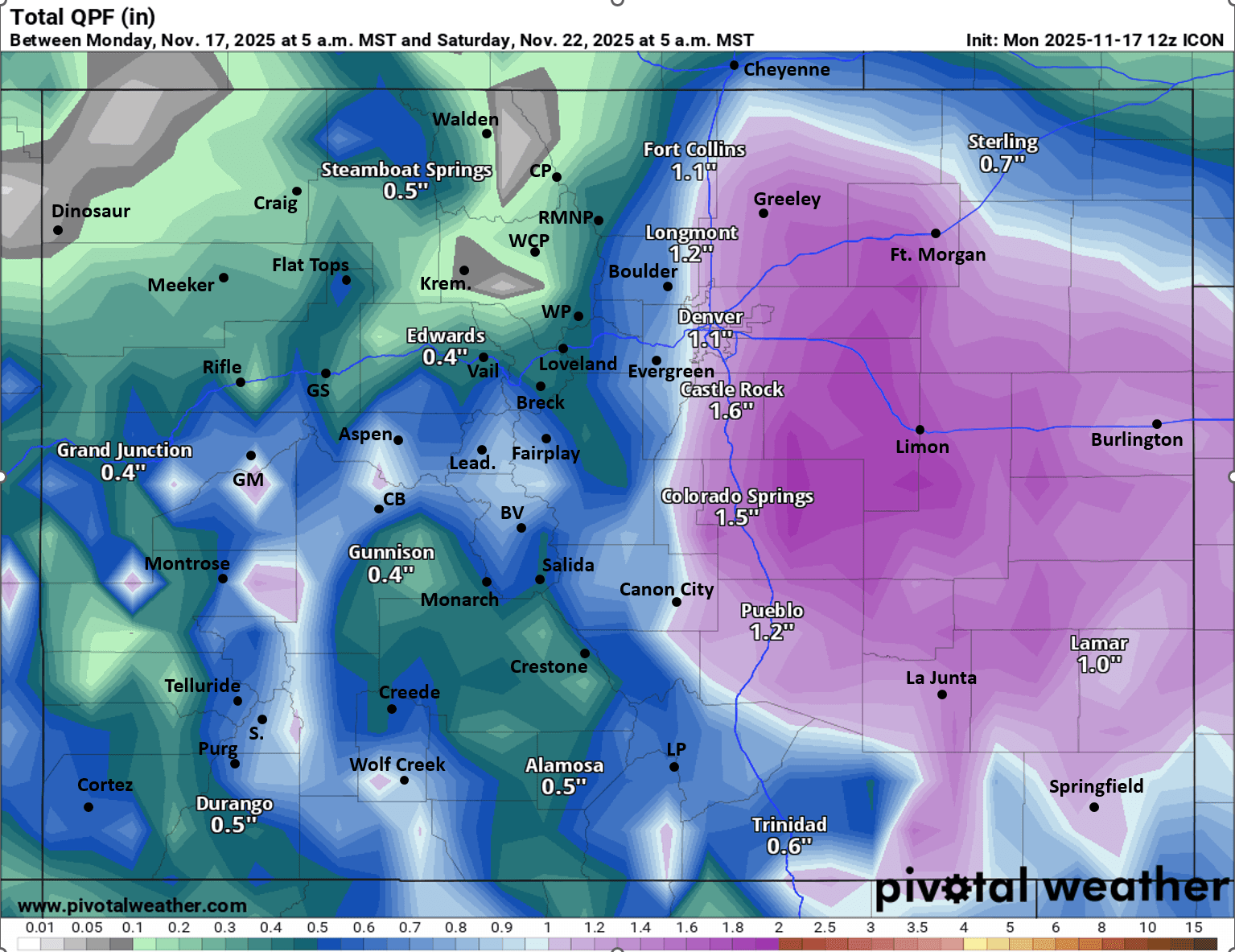
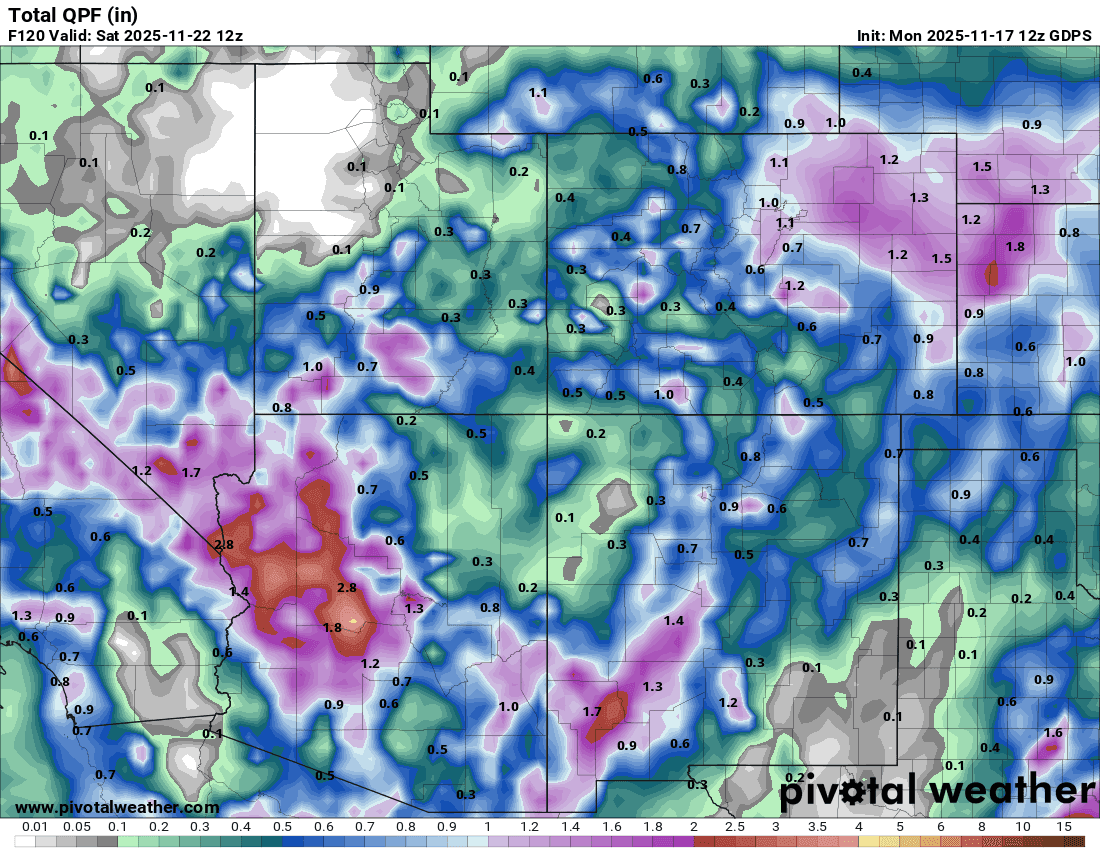
Very latest models trends (12z models from today) have the low setting up just a bit too far south / southeast for really big impacts in Den/Bou with the heaviest precip offset to the south and east. Not all models show this, ICON has a huge event, so does GEM (with the low strengthening further north and west) but GFS is not looking good and ECMWF is in-between. See total precip comparison below.
Given a weak storm and borderline temps, I'm skeptical that Den/Bou and the urban corridor is going to get much snow out of this storm (unless ICON verifies lol). Most likely scenario at the moment is a rain/snow mix or a change over to all snow falling by early Fri morning, but maybe no accumulation below 5600ft.
Does look like the foothills and Palmer Divide will get some snow Thu night into Fri.
Also looks like the mountains will get more snow Thu into Fri afternoon with biggest impacts expected in southwest CO / San Juans (in terms of heavier snowfall).
Overall impacts to Colorado will be from about 11am Thu through 5pm Fri (with biggest impacts on Fri am).
Right now I only give Den/Bou about a 30% chance of getting its first snowfall by Fri am, may have to wait until near/after Thanksgiving when much colder (arctic air) is expected to arrive.
First image shows the upper-level low at 5am Fri via 500mb vorticity / wind from latest GFS (its too far southeast). Image 2-5 compare forecast liquid precip from now through 5am Sat (11/22) from ECMWF, GFS, ICON and GEM (regional view). Take amounts with grain of salt, and of course for the mountains all this precip will be snow (you can use a 12:1 ratio to estimate).
I'll have more details later.

Like what you read?
Receive daily weather reports straight to your inbox with Seth's Daily Newsletter. Sign up below.