A quick look at the seasonal outlook
Jan 12, 2026
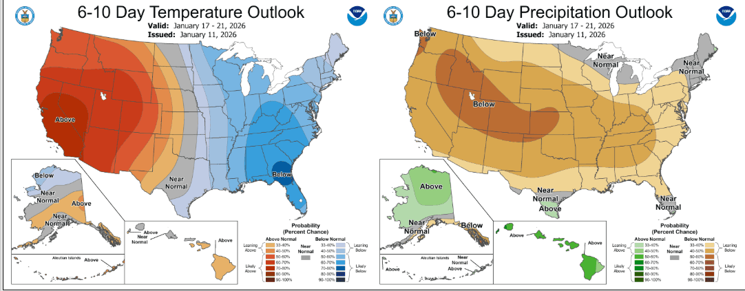
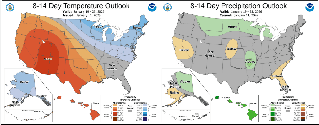
01/12/26 8:15am: Morning its Monday. As I mentioned yesterday we are back in a warm and dry pattern overall for the next 1-2 weeks, you can see this on the updated 6-10 day and 8-15 day outlooks from NCEP below. I still see a more active pattern between Jan 23rd-27th but that is a ways out and uncertain. In the meantime mostly warm and dry except a couple back-door cold-front for eastern CO and the front-range (Wed morning and a stronger one on Friday).
In terms of the climate pattern teleconnection we still have the same factors in place that have been given us this warm and dry pattern across much of the western U.S and Colorado: Weak La Nina, near positive PNA, very warm sea-surface-temperature off the southwest coast of California (the blob) and a inactive MJO (Madden-Julian Oscillation). We need these to change.
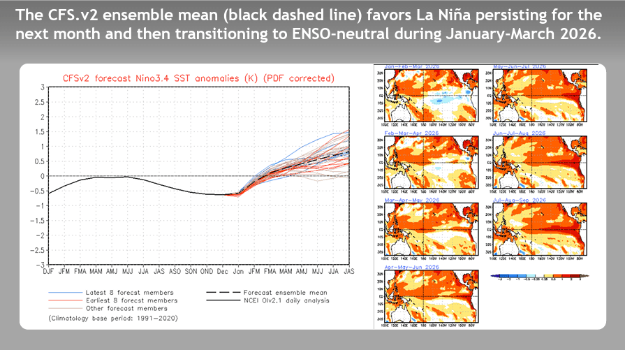
The question is can we get out of this pattern: What I'm looking for is a transition from La Nina to neutral to El Nino.. The latest climate models (like the CFSv2) forecast do show this transition starting in February to March...but if this is delayed and say doesn't happen until April or later, then we will continue to be mired in this overall warm and dry pattern.
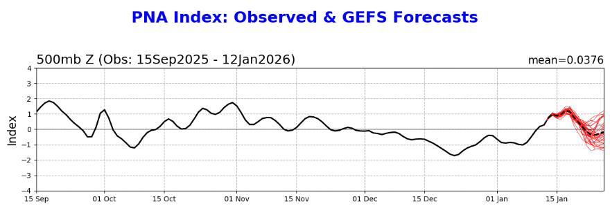
Also, the PNA (Pacific Normal Index: which determines positions of overall high/low features between AK and HI) has been hanging out much closer to positive (or neutral) vs the expected negative phase, which usually brings stormier conditions to the western U.S. (the transition to a more consistent negative phase hasn't happened). We want to see the PNA go negative.
So if we can transition away from La Nina (ENSO neutral) by February and if the PNA can become more negative and MJO become more active, we could end up with a more active, cold and snowier pattern from mid-February through May....
If we end up with weak La Nina through April, the PNA stays more positive and MJO remains weak / inactive, then this pattern of long dry stretches between storms will continue and we will end up with a very low snowpack year (and low snow on the front-range as well). Time will only tell.
That's my Monday morning thoughts lol. Later today or tomorrow we will look at the updated snowpack numbers.
First image shows the current CFSv2 ENSO forecast (we want to see that transitions from La Nina to neutral). Second image shows the current PNA forecast (and observations). Image 3 and 4 show the latest 6-10 day and 8-14 day outlook from NCEP.

Like what you read?
Receive daily weather reports straight to your inbox with Seth's Daily Newsletter. Sign up below.