A look at the complicated forecast for Fri to Sun (some snow for mountains and front-range)
Jan 20, 2026
01/20/26 8:30am: Morning, its Tuesday lol. As I mentioned yesterday we have a complicated forecast setting up for Friday to Sunday and the details are very uncertain. Models show a southern branch upper-level low combining with a northern branch trough with some colder air and deep pacific moisture (and even a shot of upslope for the front-range). Big questions on how far south the overall setup is on Fri night into Sat and that will determine snow amounts especially in northern CO.
Overall, biggest impacts will be from 11am Fri to 5am Sun with maybe more snow for the mountains on Sun night into Mon am.
Right now heaviest heaviest snowfall is expected over southern / southwestern CO (southwest of a Vail to C. Springs line, including Aspen, CB, Grand Mesa, western and eastern San Juans, southern Sawatch (Monarch) parts of SLV and Sangers and maybe southeast CO.
Big questions on snowfall amounts for both the I-70 mountain corridor and Den/Bou and the front-range (some snow likely in both those areas though).
ECMWF and GEM models have the setup farther north with good snowfall for north-central CO (and southern CO). GFS has the setup further south with most of the meaningful snow over southern CO and very little for Den/Bou and the front-range (some for the mountains).
For Den/Bou and the northern front-range turning colder by the end of the week with a chance for light snow from about 8am Fri through 2am Sunday, with best chances 2am-2pm Sat. Maybe 1-4" for Den/Bou and 2-6"+ for the foothills or much less, who knows. Looks cold on Saturday with high temps only in the low 20s (or colder, so heads up there). For the Broncos game Sunday: highs likely in the upper 20s / low 30s (but just cloudy).
For the north-central mountains / I-70 mountain corridor snow likely from 2pm Fri to 11pm Sat initially: maybe 3-8" for the local ski areas. Then more snow possible from 11am Sun to 5am Mon (maybe an additional 1-3")
For the southwest / south-central mountains (Elks, San Juans, etc): snow from about 5am Fri through 5am Sun, heaviest during the day Sat. Could pile up in spots: Maybe 6-12"+ for the ski areas down there by Sun am.
Prior to all of this, a weak short-wave will bring a few snow showers to the northern mountains tonight into tomorrow am (8pm tonight to 5am Wed): Trace-1" in a few spots (favoring areas near Cameron Pass to Park Range, won't be much).
So you can see its uncertain for the weekend. Right now I"m leaning towards and hoping for the ECMWF solution which has been the most accurate model latel.
I'll have more later.
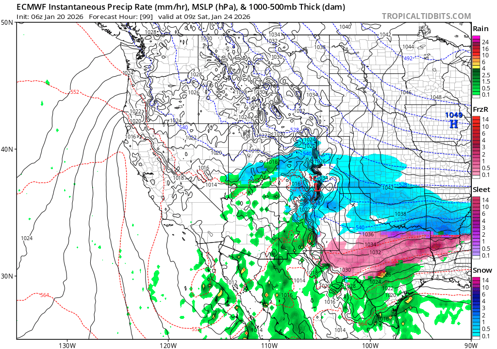
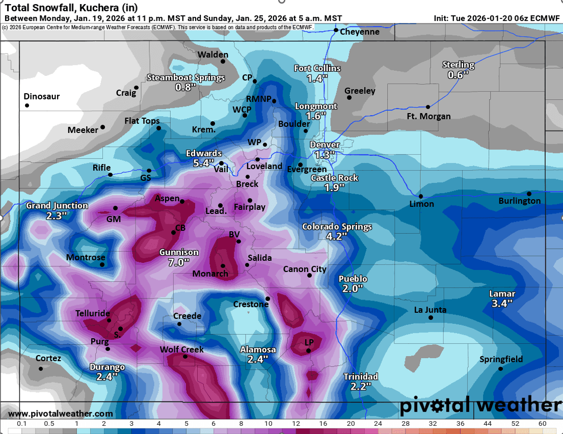
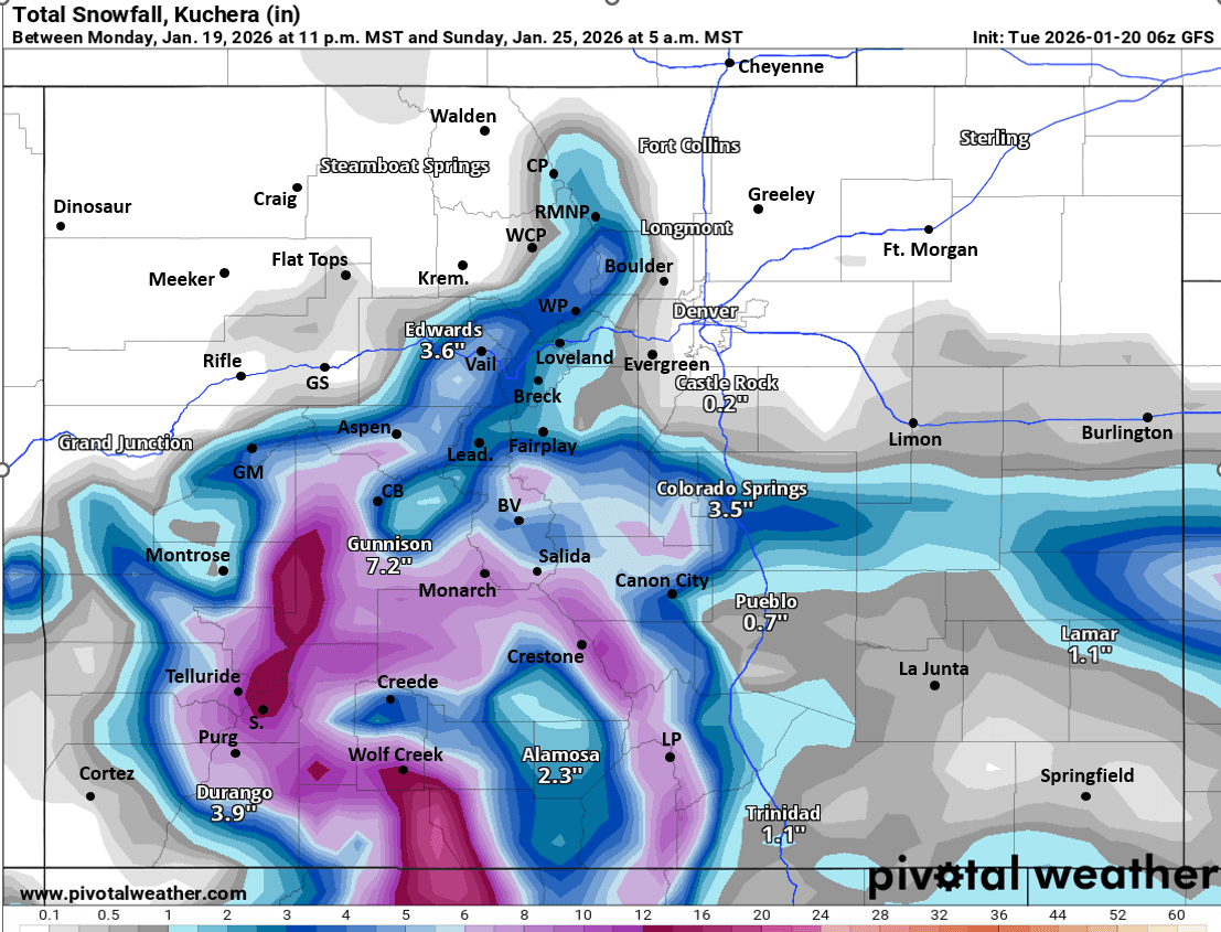
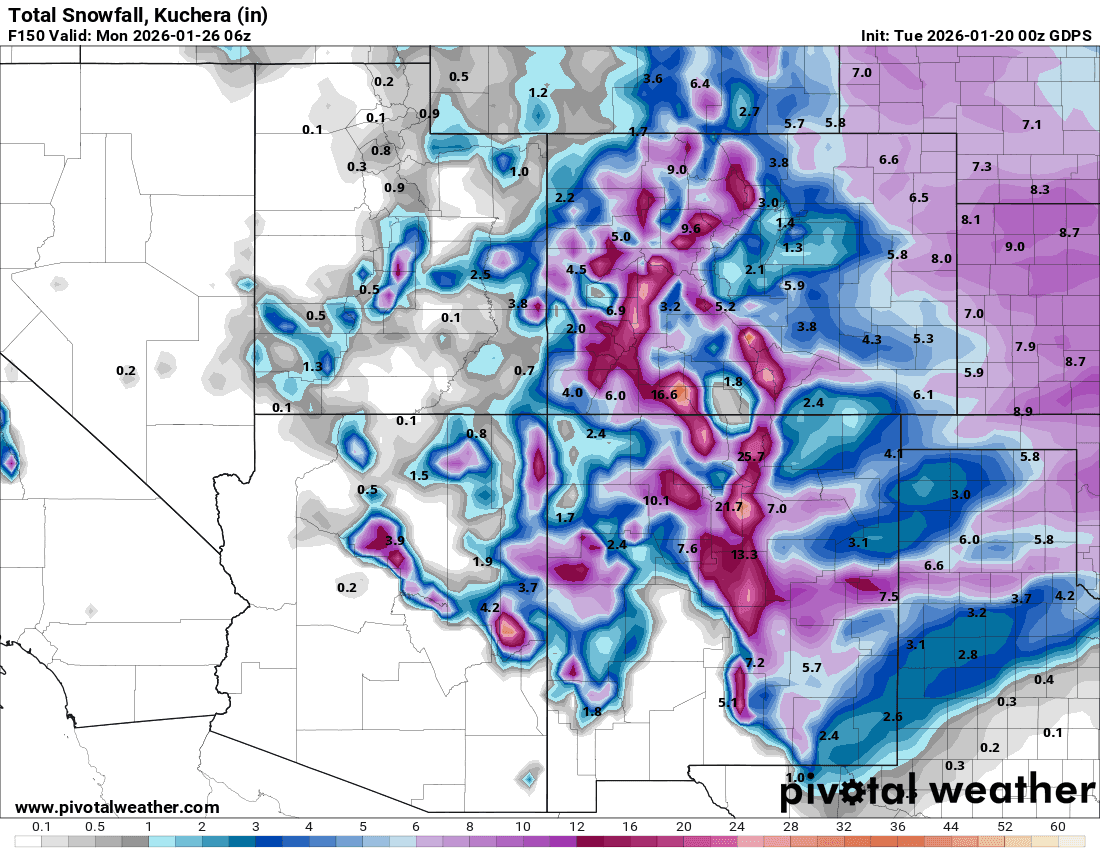
First image shows forecast precip-type/rate at 2am Sat from latest ECMWF model. Images 2-4 compare forecast total snowfall from now through 5am Sun from latest ECMWF, GFS and GEM (CMC) models, take modeled snowfall with a big grain of salt as uncertainty is very high.

Like what you read?
Receive daily weather reports straight to your inbox with Seth's Daily Newsletter. Sign up below.