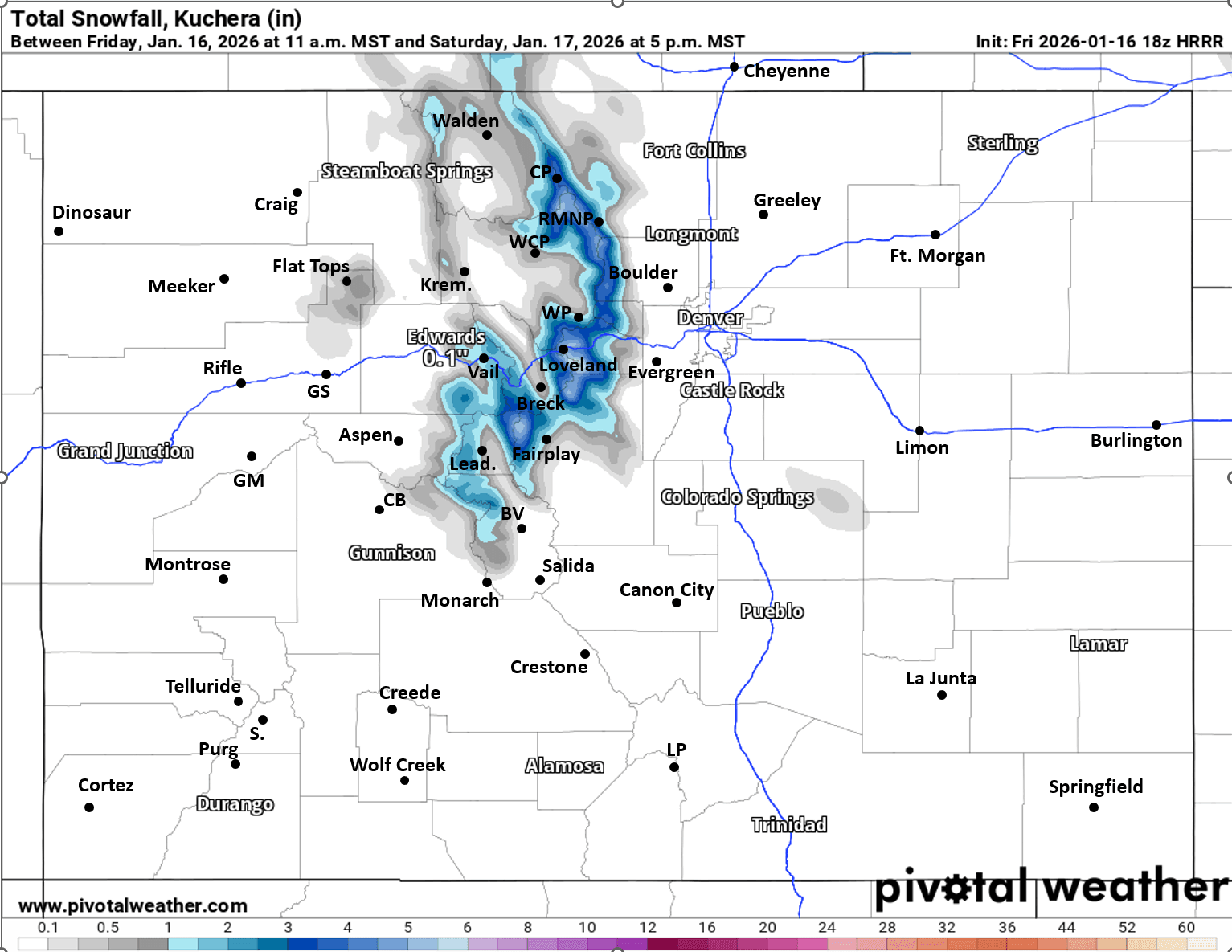
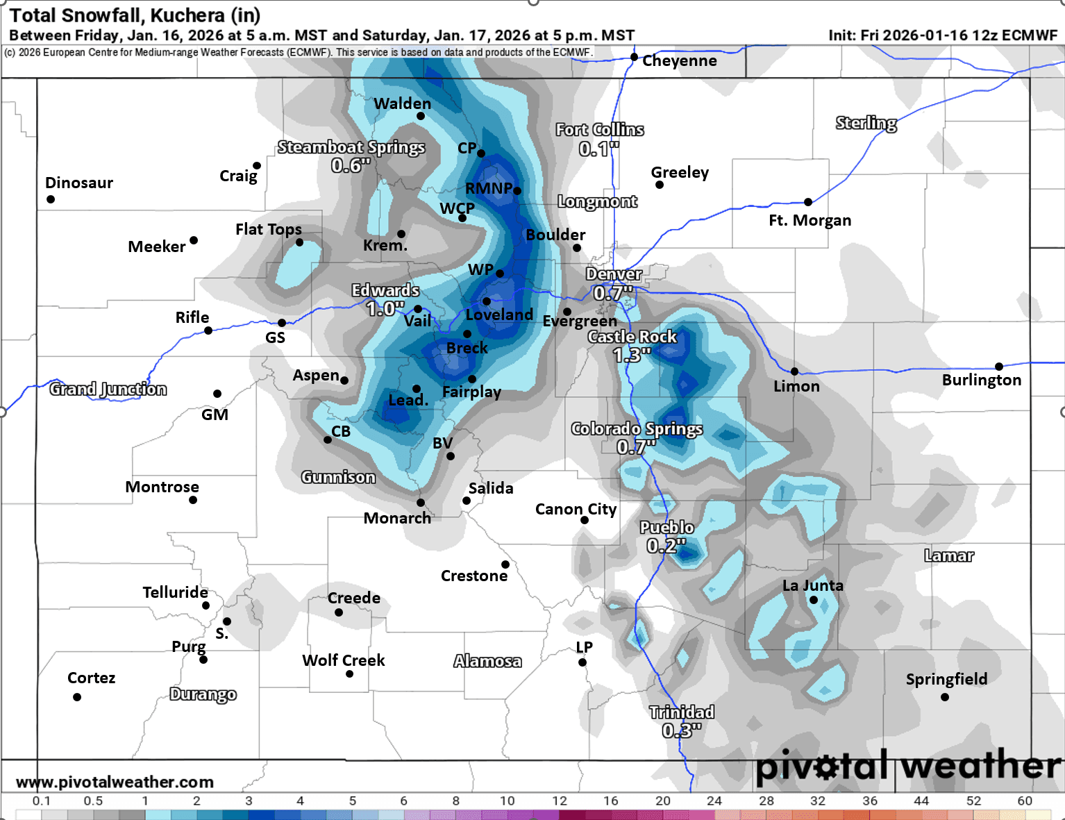
A look at additional snowfall amounts for tonight through Sat afternoon (for next wave)
Jan 16, 2026
01/16/26 12:45pm: Here is a quick look at expected, additional snowfall tonight into mid-day tomorrow.
For the north-central mountains, including Eagle, Summit, ClearCreek, Grand, western Boulder/Larimer counties, I-70 mountain corridor and local ski areas: light snow showers through today. Then next round of more consistent light to moderate snow will be from 8pm this evening through 2pm Sat, heavies early Sat am.
For eastern Summit Co and the Front Range mountains near/east of the Cont. Divide: 1-5" of new snow (with highest amounts near A-Basin, Loveland Jones Pass, etc).
For areas closer to Vail, Beaver Creek, Steamboat ski area, Leadville and maybe Aspen ski areas: Trace-2" by Sat mid-day
For Den/Bou, northern front-range and northeast plains also a chance for some light snow primarily from 11pm tonight to 8am Saturday: Trace-2" of snow in a few spots, best chances near/along the Palmer Divide, foothills west/southwest of Denver and areas near and east of DIA (likely not much for Den/Bou proper, but maybe dusting)
And of course very windy this afternoon, especially for the northern front-range near Ft. Collins and the front-range foothills and mountains in western Boulder/Larimer counties: northwest wind-gusts of 60-90 mph. For Den/Bou proper, wind-gusts of 30-60mph, mostly east of I-25.
Wind calms down in most areas after 8pm this evening. On Sat less wind, except for in the Front Range mountains and foothills above 8k ft (along/east of the Divide): winds of 30-60 mph tomorrow, otherwise less west of the Tunnels.
That is all for now. We will be heading up to Silverthorne this afternoon for the holiday weekend. I'll have some updates from up there.
First two images compare forecast additional snowfall from now through 5pm Sat from latest HRRR and ECMWF models (they have been the best lately, EC includes some from this morning, take amounts with grain of salt). Third image shows forecast wind-gusts at 3pm today from latest HRRR.


Like what you read?
Receive daily weather reports straight to your inbox with Seth's Daily Newsletter. Sign up below.