A gradual return to a more active and cooler pattern by June 13-17
Jun 7, 2026
06/07/26 4:45pm: Hi, hope you are having a good Sun. Just a few gusty storms out there this afternoon, but the cloud-cover and breeze is nice. We had a great time in Boulder earlier playing / tubing on Boulder Creek (at Eben G. Fine) with friends. Was great weather and good creek conditions given the lower flow, but also crowded when we left at 2pm.
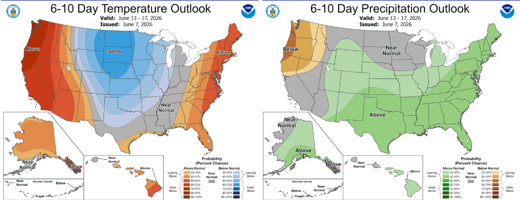
Anyway, I just wanted to mention that after this little heat wave Mon/Tue, we are looking for a gradual return to a more active and cooler pattern (this is also reflected in the NCEP 6-10 day outlook below).
Here is what I’m seeing weather-wise coming up this week into next week:
Generally hot across the state Mon-Wed, especially Tue, with high temps in the mid-90s for Den/Bou, 70s/80s for the mountains. Breezy / windy at times. Limited afternoon thunderstorms.
First a weak cold-front will move across northern CO and down the front-range late tonight / early Mon morning: this will just drop temps into the 80s for Den/Bou on Mon and bring in a better chance for afternoon thunderstorms from the front-range east, favoring some strong storms east of a Greeley to DIA line: 3pm-9pm.
The eastern plains will be favored for some stronger thunderstorms tomorrow afternoon, mostly after 4pm (hail, etc).
Then another fairly weak short-wave and cold-front will move across northern CO on Tue night into Wed am, this will bring some rain showers to parts of the north-central mountains (and some snow above 11k ft) from 3pm Tue to 3am Wed, likely won’t be much (but maybe some colder rain showers for Summit/Grand counties, etc Tue evening into Wed).
Then models show some colder air and a broad trough / slow moving low moving in from the north around the afternoon of Sat, June 13th. Still unclear how far south the cold-air and low will move in… But overall looks like a cooler wetter period from about June 13th-16th and that is reflected in the 6-10 day outlook from NCEP showing cooler than average and wetter than average conditions possible for CO from June 13-17th, fingers crossed!
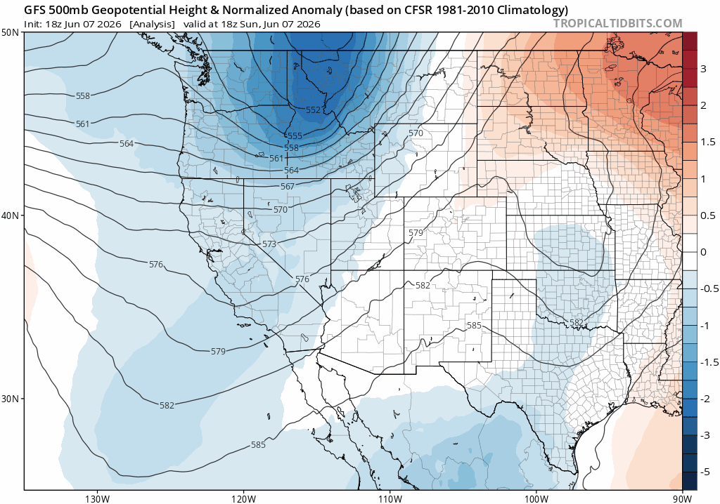
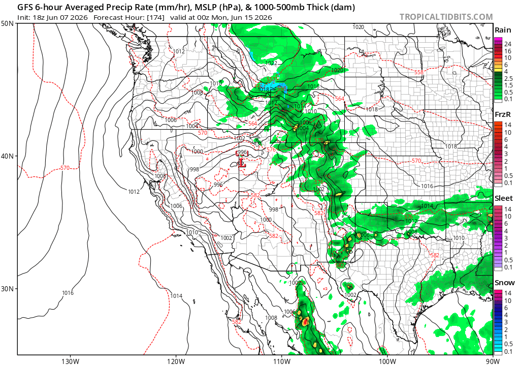
First image loops shows the evolution of the pattern via 500mb height anomalies (the blue represents low pressure / colder air and storms, orange to red is high-pressure and hot). Second image is the 6-10 outlook from NCEP, looking favorable for CO. Fourth imae shows forecast precip-type/rate for next Sun 06/14, showing a wet setup if things can come together just right, but take with big grain of salt as details will change.
How is your Sun going weather-wise?

Like what you read?
Receive daily weather reports straight to your inbox with Seth's Daily Newsletter. Sign up below.