A colder storm system for Tue/Wed
May 2, 2026
05/02/26 8pm: The thing I like about this next storm system for Tue/Wed is that we have will have some much colder air to work with via the trough and cold-front coming in from the north.
Models show a more winter-like airmass moving into CO Tue morning, combining with deeper moisture and energy coming from the southwest (the southern track low). Again if these can phase together, this could be a significant snow event for parts of northern CO including Den/Bou and the front-range, especially the foothills.
I have some rules of thumb for determining snow in Den/Bou: 1000-500mb thickness below 552 (thickness is a measure of how cold the column is) and a 700mb temp (at about 10,500ft) at/below -5 degC (23 degF)...
Well many of the models, show the 1000-500mb thickness dropping to 540 by Wed am with a 700mb temp of -8 degC...that is a chilly airmass for May and if this holds or is even close, it will for sure lead to accumulating snowfall for Den/Bou and lower elevations, so heads up there.
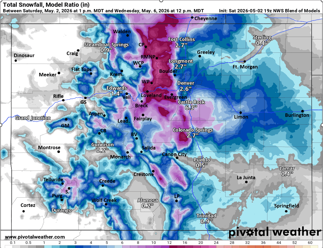
Some models like GFS, which has been so consistent run to run show a potent setup: > 1.15" of liquid precip for Den/Bou and 5-10" of snow, with > 15" of snow in the foothills
ECMWF on other hand shows the setup a bit further north and not quite as strong but like 0.65-0.85" liquid and maybe 1-6" of snow for Den/Bou, more for the foothills.
Looks like the foothills above 7k ft could get 6-12"+ of new snow in spots.
Also looks like the front-range mountains and parts of the eastern north-central mountains will get 6-14" of snow or more in spots (favoring areas near/east of the Divide) by Wed night.
Again main impacts from 3pm Mon to 3pm Wed, with biggest impacts and coldest air on Tue night into Wed am
Fingers crossed for a May snow storm surprise, we are do... This is a different animal than this last storm system.
Going to be cold on Wed!
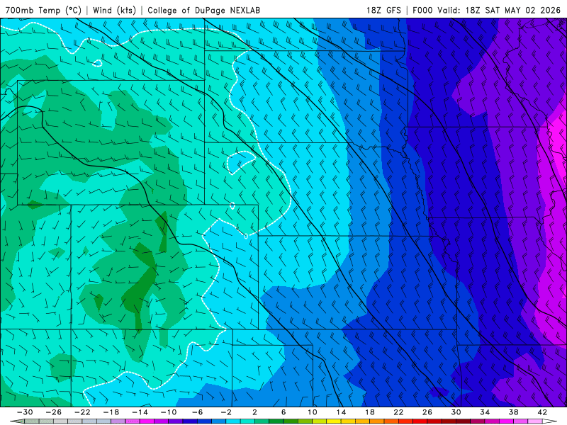
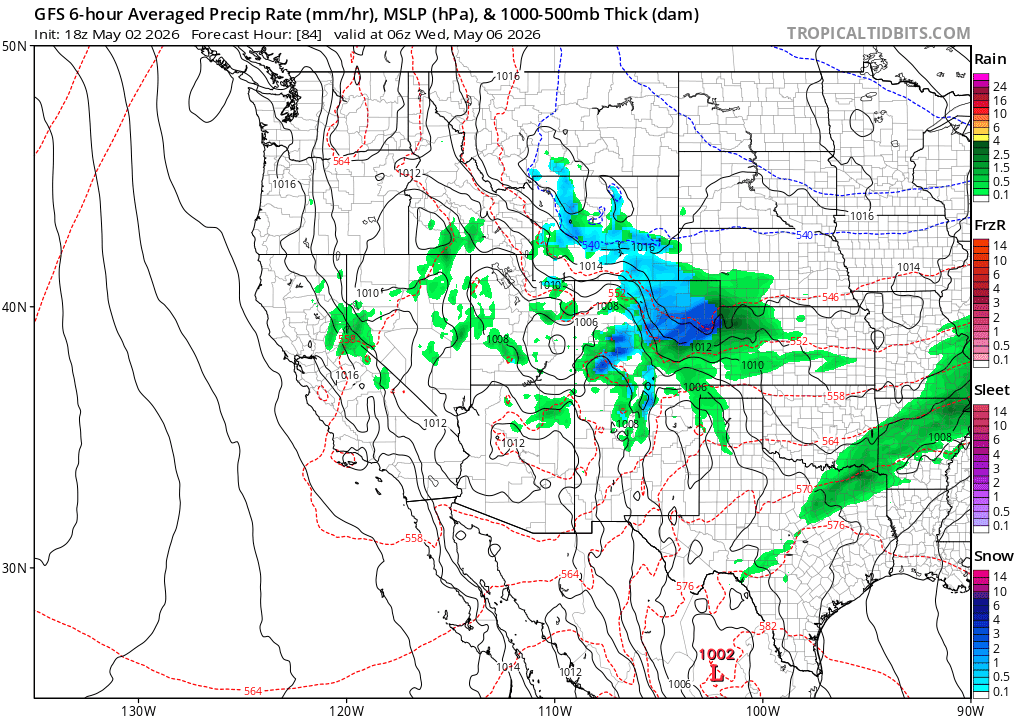
First image loop shows forecast 700mb temps over the next 6 days from latest GFS, you can see the much colder airmass move into norther CO on Tue morning. Second image shows forecast precip-type/rate valid 12am Wed showing a nice snow-storm on the front-range, we shall see. Third image shows forecast total snowfall from now through 6am Thu (05/07) from NWS Blend of Models...take with a big grain of salt, but shows just what may be possible in terms of snowfall (will be less for parts of the foothills and mountains, but still good amounts).

Like what you read?
Receive daily weather reports straight to your inbox with Seth's Daily Newsletter. Sign up below.