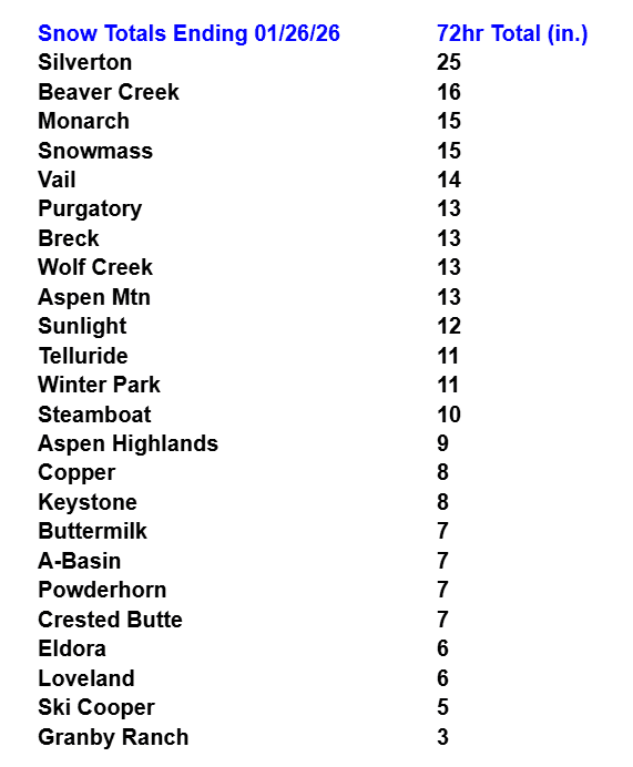
3-day snow totals for the back to back storms
Jan 26, 2026
01/26/26 12:30pm: Here is a look at some official 72hr snow totals from the ski areas and from town CoCoRaHS reports. It was an interesting couple of storms. Many locations did get into the forecast range (from my Thu map) but as is the case with all these complex storm systems (and two waves), there were some busts and booms in spots.
First good to see a wide-swath of 10-20" for the western ski areas as expected with closer to 5-10" for the Summit and Grand ski areas (but still within my forecast range).
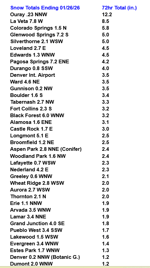
Also good to see generally 1-4" across Denver/Boulder between the two waves, which was expected. This time around DIA, picked up more than Denver proper (reporting 3.5" in the last 3 days). At my house in Westminster, I estimate 1.8" total.
The most obvious bust was in the foothills, where I was expecting at least 3-8" total and they only got 1-4"...it was just weak upslope, weak jet-dynamics and strange wind-flow (models didn't handle that well).
Given the complexity in the forecast on Thu, for two big waves, I'm pretty pleased with the forecast and it wasn't a bust in most areas.
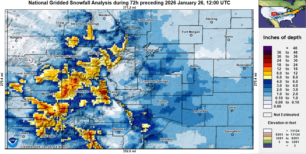
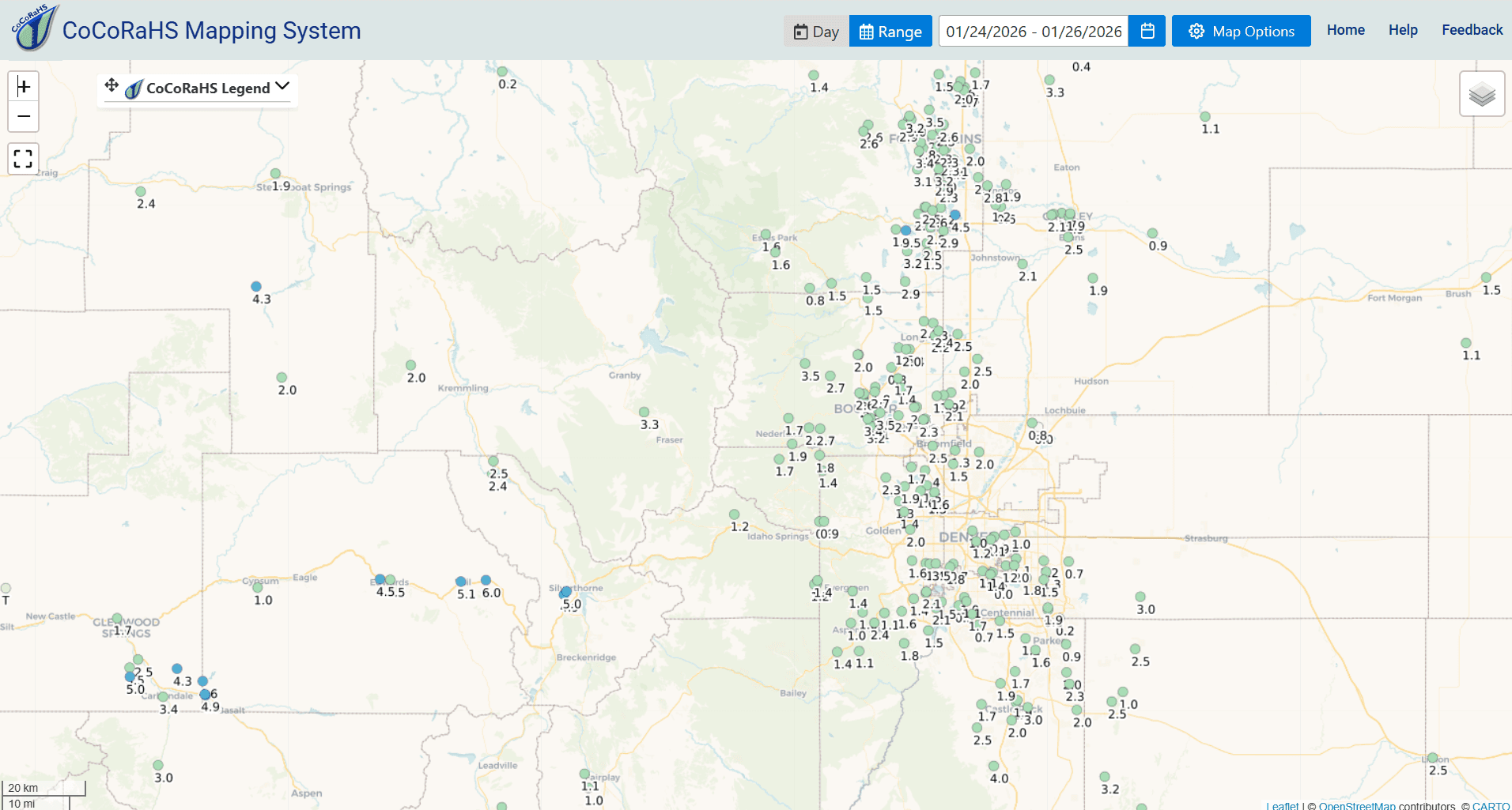
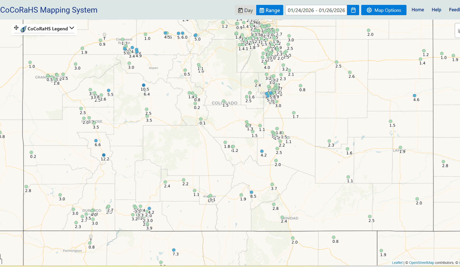
Below I show 72hr totals for the ski areas (image 1) and towns from CoCoRaHS (image 2). Along with 72hr observed snowfall from NOHRSC (its interpolated analysis so can be off in spots). Image 4 and 5 show 72hr CoCoRaHS reports for Den/Bou and northern front-range and rest of CO.
Pretty good snow storm!

Like what you read?
Receive daily weather reports straight to your inbox with Seth's Daily Newsletter. Sign up below.